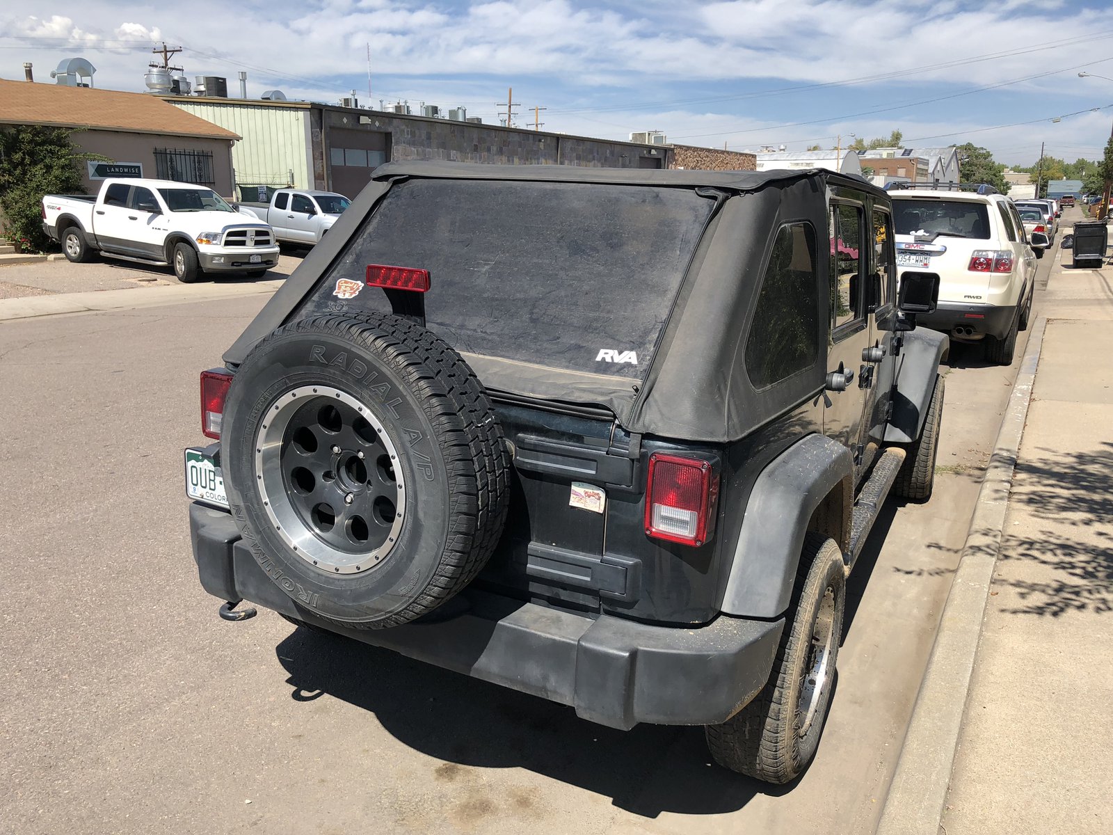
- photo 85
- summer2018 30
- summer2019 8
- hex2019 4
- drone 3
- mbta 1
- night 1
- Boston 1
- 🚲 1
- 🌕 1
- ❤️ 1
- home improvement 1
- diy 1
- themurphstagram 1
photo
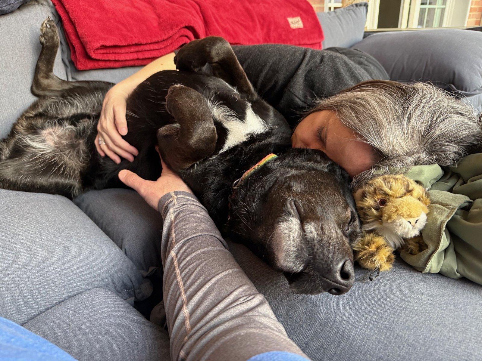
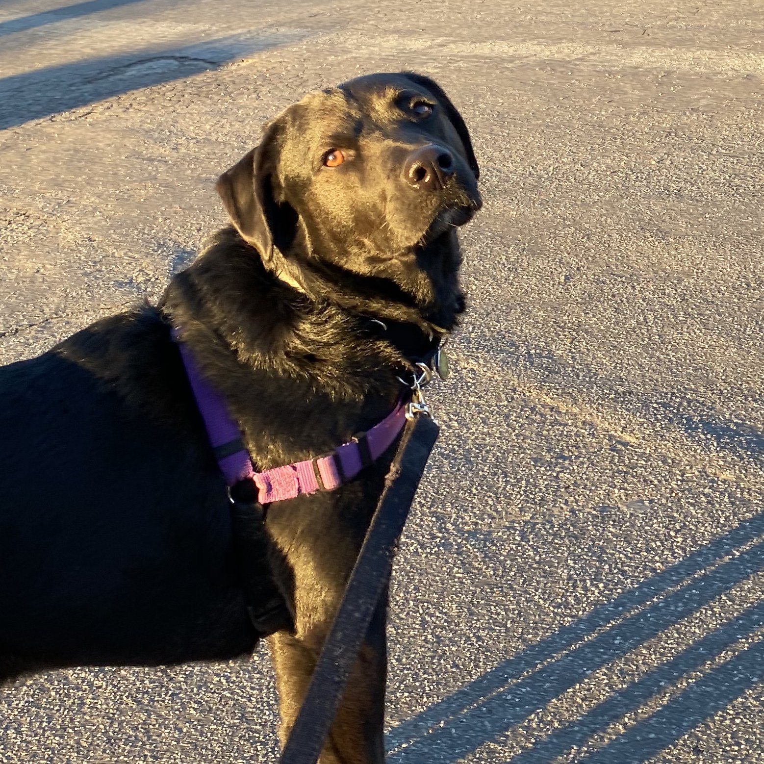
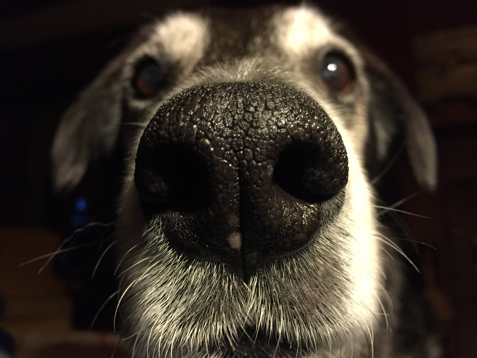
Happy dog
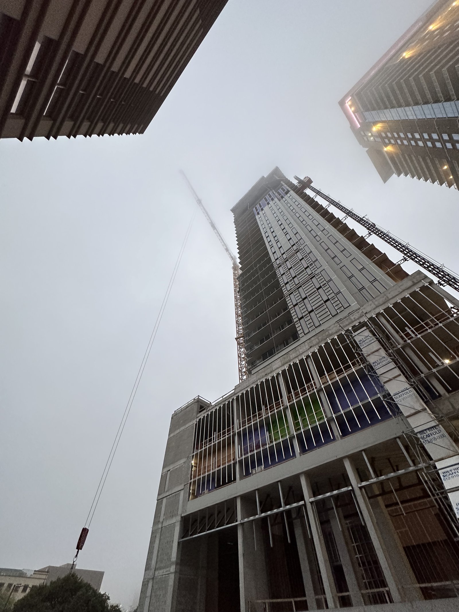
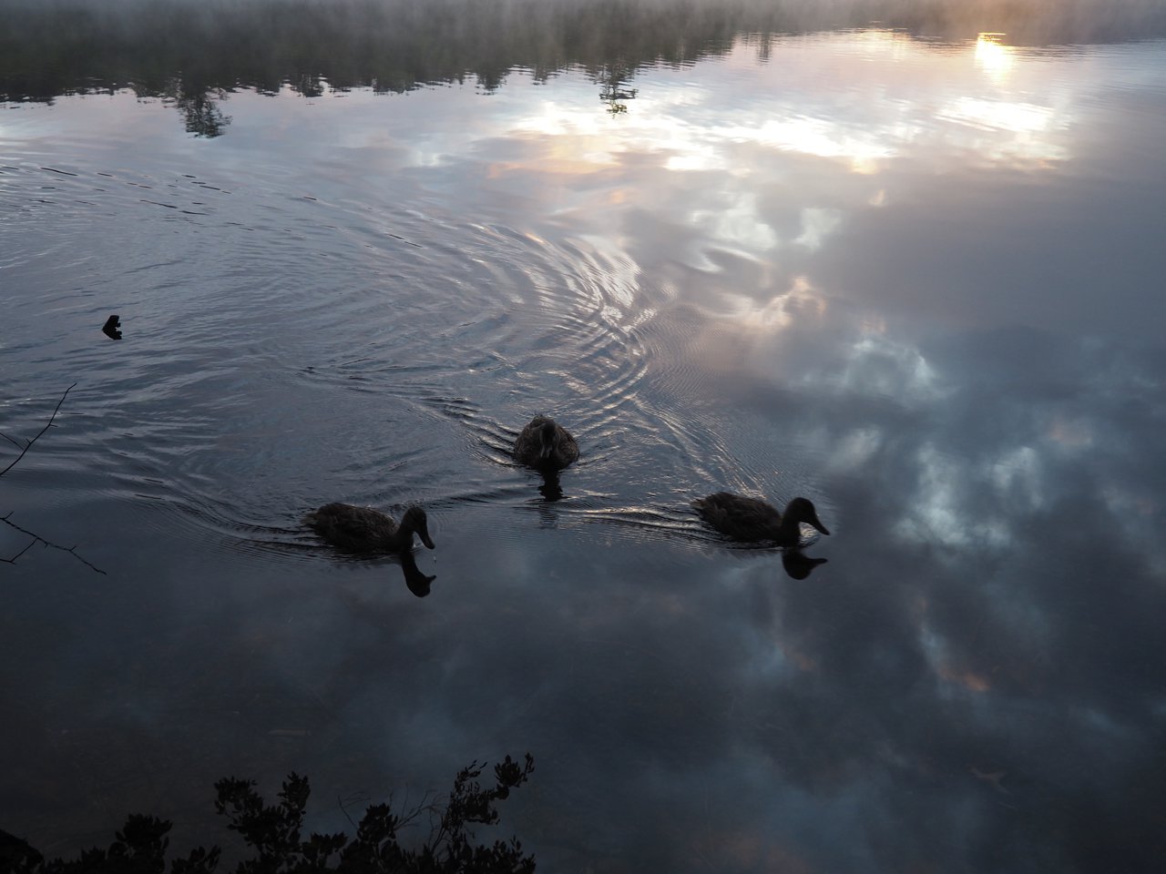
A foggy morning in Austin

Departure
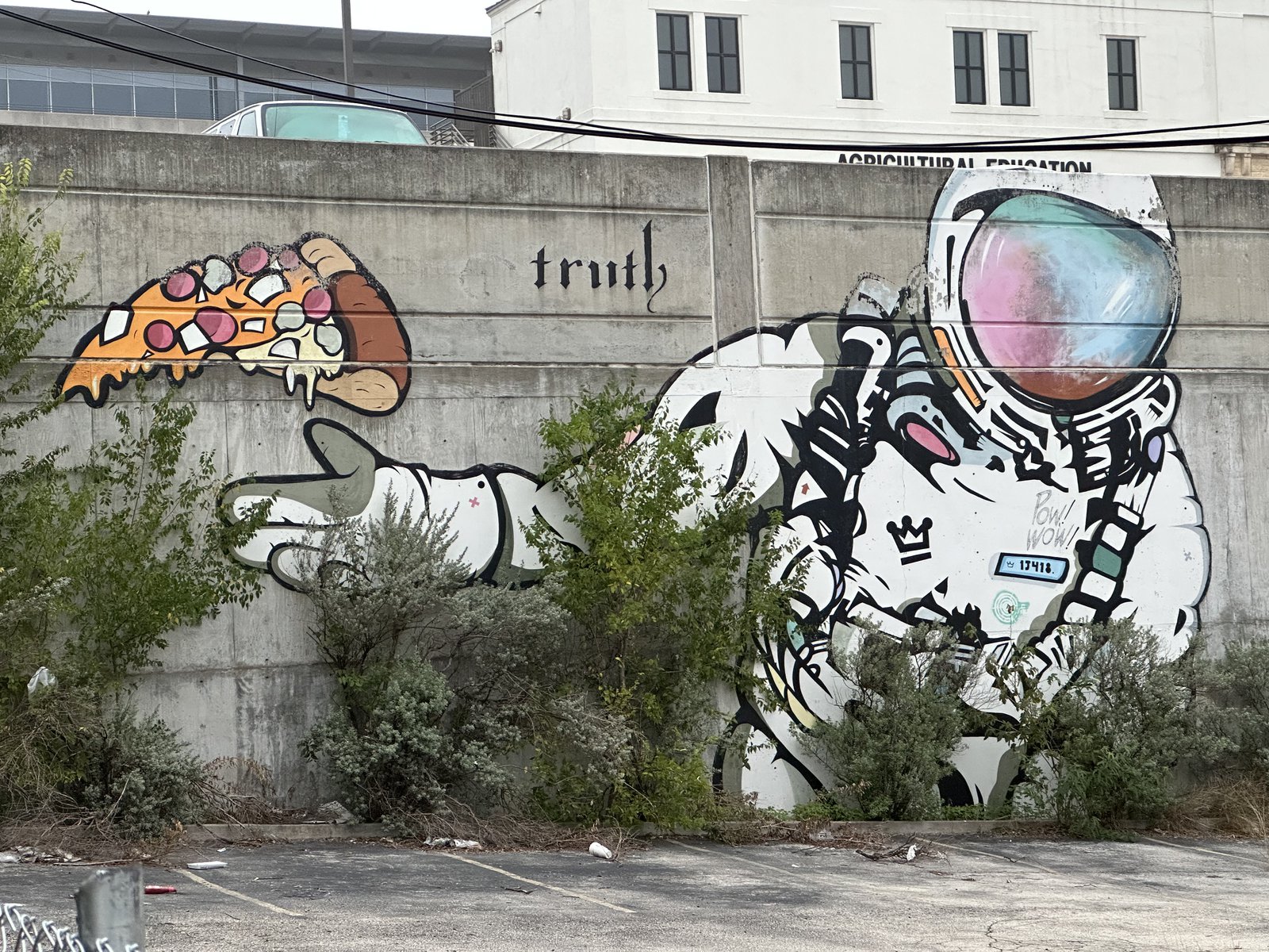
Free speech

https://xkcd.com/1357/
As relevant as ever. 🌲
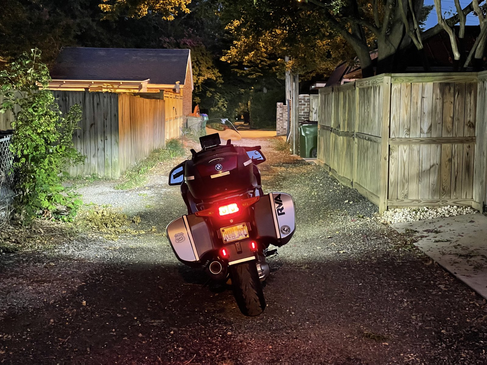
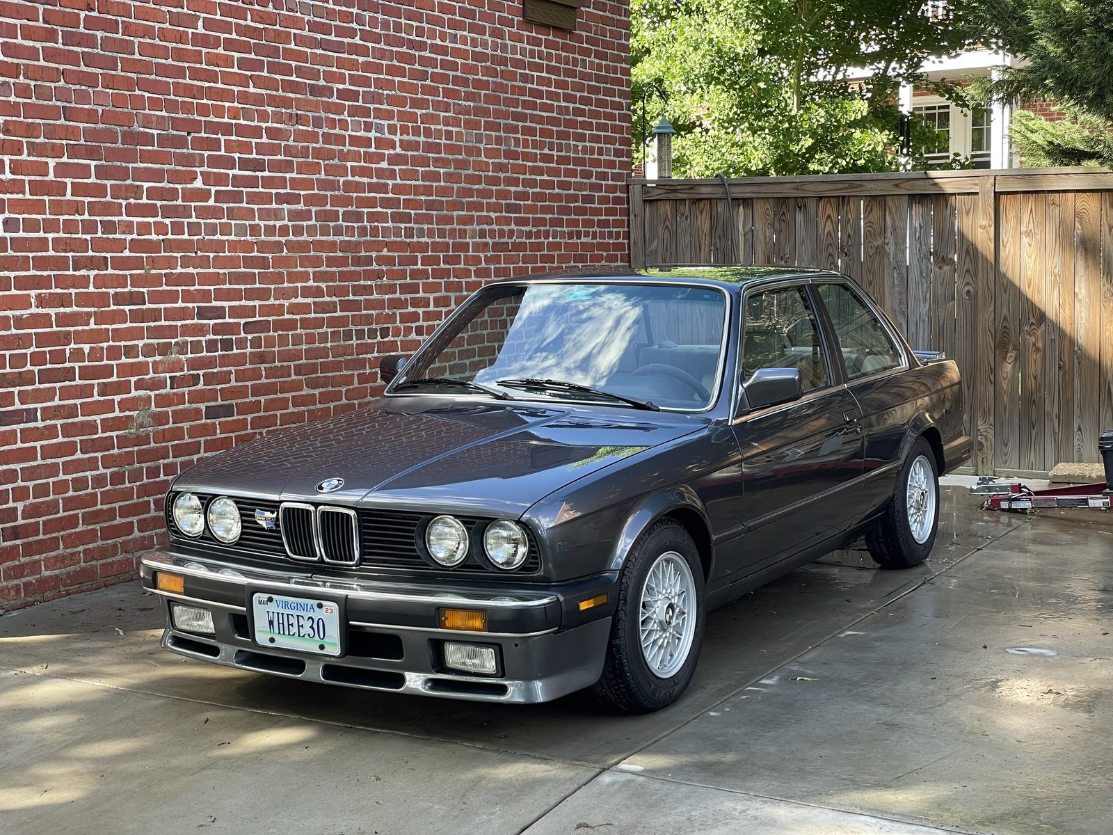
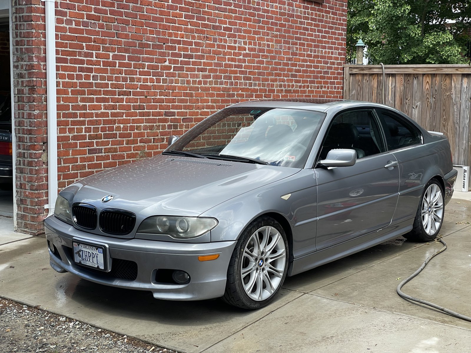
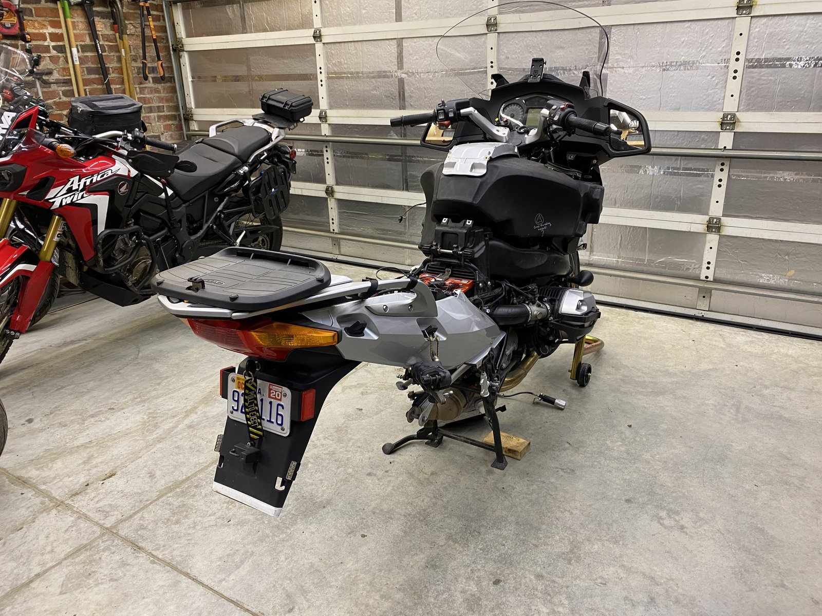
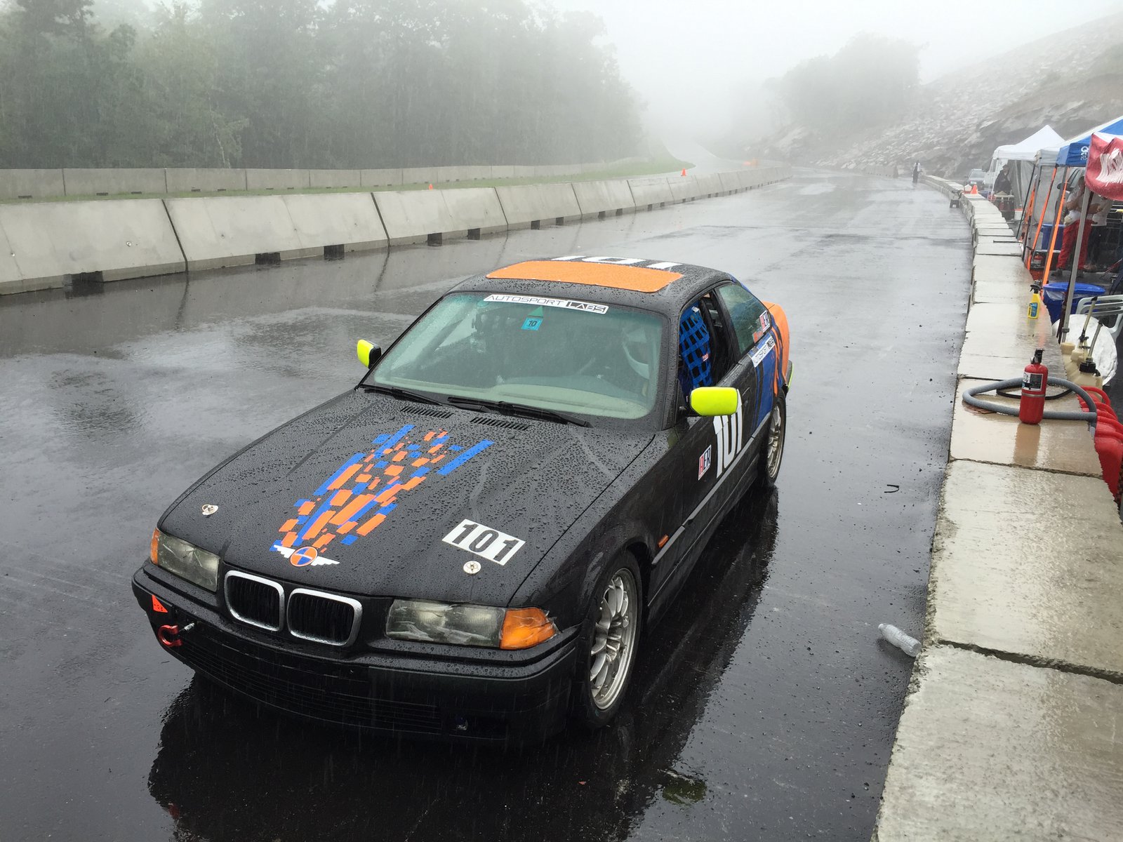
BMW cleaning day
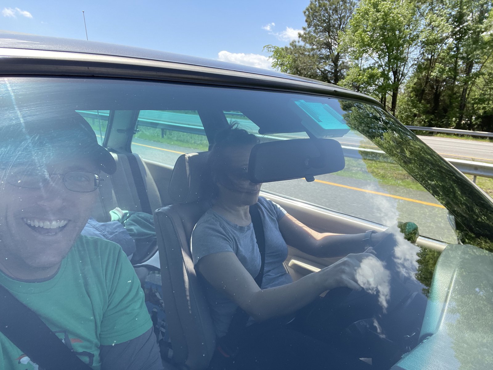
Road trip!
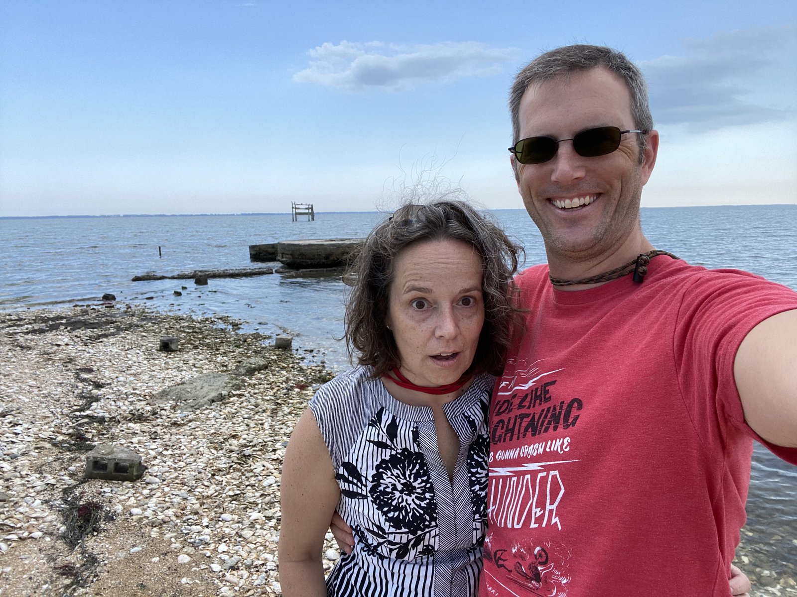
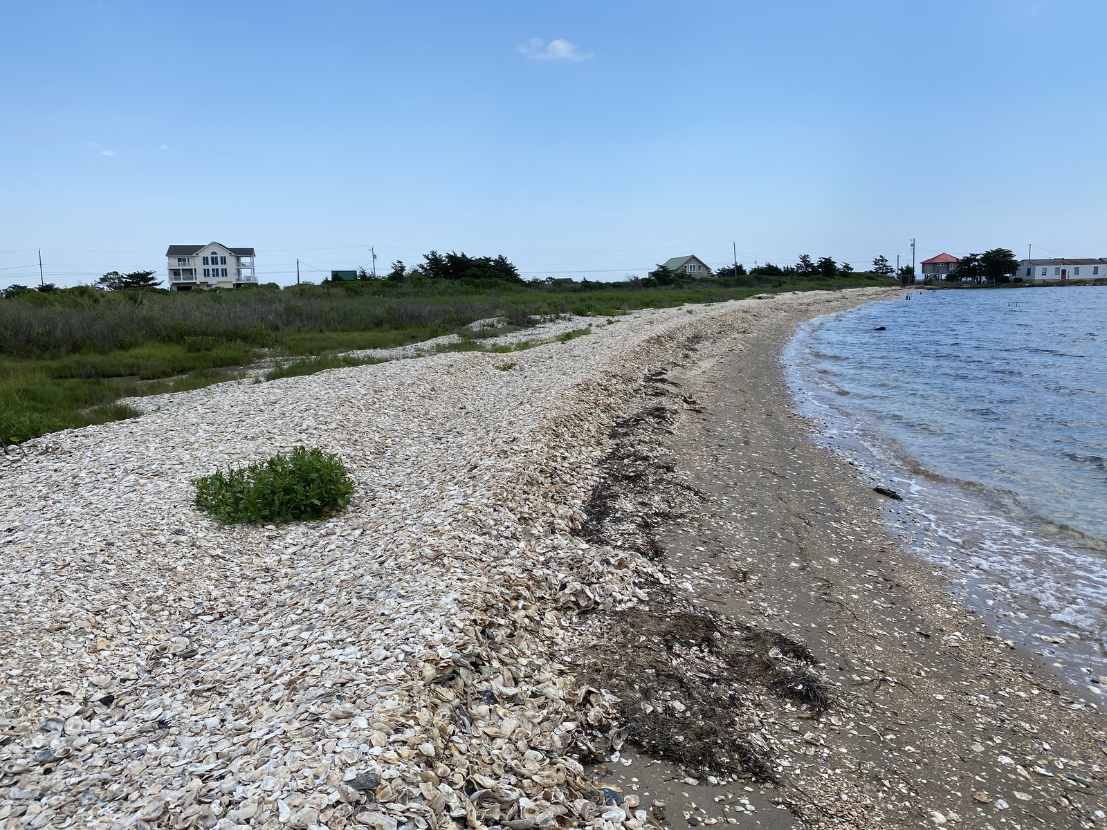
Franklin City


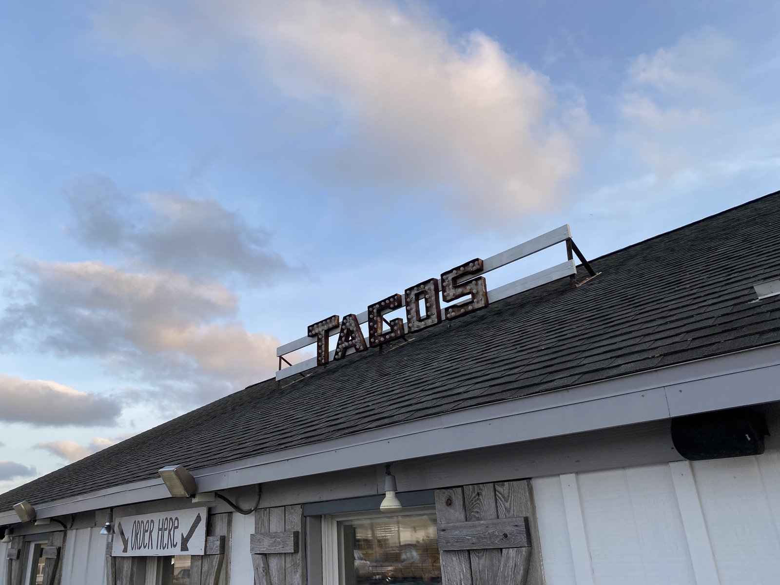
Tailgate 🌮s
A historic day in Richmond
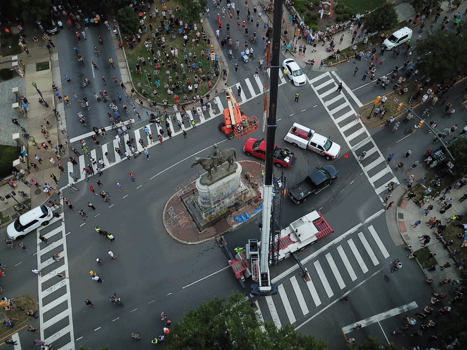
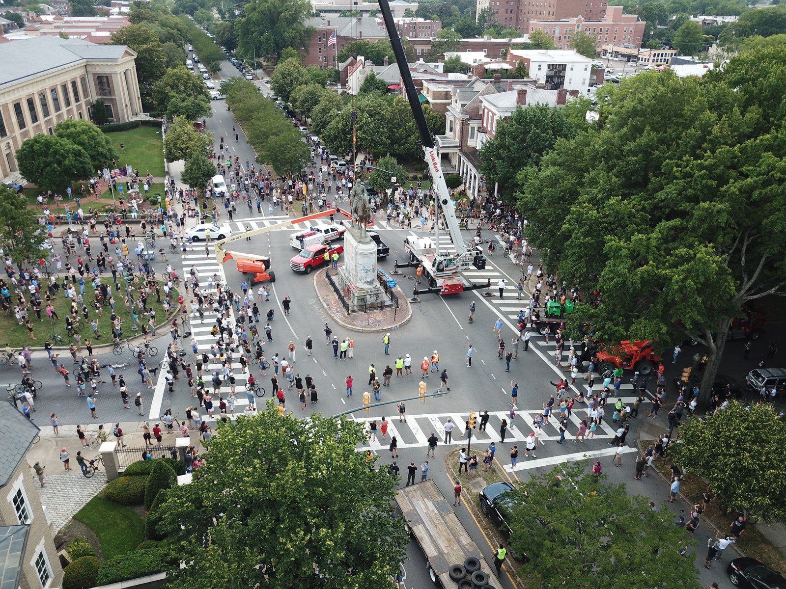
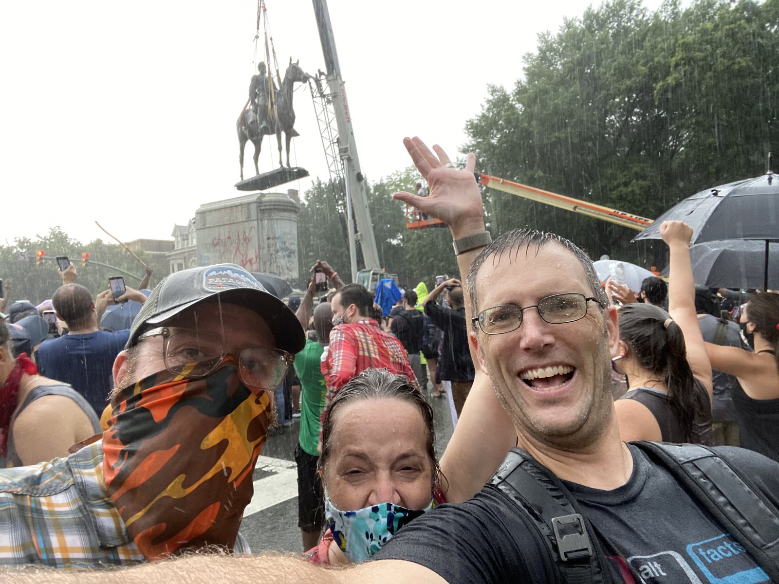
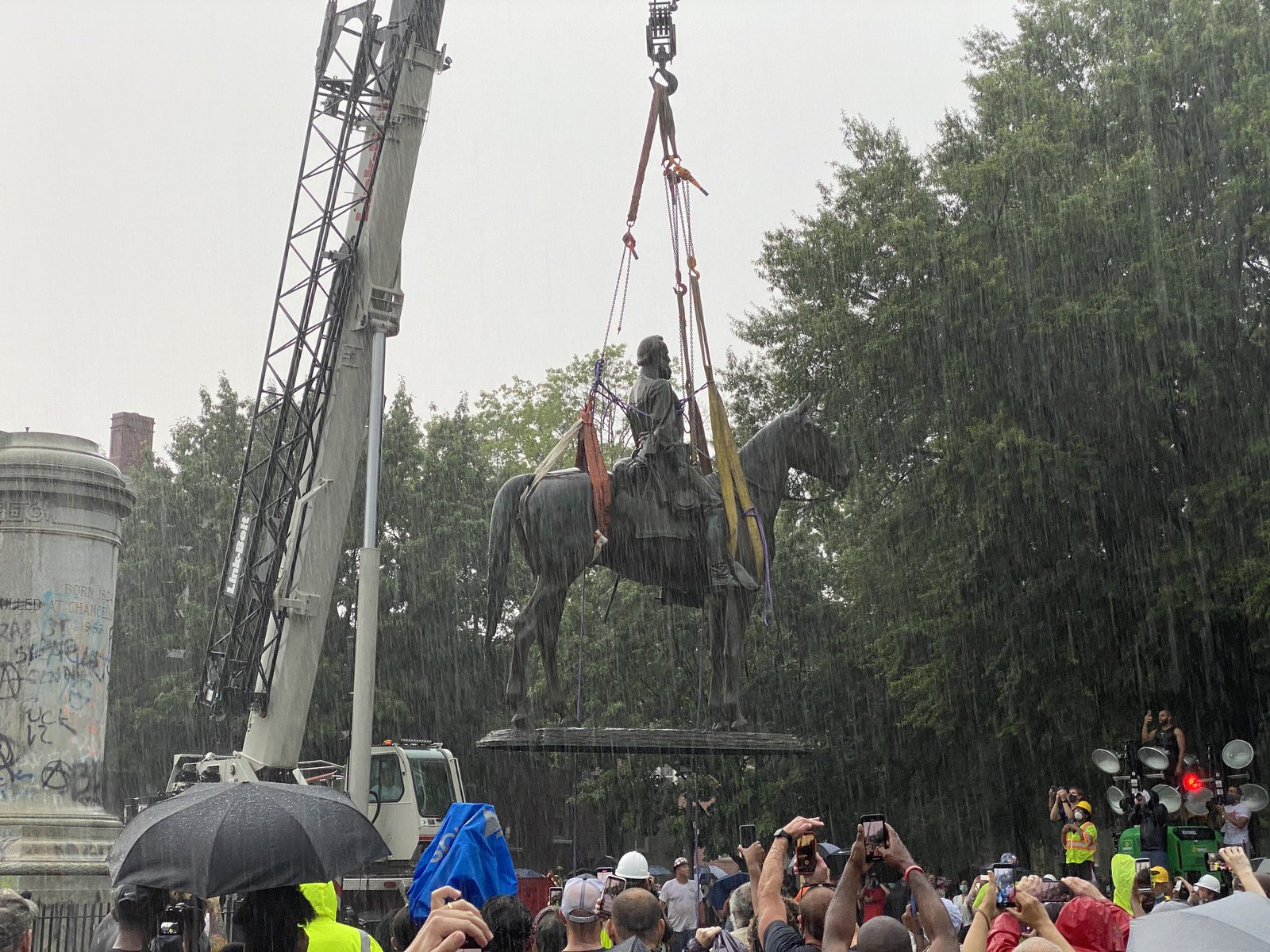
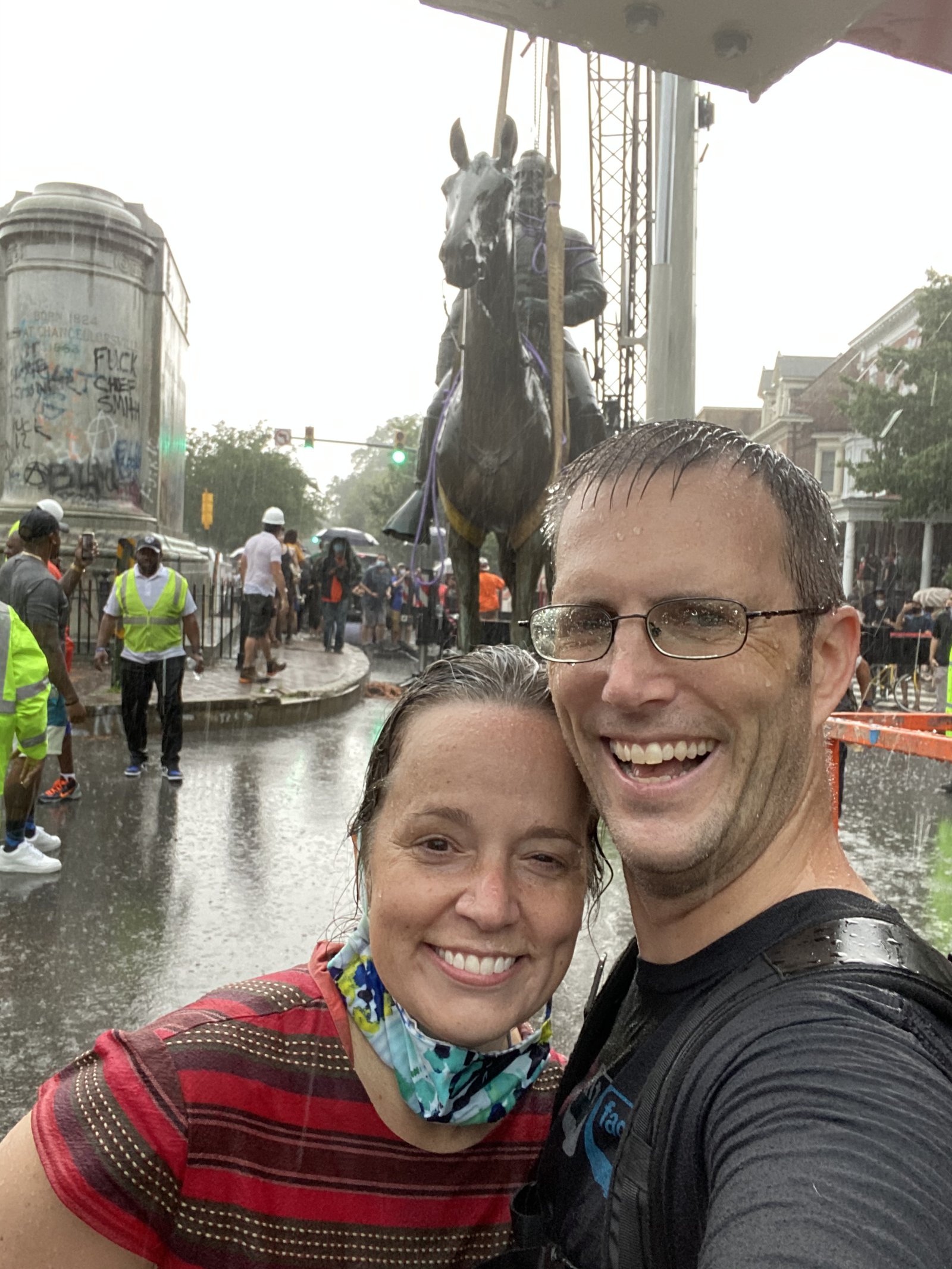
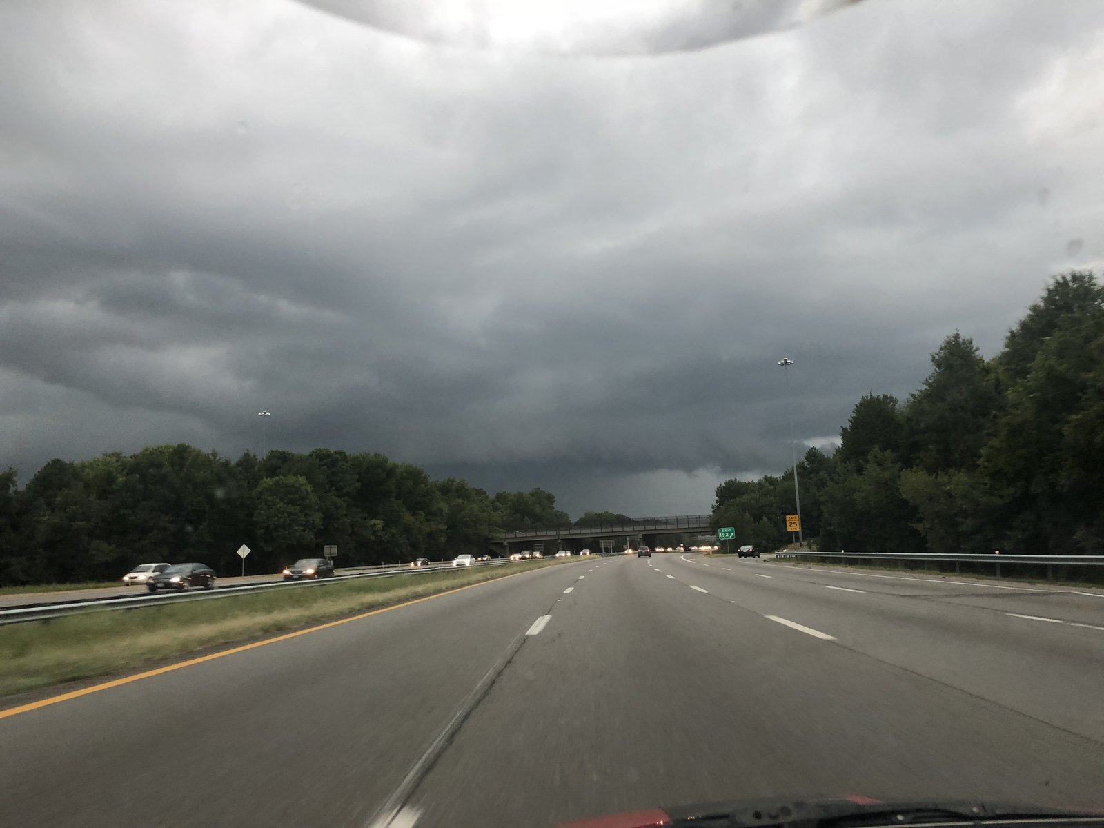
What a month it’s been here, with more than 25 days of protests against police brutality and systemic racism, met by — of course — police brutality. But protests do work, and we’re starting to see change, even if it’s just of the superficial and symbolic type. The first of the memorials to the Lost Cause of the Civil War has been brought down by the government (but not before protesters tore down several on their own, first). Today started out hot, humid, and clear, but then some amazing summertime storms rolled through. I don’t think a single onlooker left because of the deluge, tho.
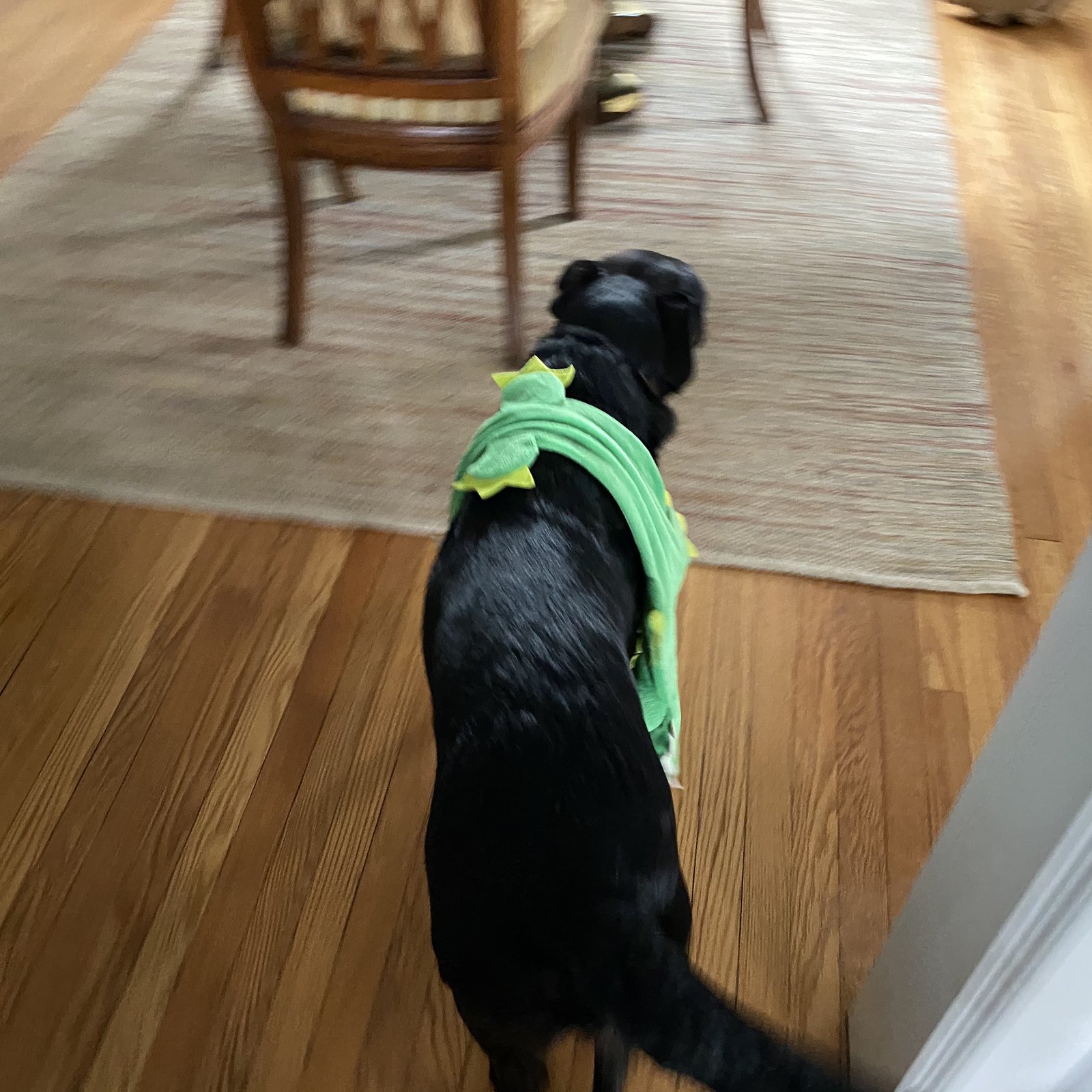
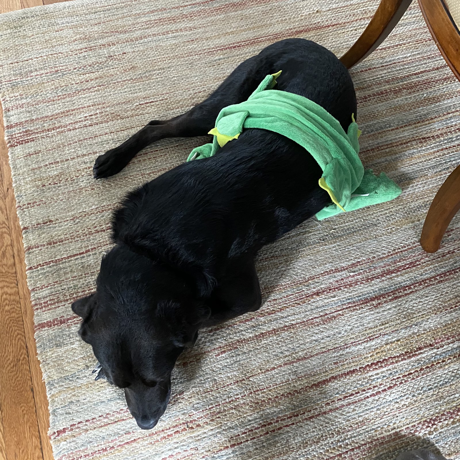
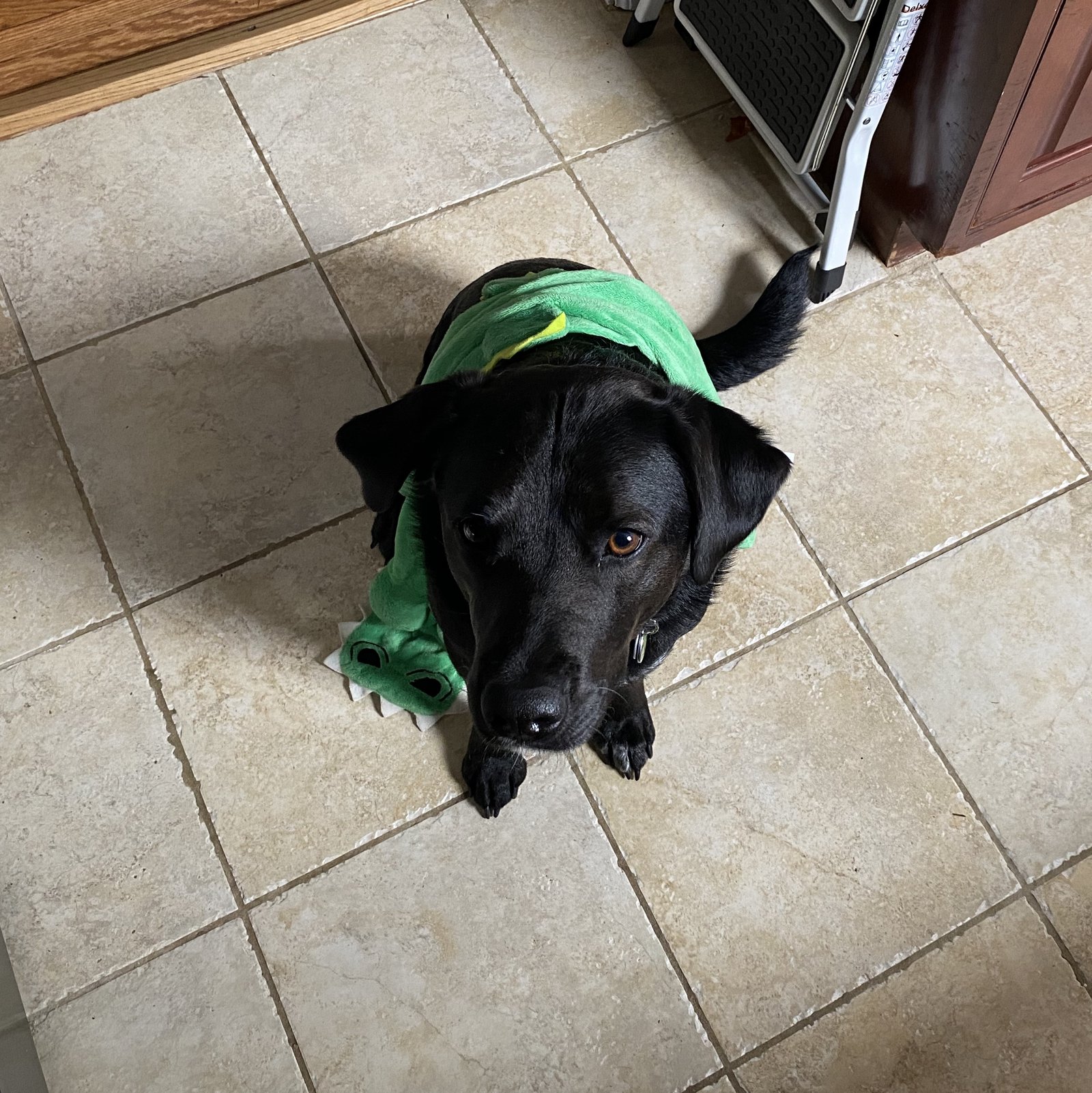
🐶+🐊
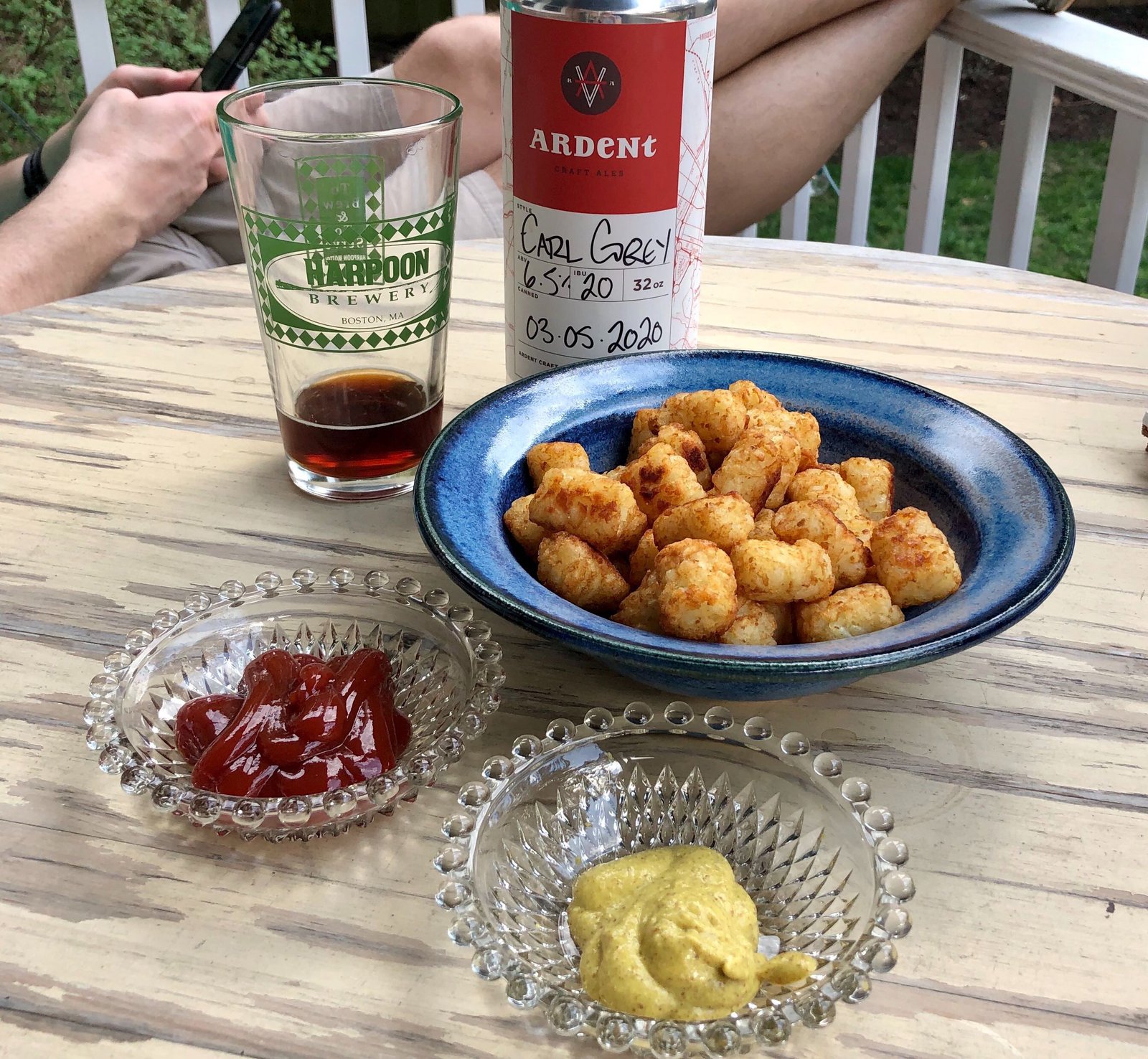
Tater tots: it’s what’s for dinner
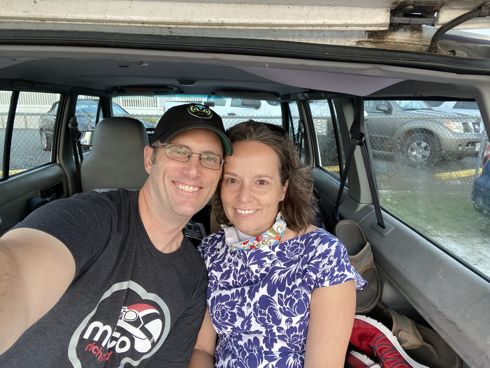
We are adulting so fucking hard right now.
I voted!

🌱
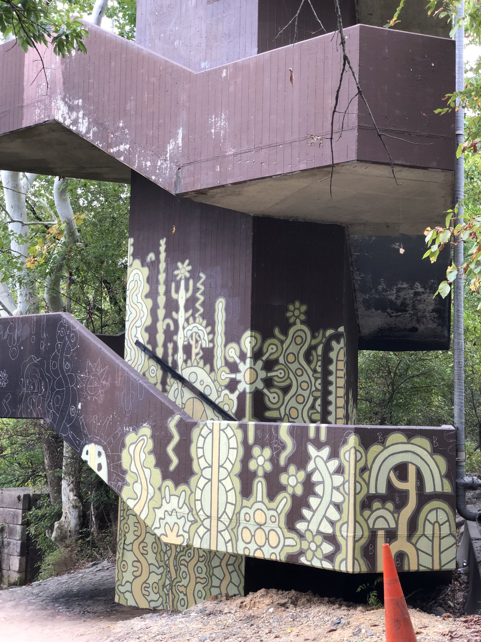
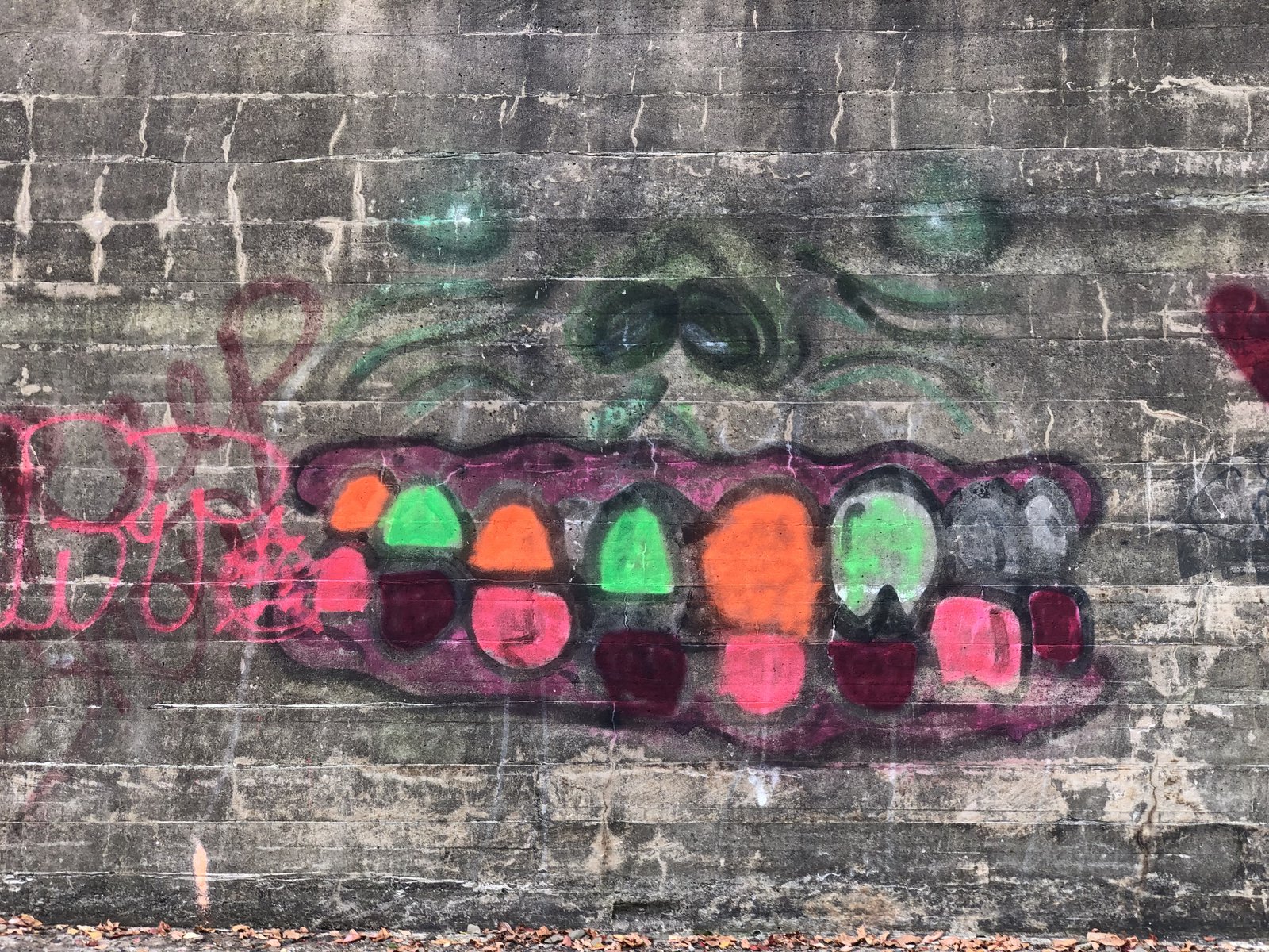
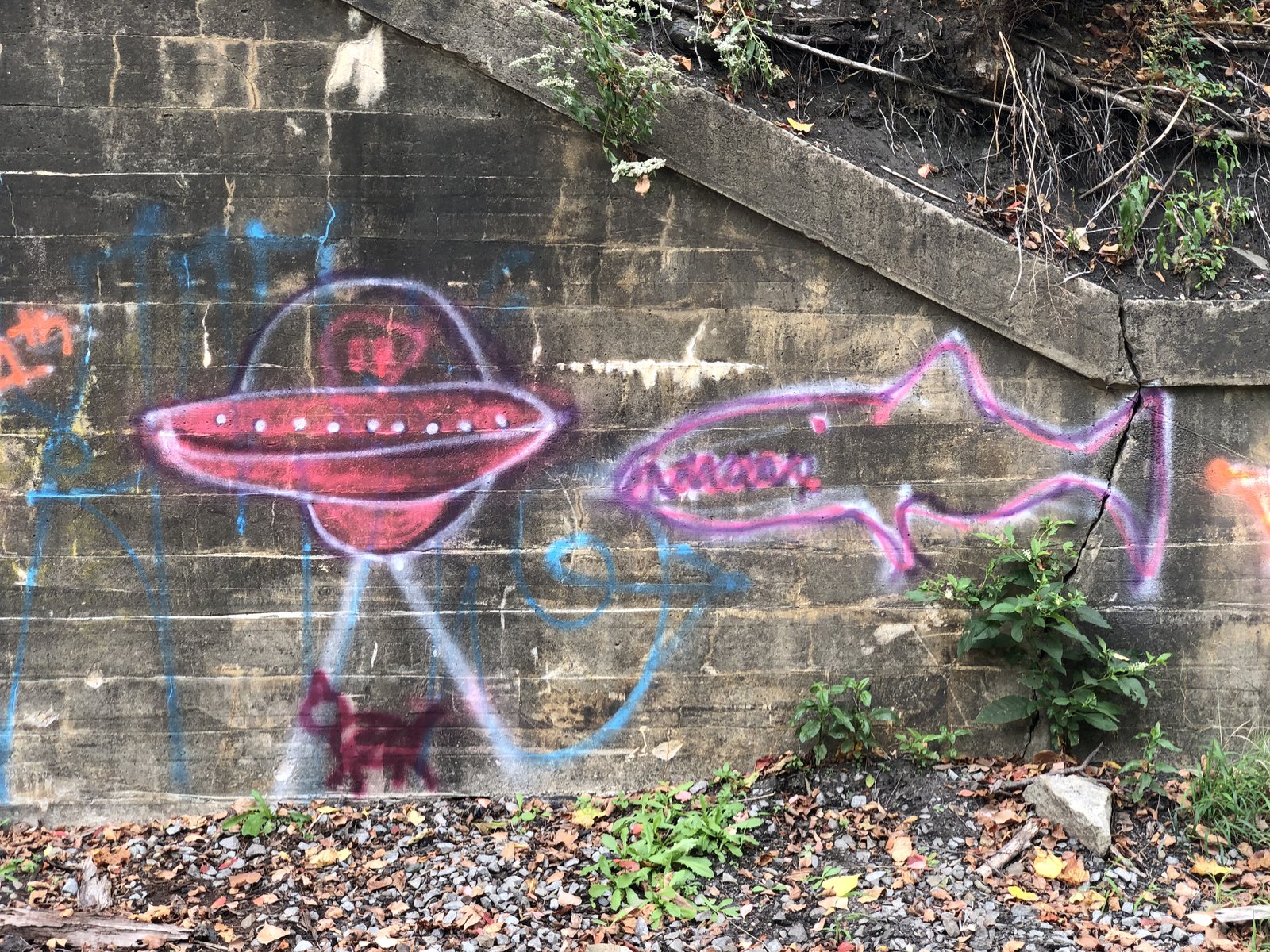
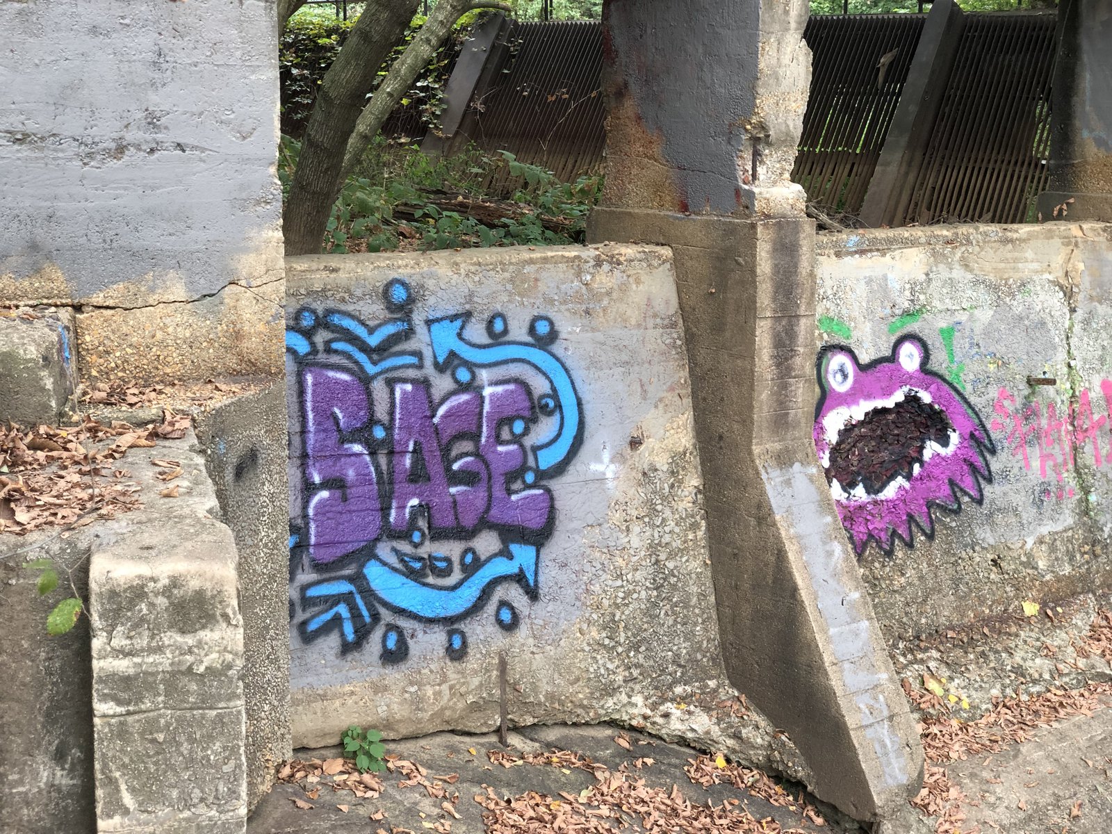
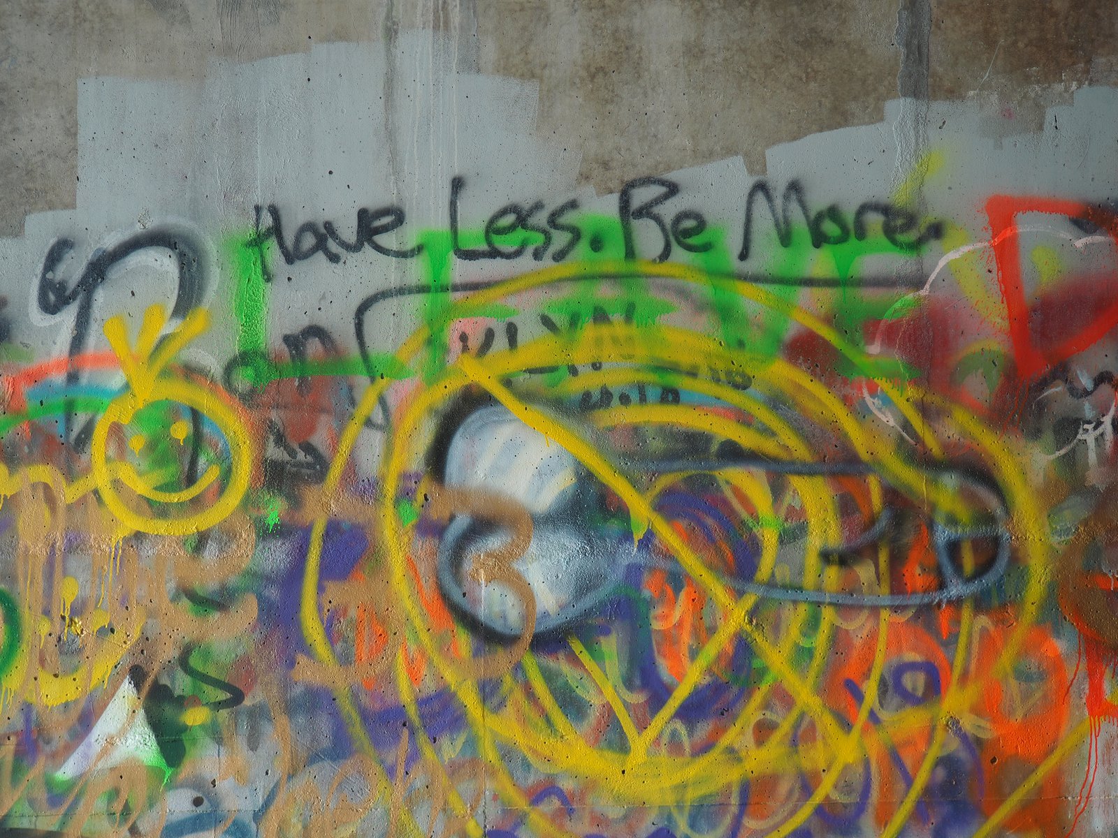
Colorful Patterns
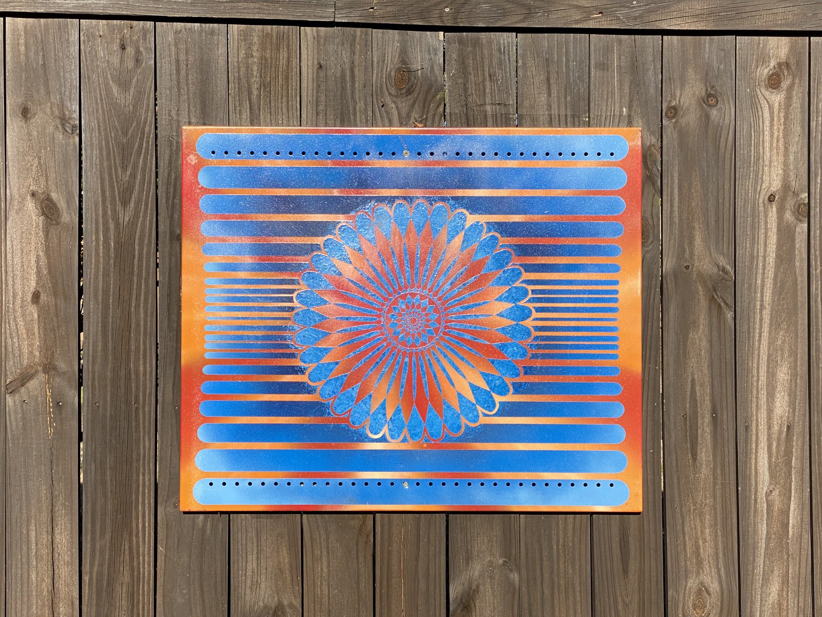

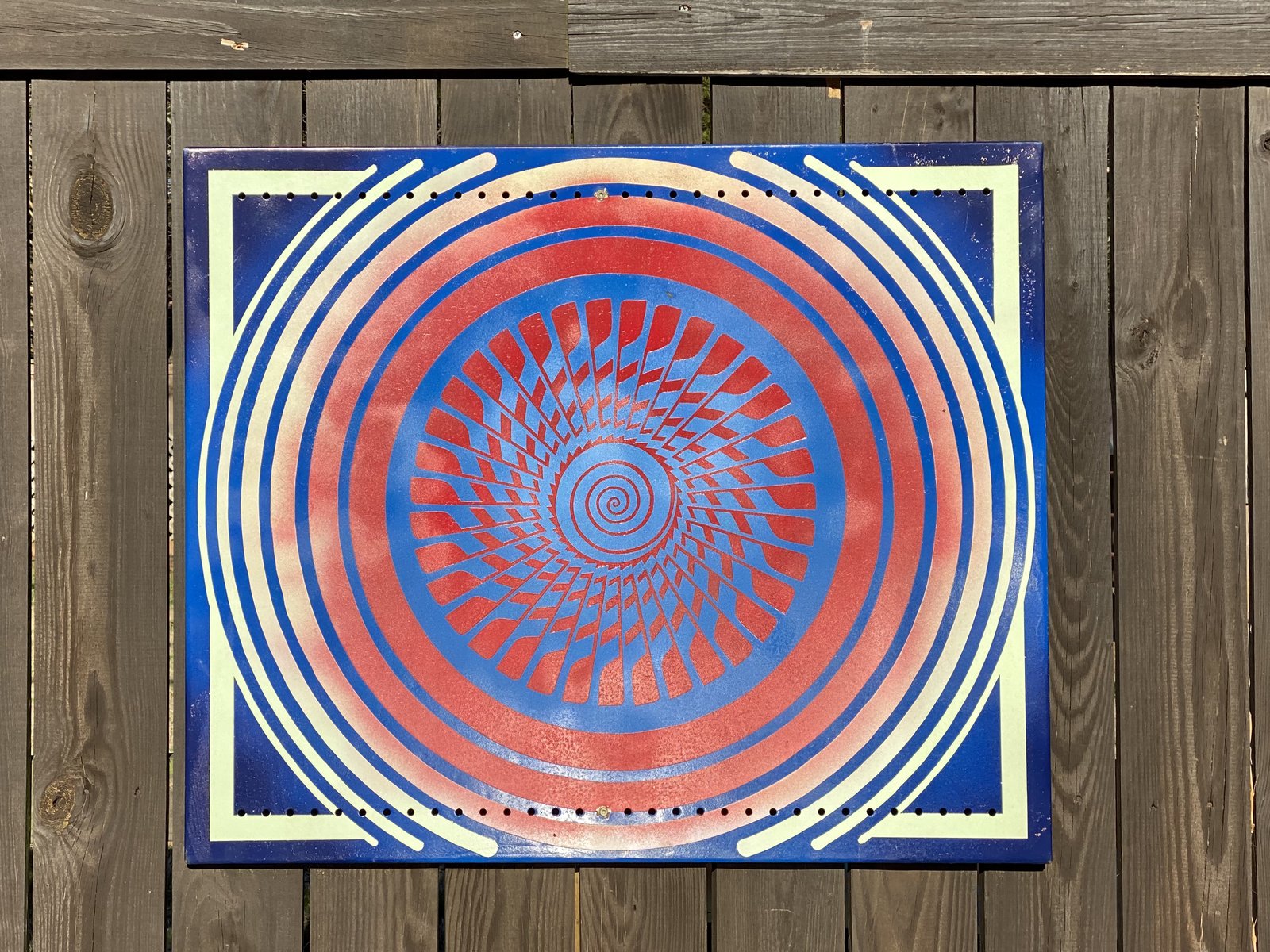
These are in a part of the neighborhood I don’t go very often. I’m always delighted when I come across them. They’re so colorful and happy.
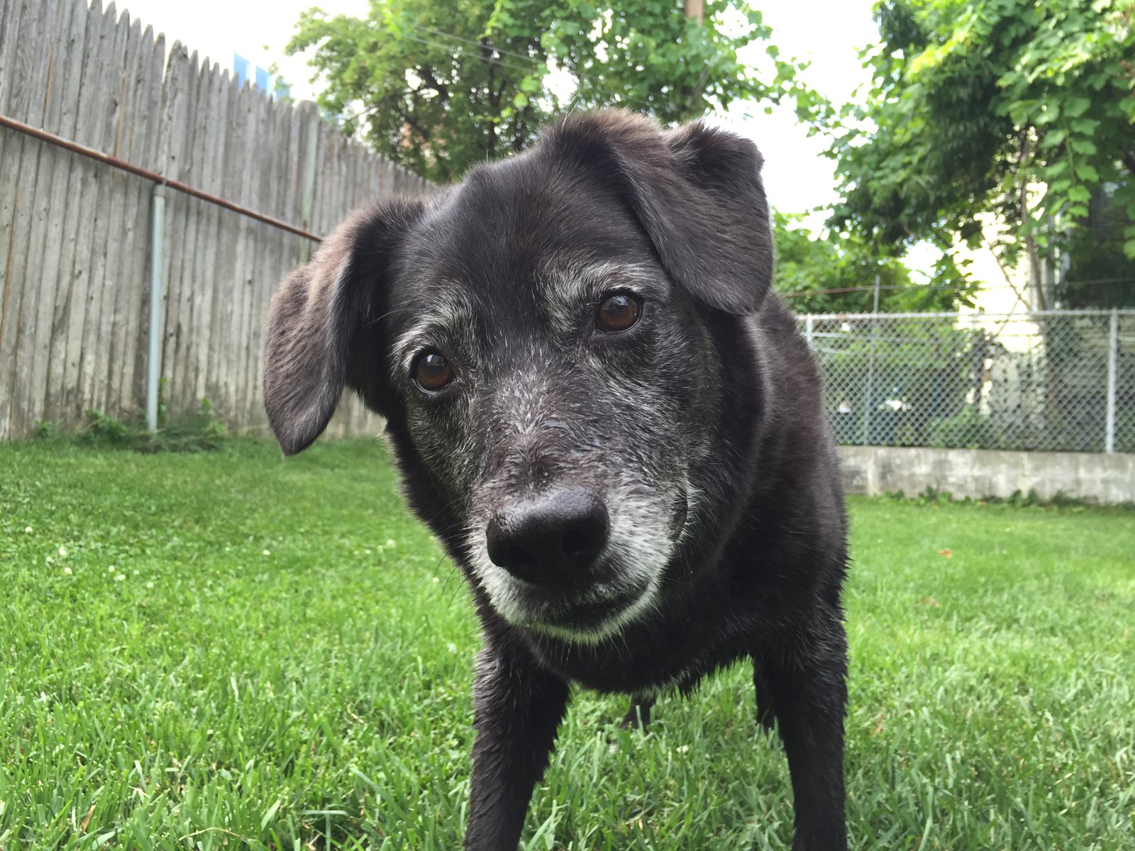
❤️🐶

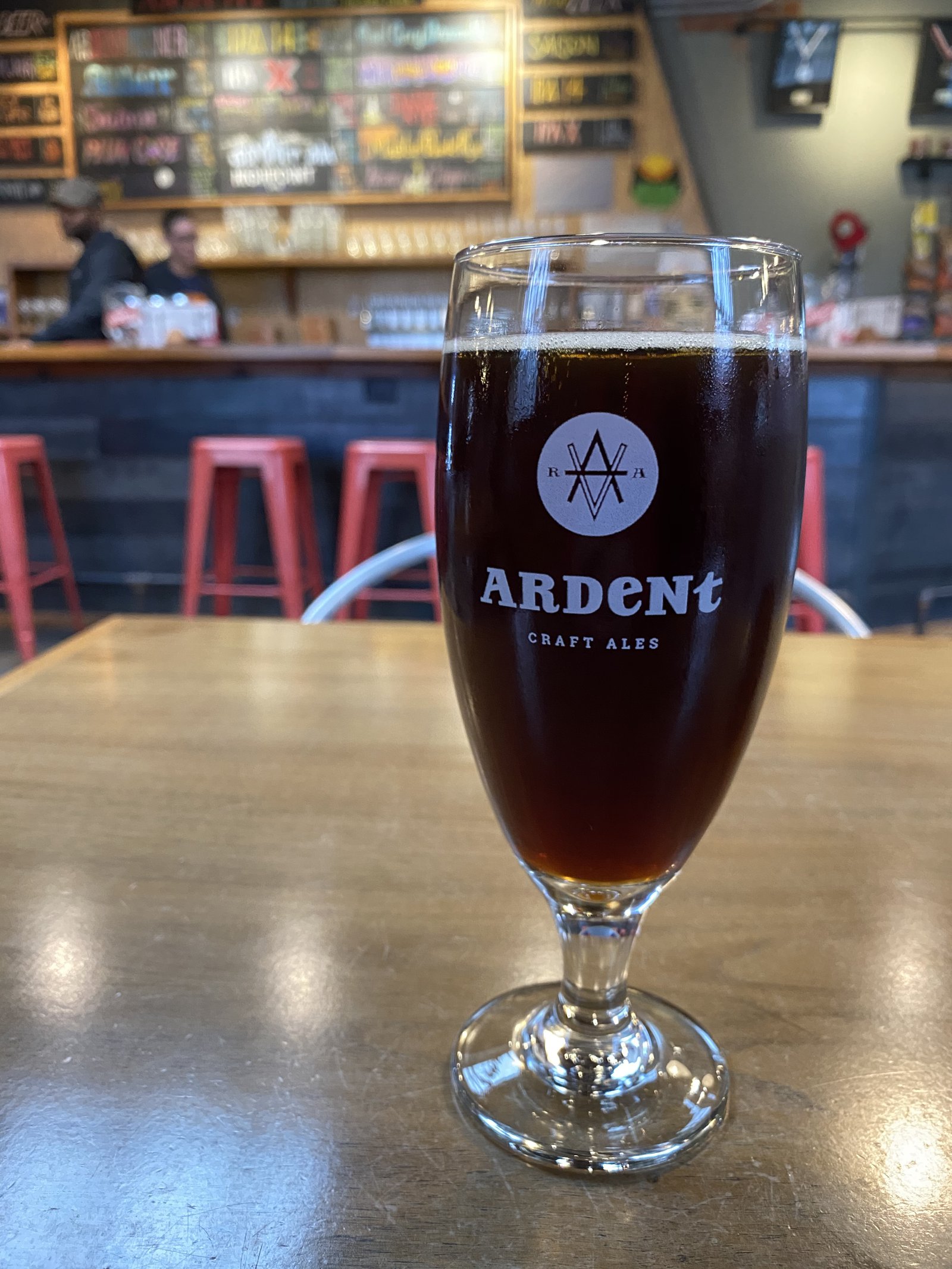
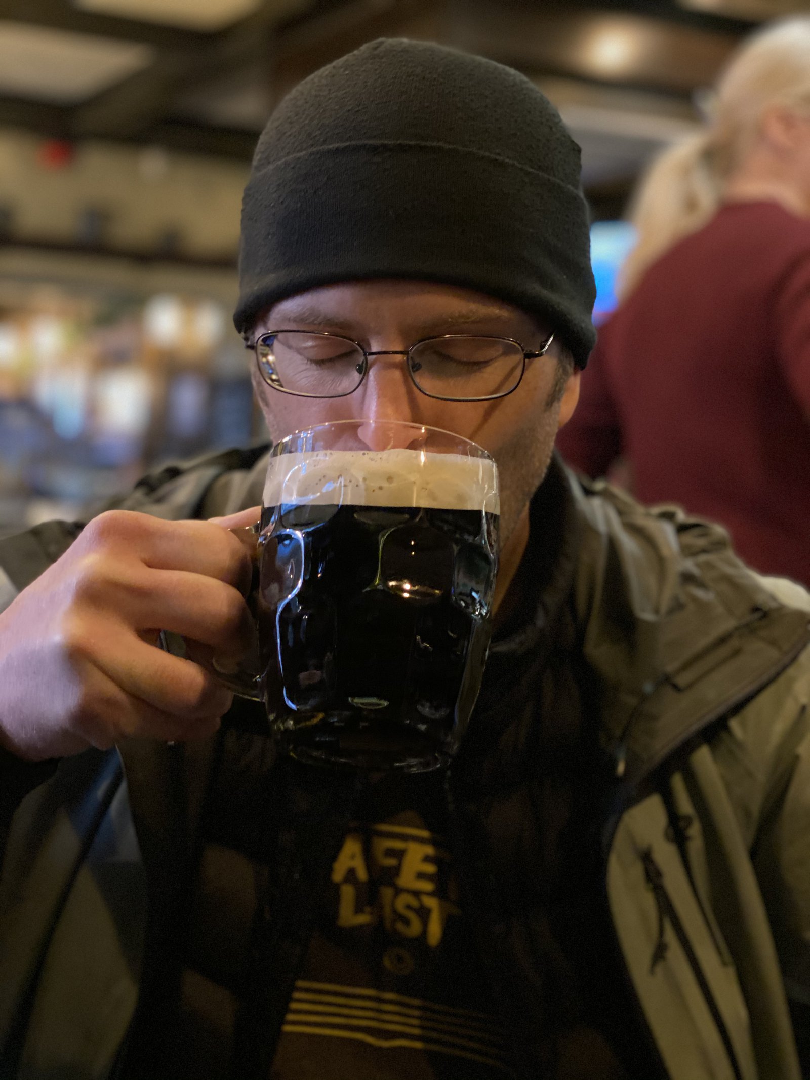
Some days you just need to be there when the brewery opens
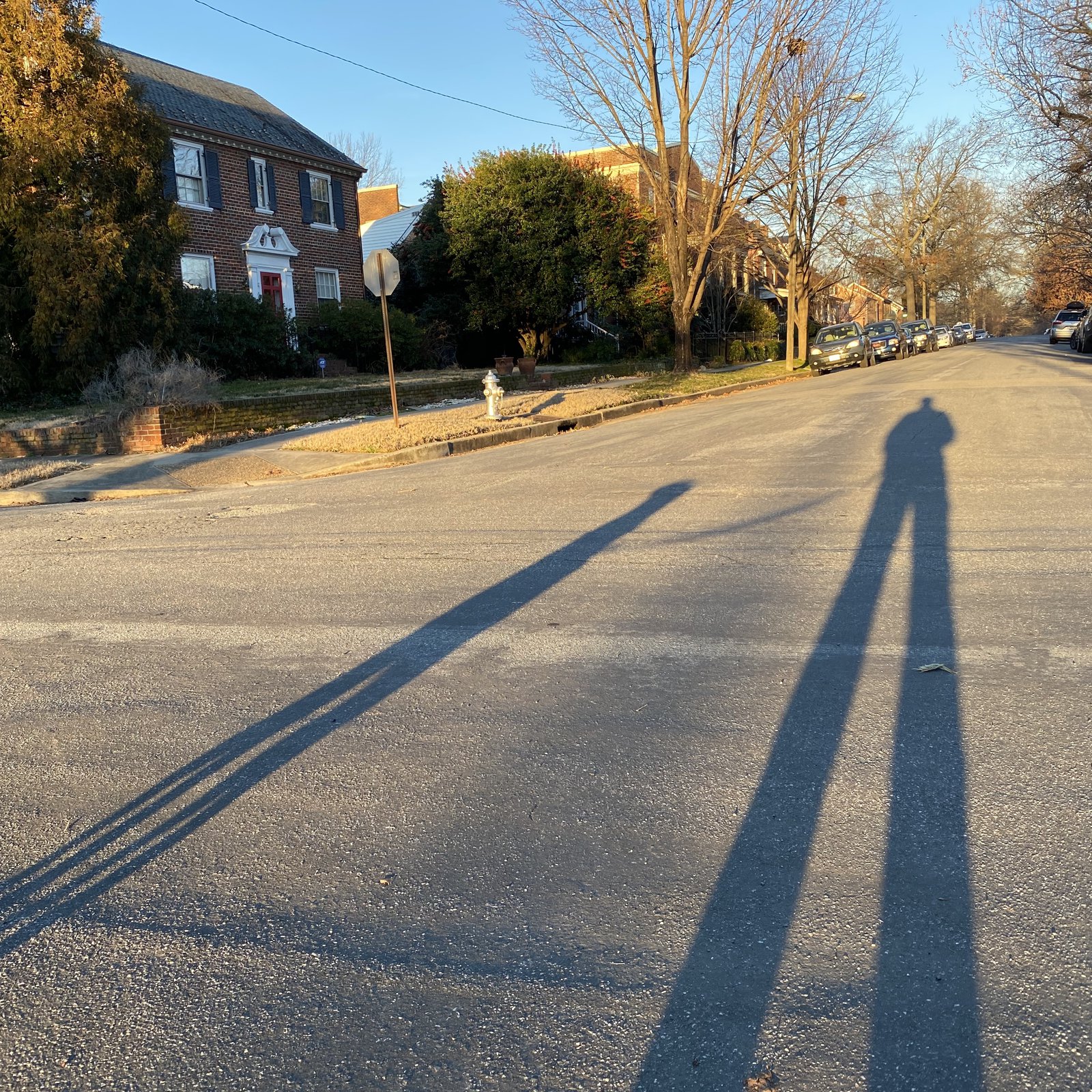
Good morning, RVA!
Sunday morning mood

Beers at the end of the world
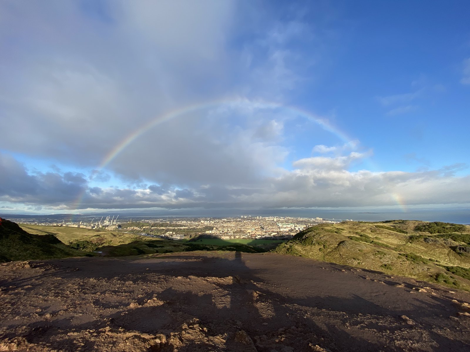
🌈 from Arthur’s Seat
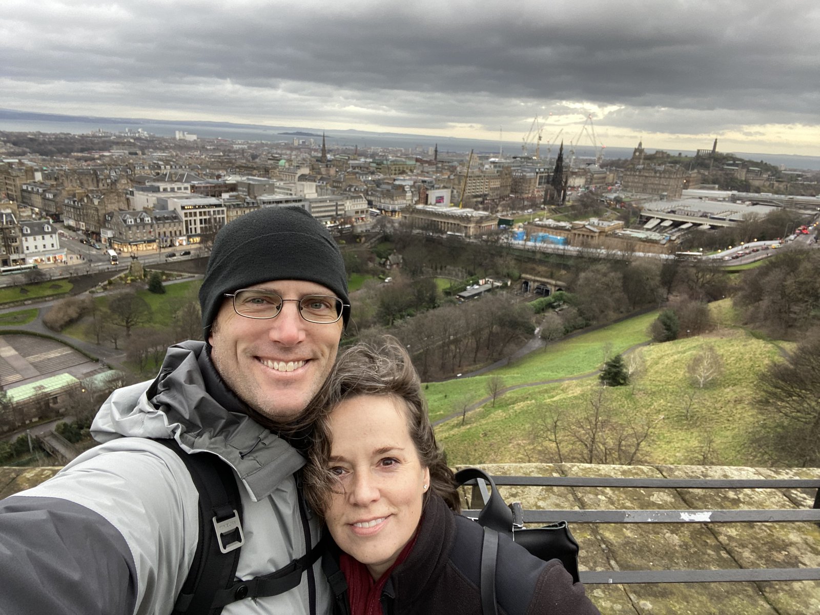
View from the castle
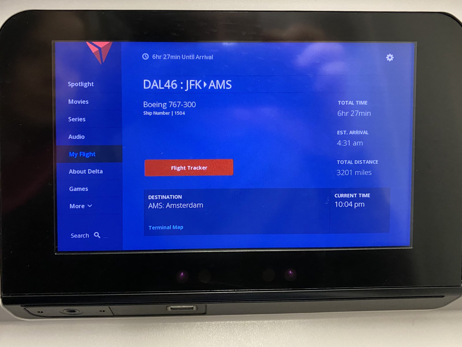
🏴 bound
Morning walk 🌞🐶
I think I just made a speeder bike
River walk with 🍀🐶
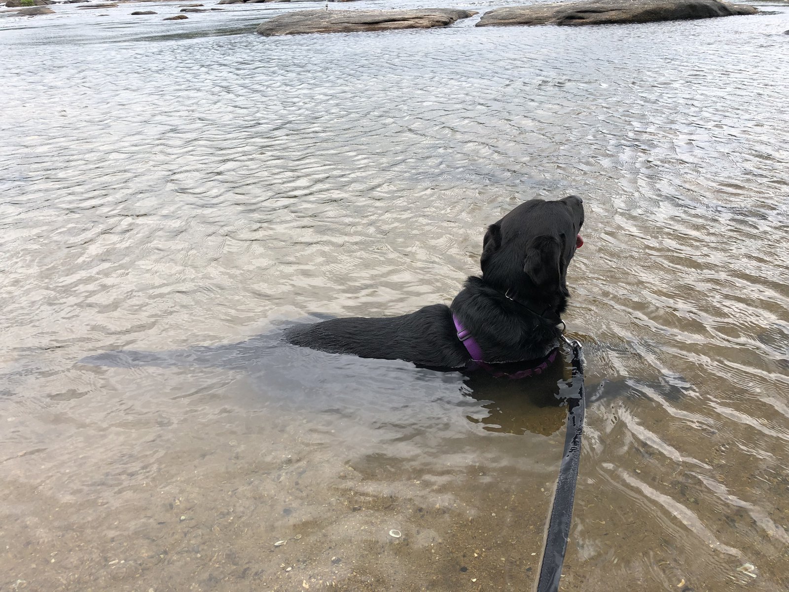
I’m done traveling but have a few more days off. Today Murph and I took a walk around Belle Isle and Brown’s Island. He’s really taken to the water…
DIY dinner
When the Red Shoe Pub is unexpectedly closed, you’ve just gotta make do. So far Nova Scotia has been colder, wetter, and windier than expected. Good thing I missed the hurricane!
Cape Enrage
I failed at visiting Hopewell Rocks this morning. Arrived too early and then got distracted trying to find breakfast and a cup of coffee. My internal conversion from kilometers to miles seems faulty (maybe from the lack of coffee), or perhaps the signs are misleading, but the side trip got me back to Hopewell at high tide, and that didn’t seem special enough to warrant paying an entry fee. Cape Enrage, on the other hand, was worth the trip. It’s an old lighthouse on the edge of nowhere with strong winds and exposed rocks, and a foghorn that has hearing damage warning signs nearby (I put earplugs in just in case). The photos don’t capture the wind: it was strong and gusty and made sticking to a line on the bike impossible. They’d just opened today after being closed for 4 days due to the storm. I was told the wind was blowing extra strong to make up for lost time.
The Adirondacks to Maine
Up early this morning, made a cup of coffee, packed up camp, and had breakfast at the Tamarack Café in Inlet. More fun roads as I pushed East, but befouled by traffic and (SO MUCH) road construction. Really pretty riding around the lakes and streams of this part of NY. If they finish the construction the roads will be awesome next spring!
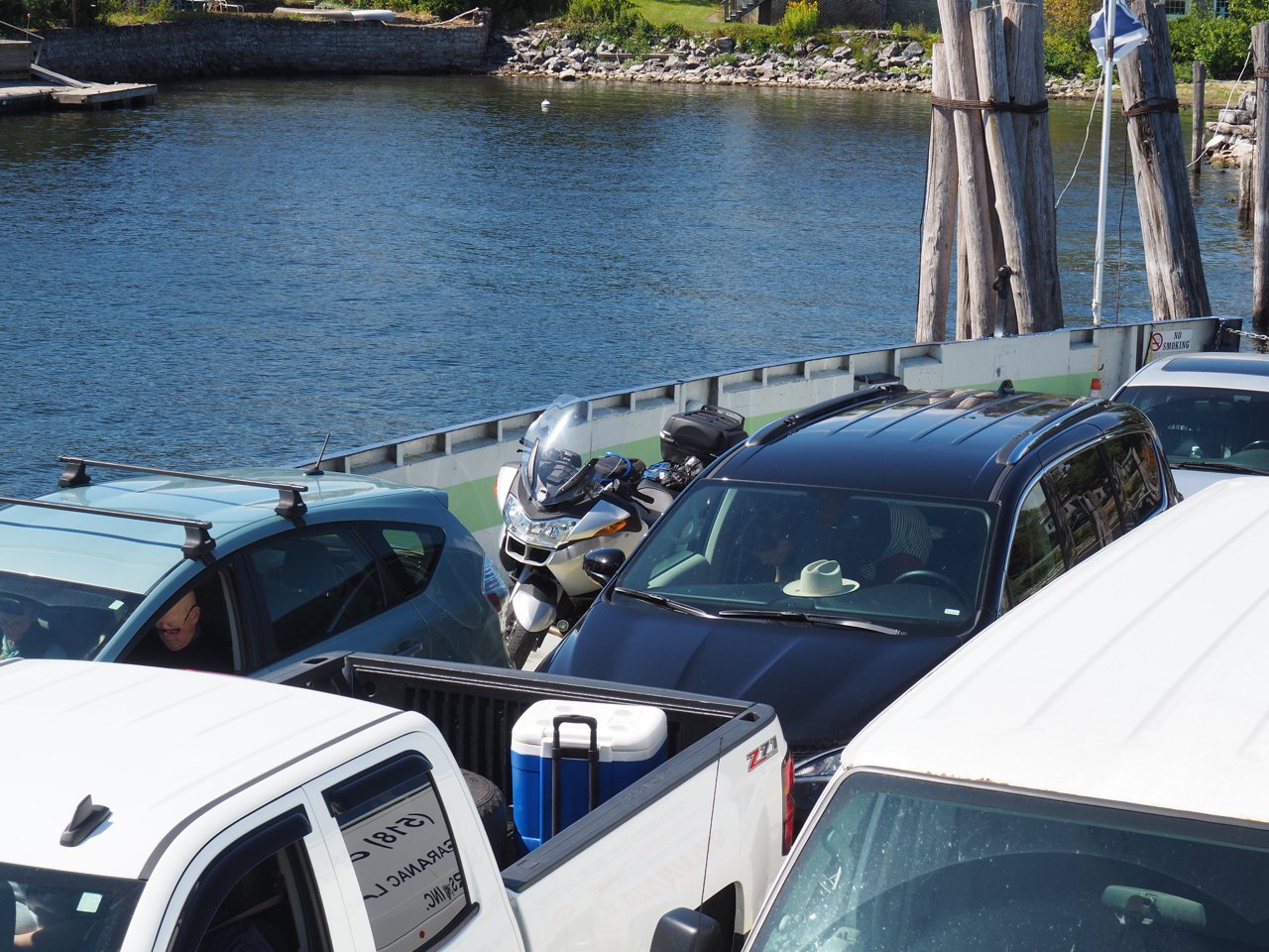
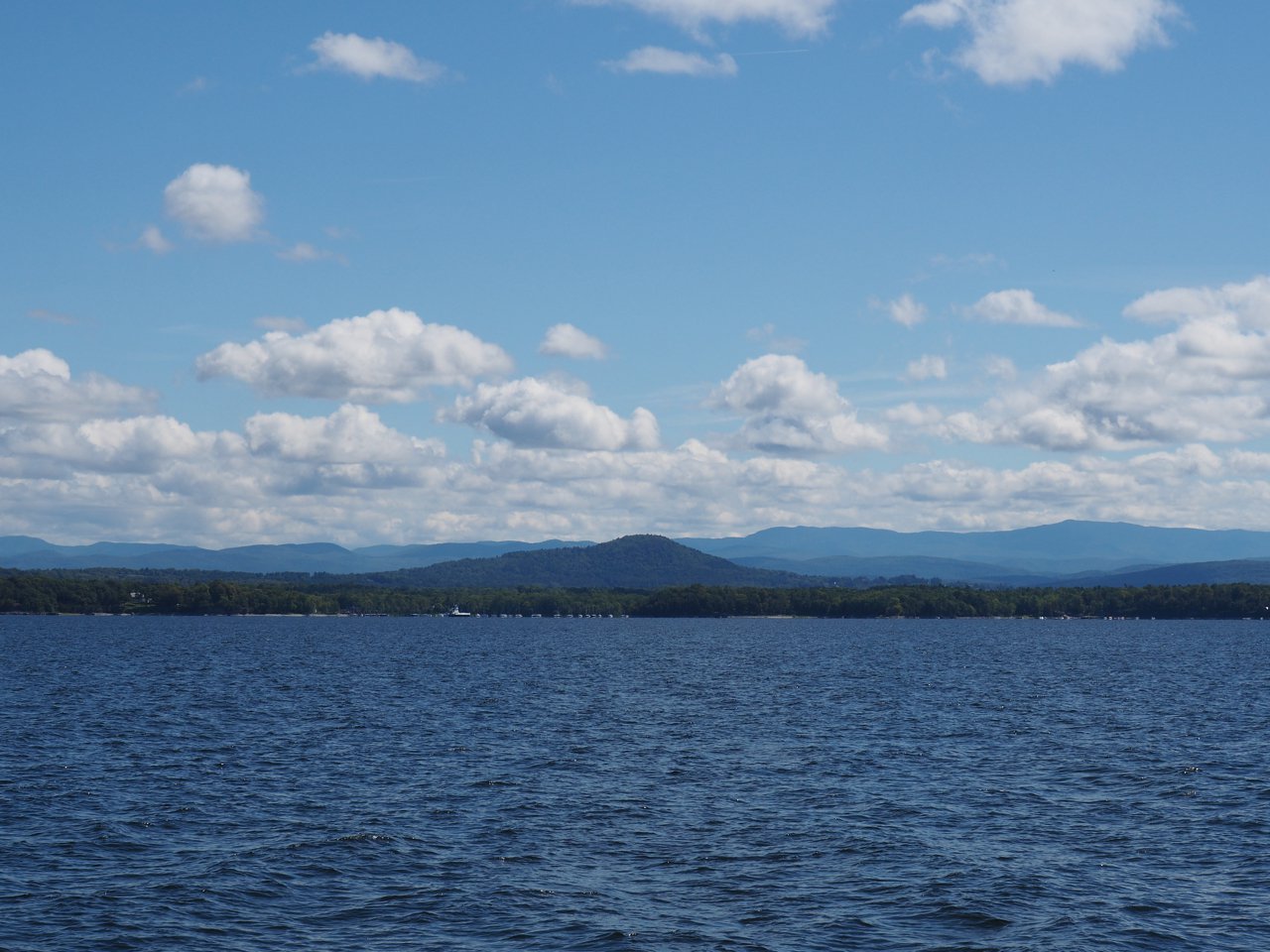
Around noon I got my first ferry of the trip, from Essex, NY to Charlotte, VT, crossing Lake Champlain. A bit cool, but otherwise perfect with blue skies and puffy clouds. Recognizing that I’d packed for far warmer weather I headed toward Burlington to try to get a more appropriate base layer; Dick’s failed me, REI is “coming soon” (Burlington doesn’t have an REI, yet‽), and I quickly tired of the traffic and malls, so I gave up and pointed myself toward Maine again. Typically for me, after taking my time in the morning and early afternoon, I started feeling some (entirely self-supplied) pressure to make more progress, so I hopped on the interstate for a bit toward Barre and then headed for the White Mountains of New Hampshire. I’m generally only vaguely aware of road names and route numbers; once I learn my way around an area I navigate by feel: I was delighted when I realized I was going past some of the old MINIsOnTop haunts, like the Town & Country motel.
I wound my way across NH and Maine, through Augusta, and to my final destination near Rockland to meet MINI friends Blaine and Monica at the amazing Café Miranda. They graciously offered to put me up for the night; it was a long day and this was a great end to it.
Tomorrow: 🇨🇦!
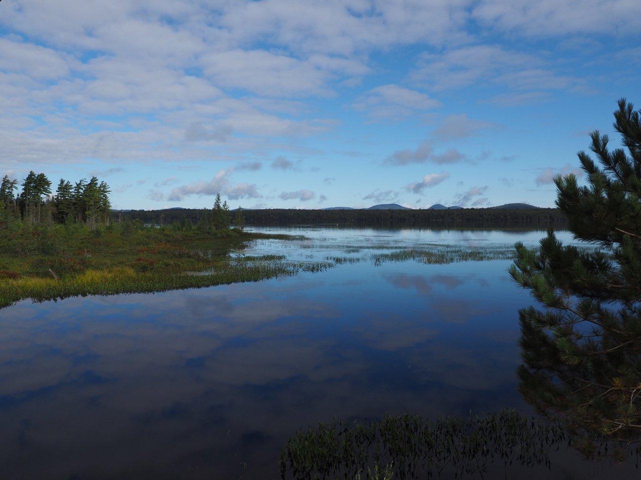

Sunrise on Limekiln Lake
Spencer to the Adirondacks
After messing with the drone we headed up through Watkins Glen to the Ginny Lee Café in Lodi, which has great views of Seneca Lake and the Wagner vineyard. There was some kind of vintage car festival going on at the Glen, so (a) there was a ton of traffic through Watkins, and (b) there were of cool cars old and new all over the region. It was a chilly morning and it made me happy to see so many roadsters out with their tops down.
After lunch I split off on my own again and headed for the Adirondacks. My initial plan had been to make a mad dash for Cape Breton in Nova Scotia from home, but Hurrican Dorian and I would have been arriving at the same time, which is right about now. So now I’m taking a far less direct but much more scenic route through NY, VT, NH, and ME, and will probably save the mad dash for getting back home. This part of NY, between the Finger Lakes and around Syracuse, is pretty flat. It’s scenic (as Scenic Highway 414 would imply), but not particularly interesting. 414, routes 5 and 20, and bunch of other pretty but straight roads took me Northeast around Syracuse, toward Rome, and generally in the direction of the Adirondacks, with no particular destination other than a pin on the map somewhere on Rt 28, which did look interesting. From Rome on to Inlet and Limekiln Lake Campground (my destination tonight) it was really a pretty ride through the woods and with some great twisty, flowing roads. I could spend a lot of time just exploring the area.
After getting settled into camp I headed back into Inlet for a glass of cider, boxed pizza, and some wifi at the Screamen Eagle (yes, it’s spelled like that). Tonight I’m camping, but it’s promising to be a chilly evening and so far I don’t think I’ve got enough warm clothes with me…
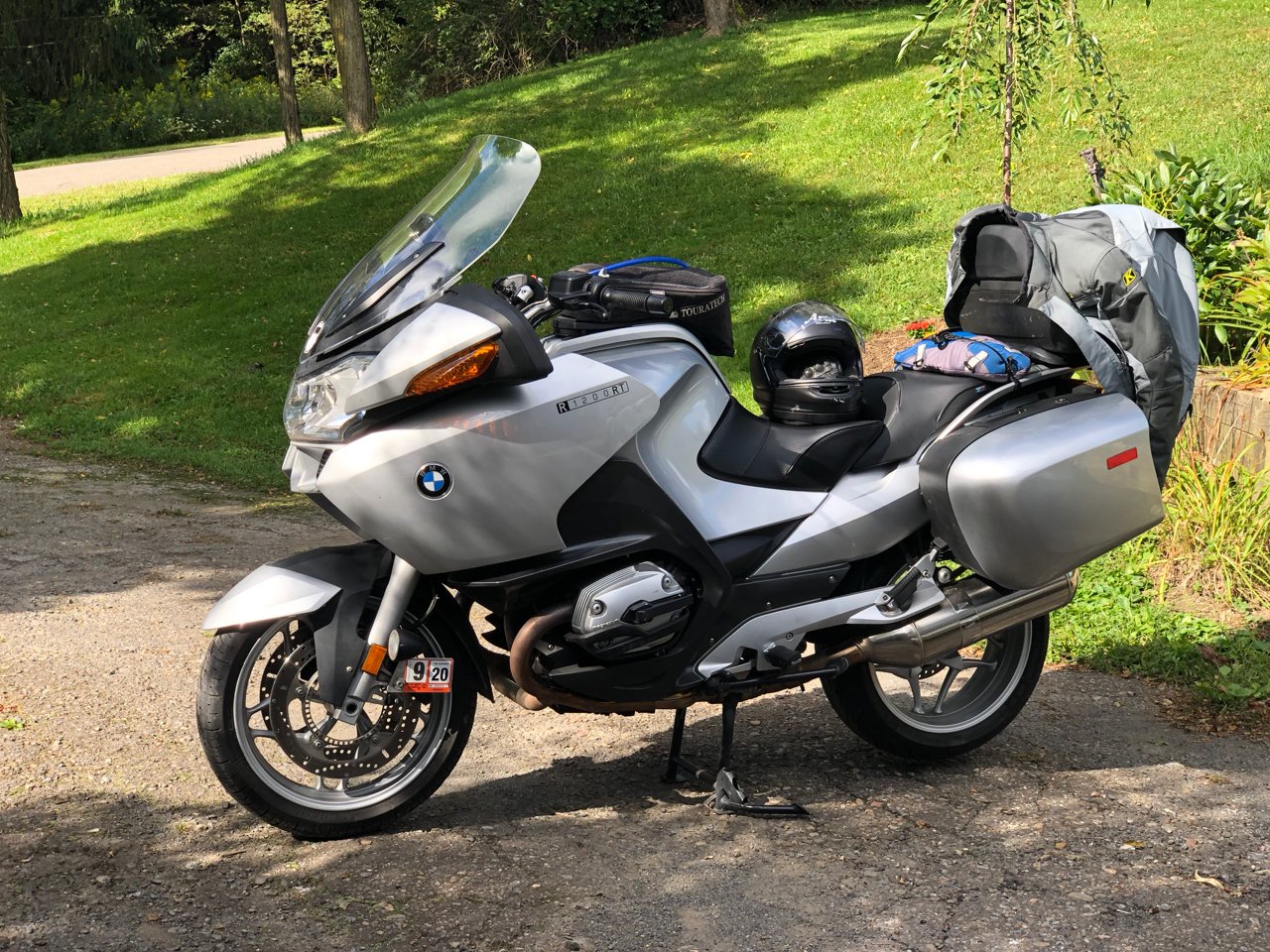
I’m loving the new bike, a 2007 BMW R1200RT. It looks one step removed from a Goldwing, but moves and handles well, and does a good job coping with the weight of all the crap I’m carrying.


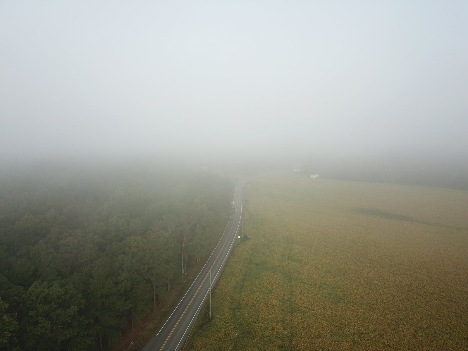
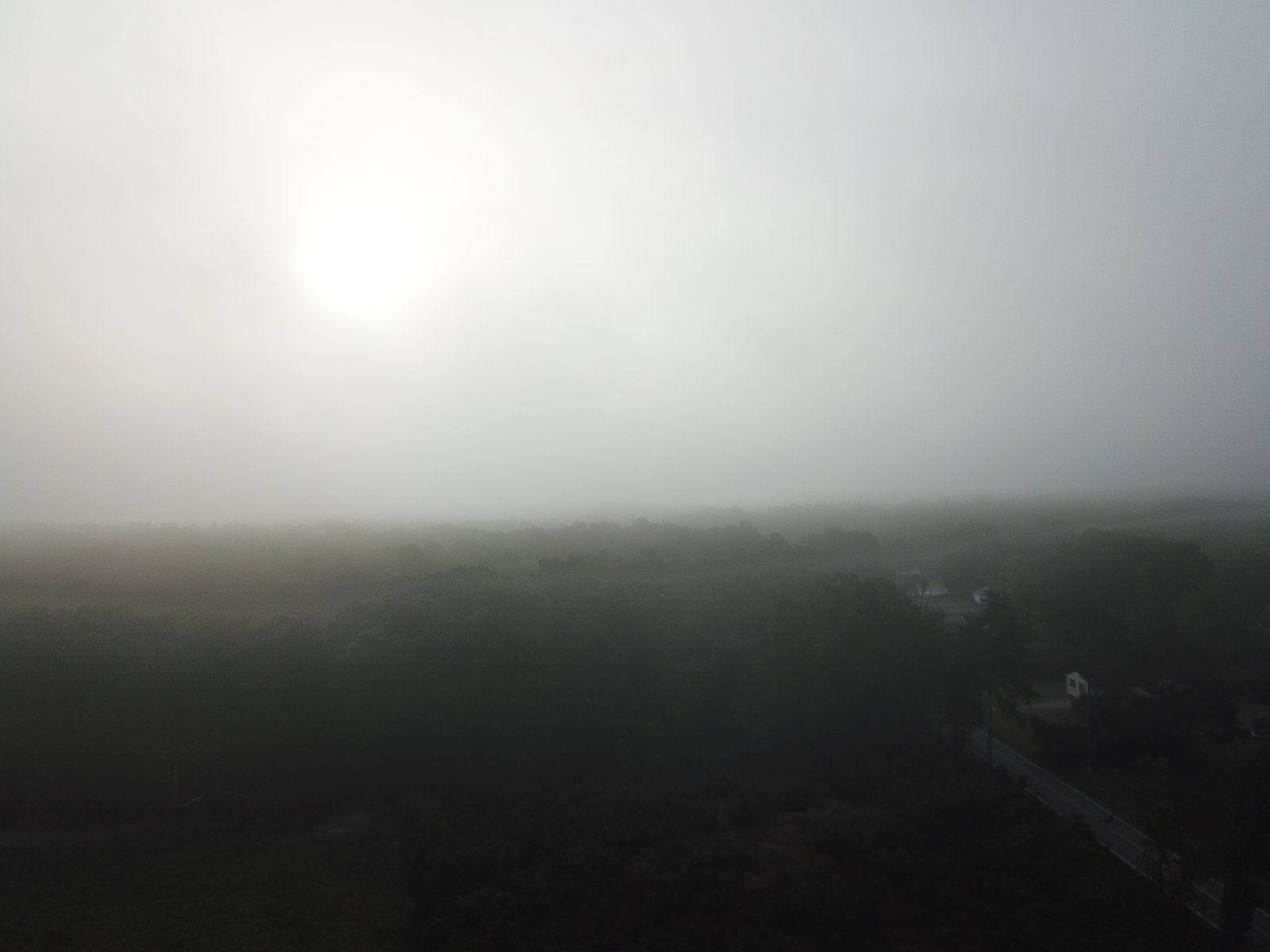
Droning Over Spencer
I bring my drone with me on lots of motorcycle trips. If I’m lucky I’m able to get some neat shots that just aren’t possible from the ground. If I’m really lucky I can avoid crashing it. If I’m super lucky it doesn’t get broken in transit. So far so good. 🍀
These were taken over the house I grew up in and that my mom still lives in. Not a lot’s changed: it’s still rural, still beautiful, still grey most of the dang year. Which makes the field of solar panels across from the high school all the more ironic. I’ve got a lot of memories from this place. I flew sailplanes for a lot of my teens and early 20s, but never managed to get over my own house, so I find these particularly neat.


Richmond to Spencer
I got a late start this morning. I was on the road before dawn, which may seem early, but it was later than I’d hoped: my alarm went off at 4am but I fell back asleep until after 5. I only had a couple things left to stash away, which is good because there were only a few remaining unoccupied nooks and crannies on the bike. North on I-95 out of Richmond for about an hour, and then start avoiding the major roads as much as possible. It’s not exhilirating riding: the Piedmont is generally flat, but the occasional bit of farm land away from NoVA is pretty. I started off fighting the GPS (a Garmin zūmo 395) pretty much right away. I had a rough route laid in to take me Northwest on 17 from I-95, and as soon as I got to 17 it wanted to take me back onto 95 and into DC. Hell no. It’s a terrible device. I blindly continued NW in the general direction of Winchester, trying to balance the desire to keep off major roads with the need to get at least one state out of the way so I’d feel like I’m making some progress. 522 looked pretty good so I started following that from the pointy top of VA through WV, MD, and into PA. Now we’re getting somewhere. At some point around Needmore, PA the GPS decided there were better roads to be found and tried a Hail Mary pass at redemption. It worked (for a bit) and for a couple of hours there were some great back roads through the middle of Nowheresville, PA (nb. not a real place, but it’s not a stretch given other places like Intercourse, Bird-in-Hand, and Burnt Cabins).
Around Lewiston I checked in with my mom and realized my late start and an unexpected shuffling of plans on her end made it so I really didn’t have a lot of extra time to burn. Fastest route it is, then: State College; Williamsport; Mansfield; Corning, NY; and now I’m back in familiar territory, riding roads I grew up on, retracing routes I could do (and have done) in my sleep. I took this area for granted: it’s beautiful, although economically depressed and grey 10 months out of the year. But the roads and scenery are great.
Not much in the way of photos today, just a neat little whistle-stop that loves its trolleys, and a rare blue sky over the old homestead.

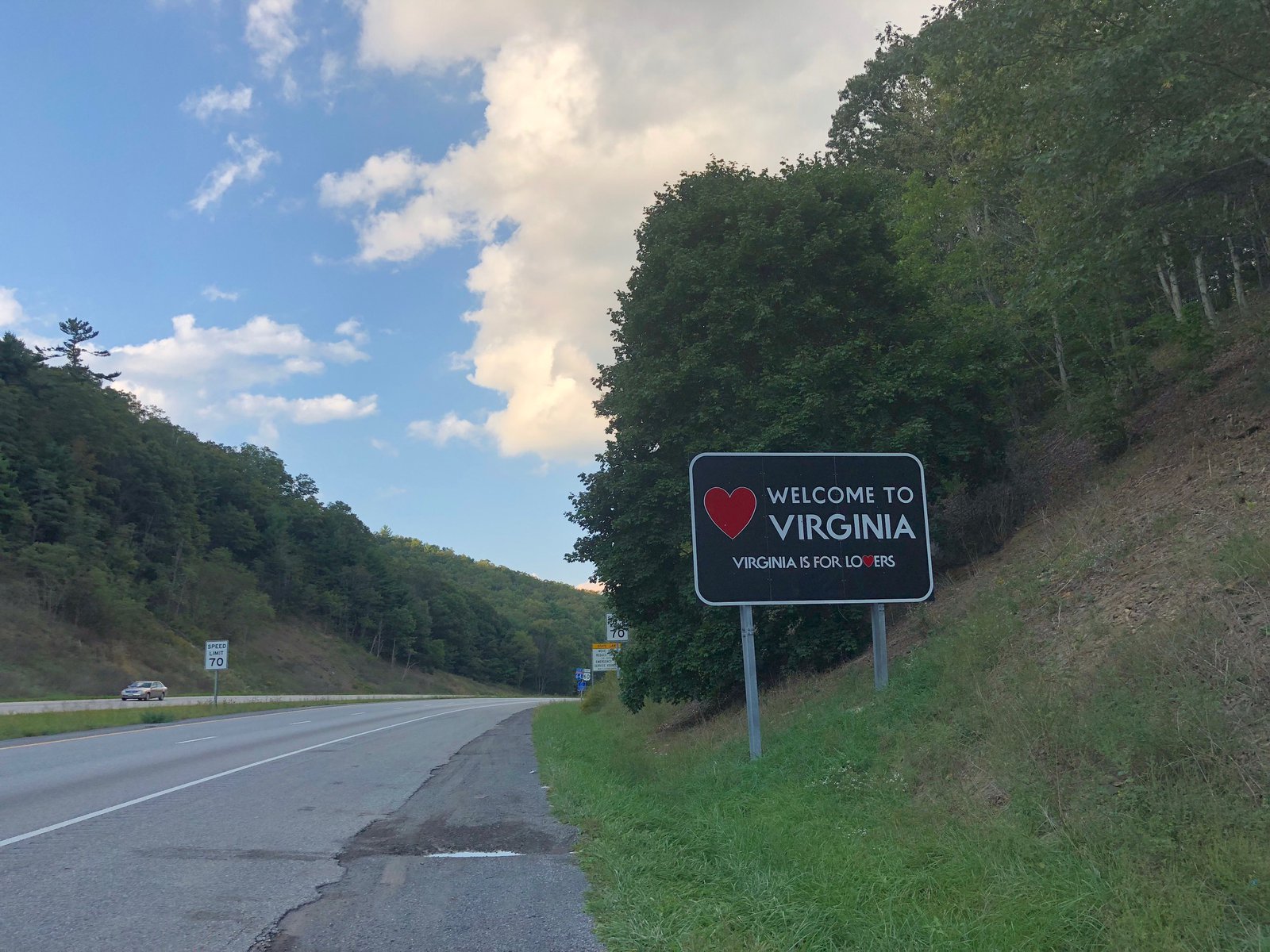
Goodbye Virginia, see you in a week or so!
Anniston and Selma, Alabama
I started planning this trip back in January without anything more than a destination of Austin in mind. It was pretty easy to see that I’d spend some time in the Smokies revisiting a few places I’d enjoyed before, but after that I didn’t have much to build an agenda with. A friend (who has inspired me to write this blog and do more trips) did the Iron Butt National Park Tour Challenge last year and I realized looking for National Parks and Monuments to check out would be a good way to find some stuff to see in places I’d normally never go. In the end I only ended up with one National Monument stop, but it helped inform the rest of the trip and gave me a lot to think about.
The Smokies from above
Confirming the adage that “stuff expands to fill available space” I grabbed my drone at the last minute because I had the room (sort of). I don’t use it much, and traveling with it on the bike is kind of a pain in the ass. But if I only use it on this trip to get these shots it’ll have been worth it.
The Smokies are amazing and photos from the ground never do the views justice. I think these do, however.
The Road to Nowhere
While I was exploring Bryson City last night I saw a sign for “Road to Nowhere”. When I asked the host of the hostel about it, she told me it was a twisty road up into the national park that dead ends at an abandoned tunnel, with lots of great hikes around it. Right up my alley. A little more digging turned up that it was supposed to be part of a road that provided the residents of the county access to their ancestors’ burial grounds after Fontana Dam was started in 1943. But there was an “environmental problem” that couldn’t be solved, so the road was never completed. (And the US Government didn’t hold up their end of the bargain to the residents, obviously).
As promised the ride up was fantastic (there’s not a bad road in the region) with some amazing views. At the end there’s a barrier just a few hundred feet from the tunnel. Hikers and horse riders use the tunnel to access trails, but it was dark af and I didn’t feel comfortable going in there without a flash light: I didn’t want to be eaten by a grue.


A hot and humid start
I hit the road this morning, almost on schedule, leaving just a little after 6am. Morning rides through the country are one of my favorite things. The smells are much more noticeable in the cool, damp air. And there’s (generally) less traffic. 221 from Lynchburg to Roanoke looked pretty good on the map, but it was really just divided highway; south of Roanoke, however, it got fun and interesting: no longer divided, some really twisty sections (like shockingly twisty), and nice views. I stayed with it until lunch beckoned and I ran south to Fancy Gap 🎩 where I had an excellent reuben at The Gap Deli. From there I took the Blue Ridge Parkway until I got bored with the traffic and the speed limit (which doesn’t take long on Memorial Day weekend…) and split off toward Glade Valley for gas. At that point I was starting to feel the heat (upper 80s) and I’d already been in the saddle for the better part of 7 hours, so I opted for interstates to get to Asheville. That only sort of worked: it took less time than back roads, but at the expense of frequent stop-n-go traffic and higher temperatures at the lower elevations. I saw 100° for a while, and it was above 90° for most of the afternoon.
I’m staying at the Smokey Mountains Hostel in Bryson City. Clean, friendly folks, and walking distance from a brewery with a taco truck and around the corner from an ice cream shoppe. Could be worse.

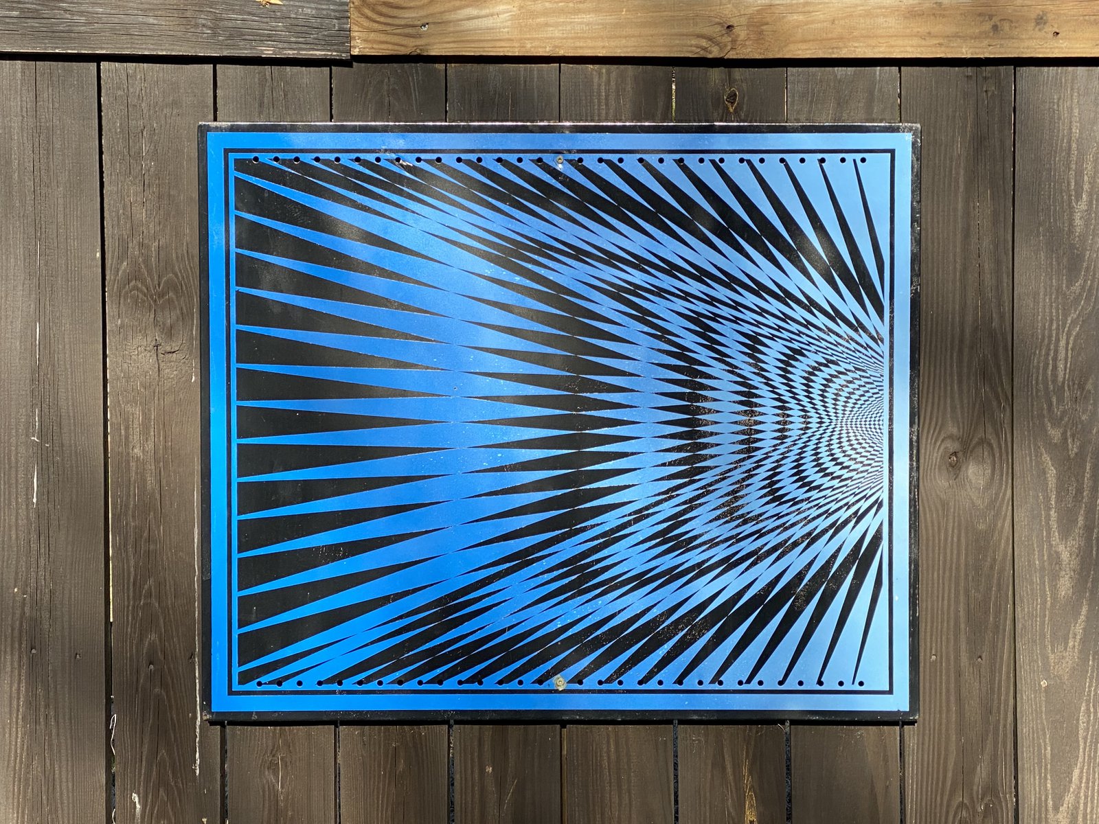
Broken Glass

The glass map panels on the Pulse stations seem to be fragile. I drove past this one a couple of days ago when the afternoon sun was behind it and it looked awesome. I just couldn’t capture it in a photo.
🌸

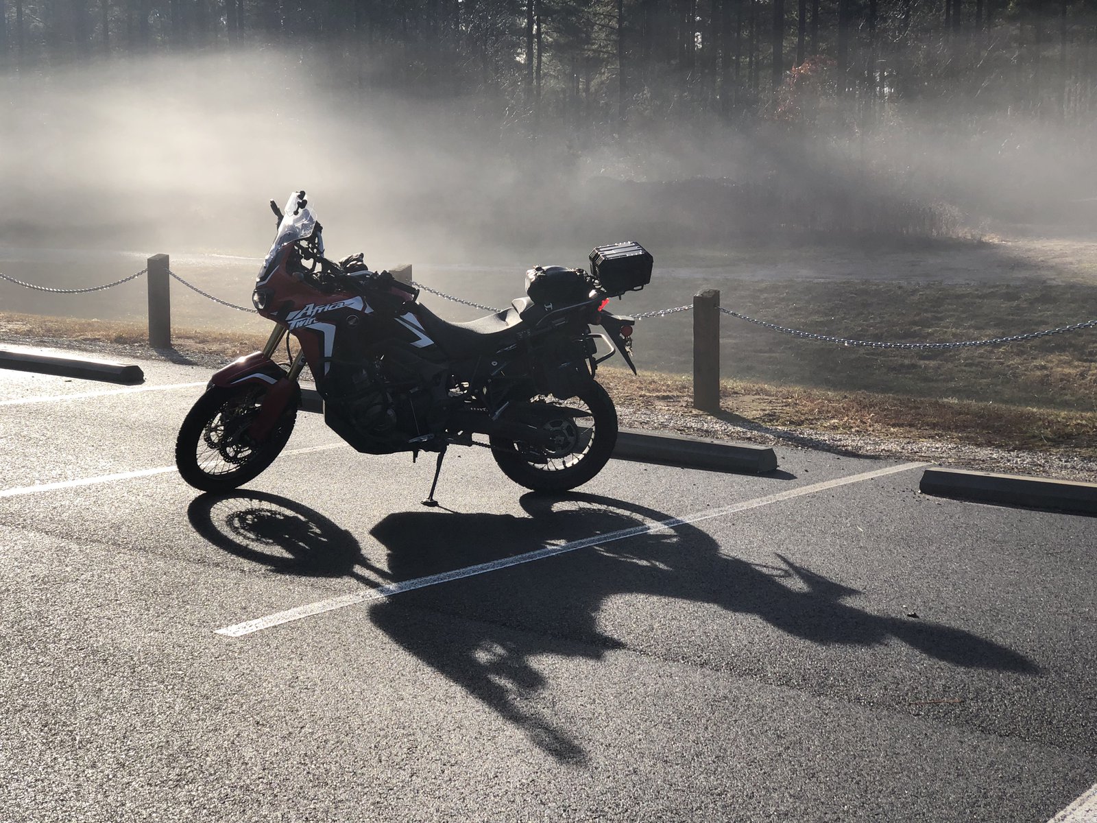
The seasons are running backwards
Less than a month ago — almost 2 weeks before the official start of winter — Richmond got a foot of snow. Today was the first 🏍 & ☕️ of 2019: it was nearly 60° and 50+ bikes showed up for coffee and waffles. It’s weird, but I’ll take it!
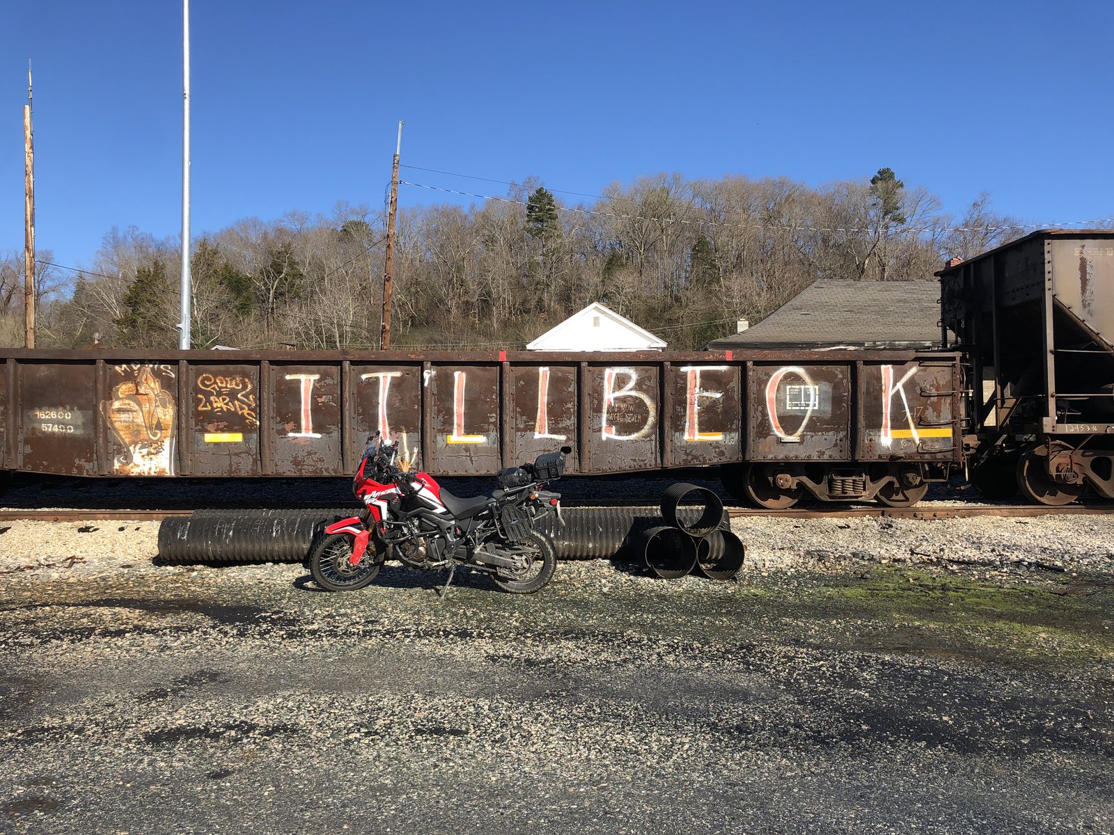
December ride
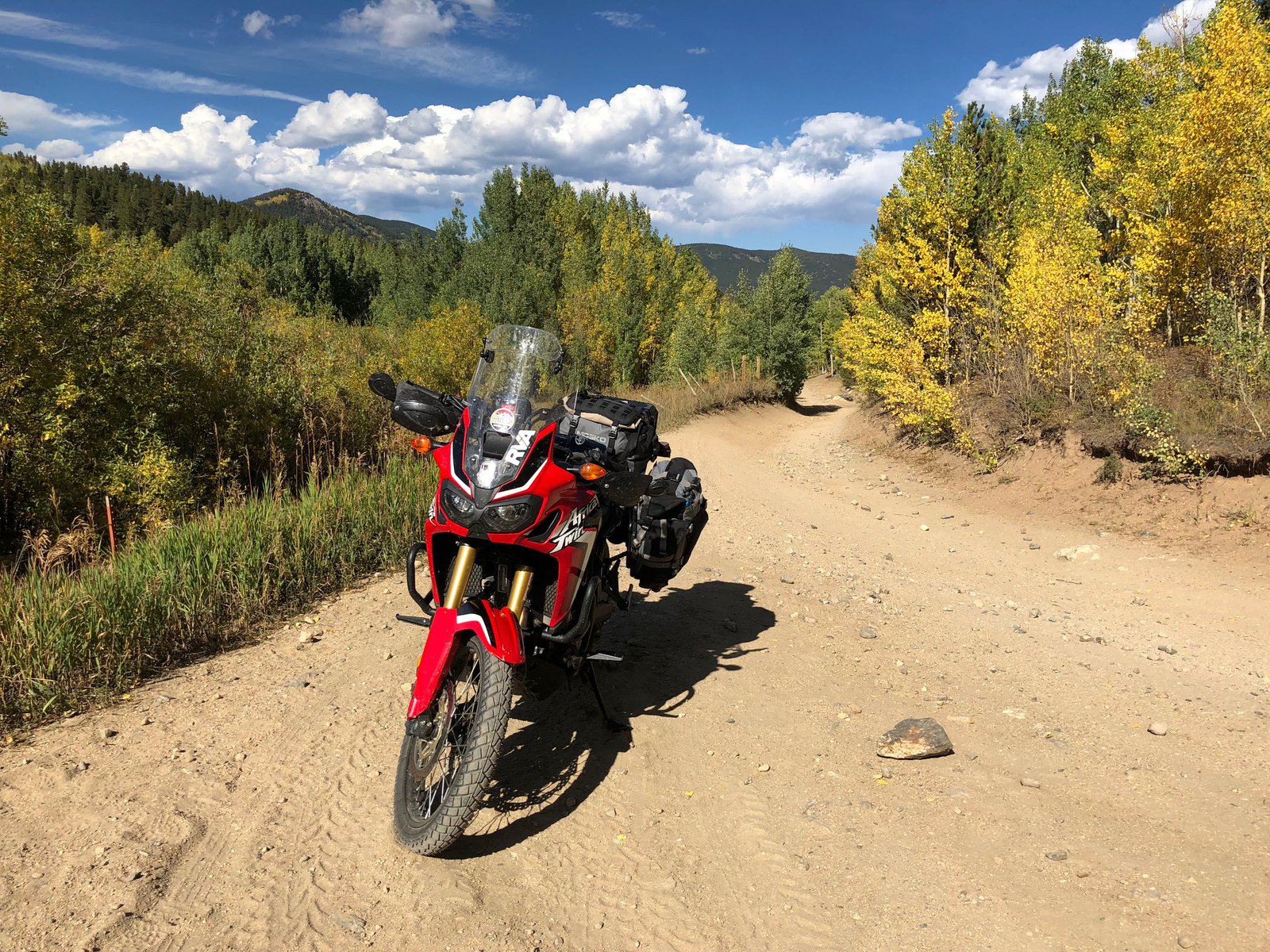
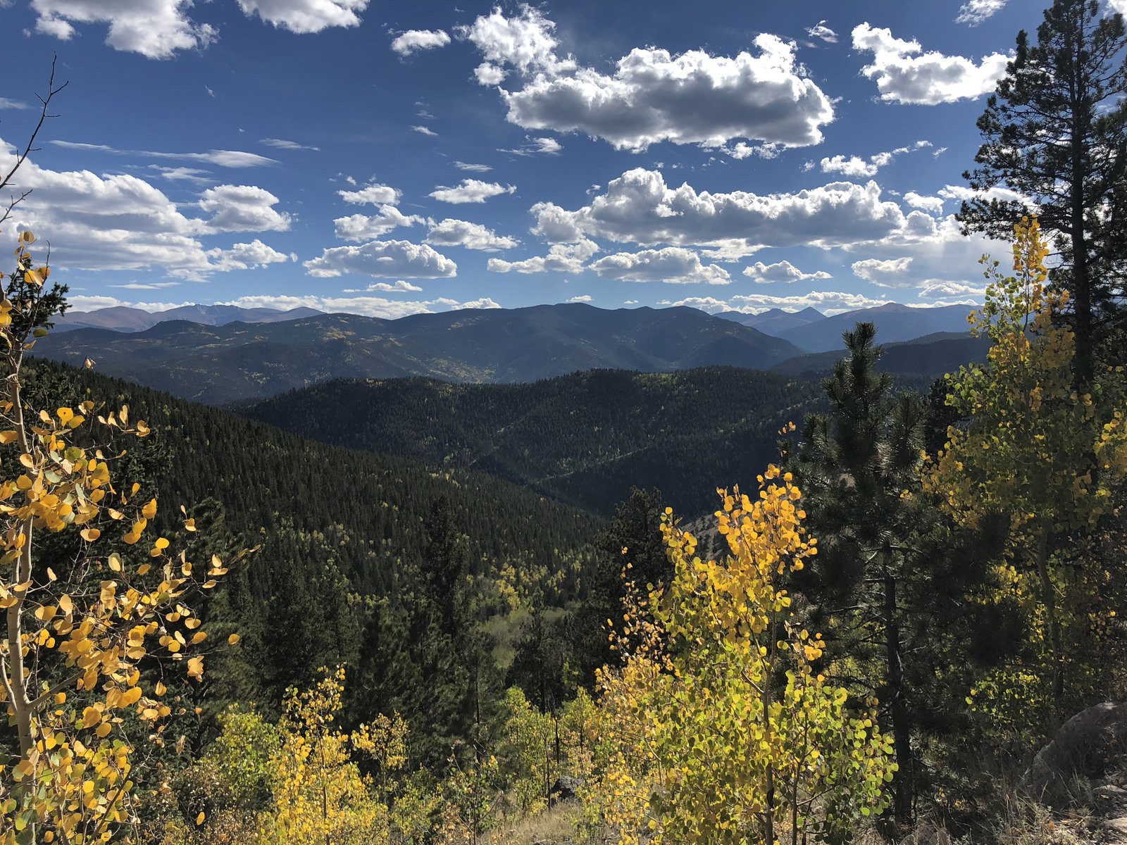
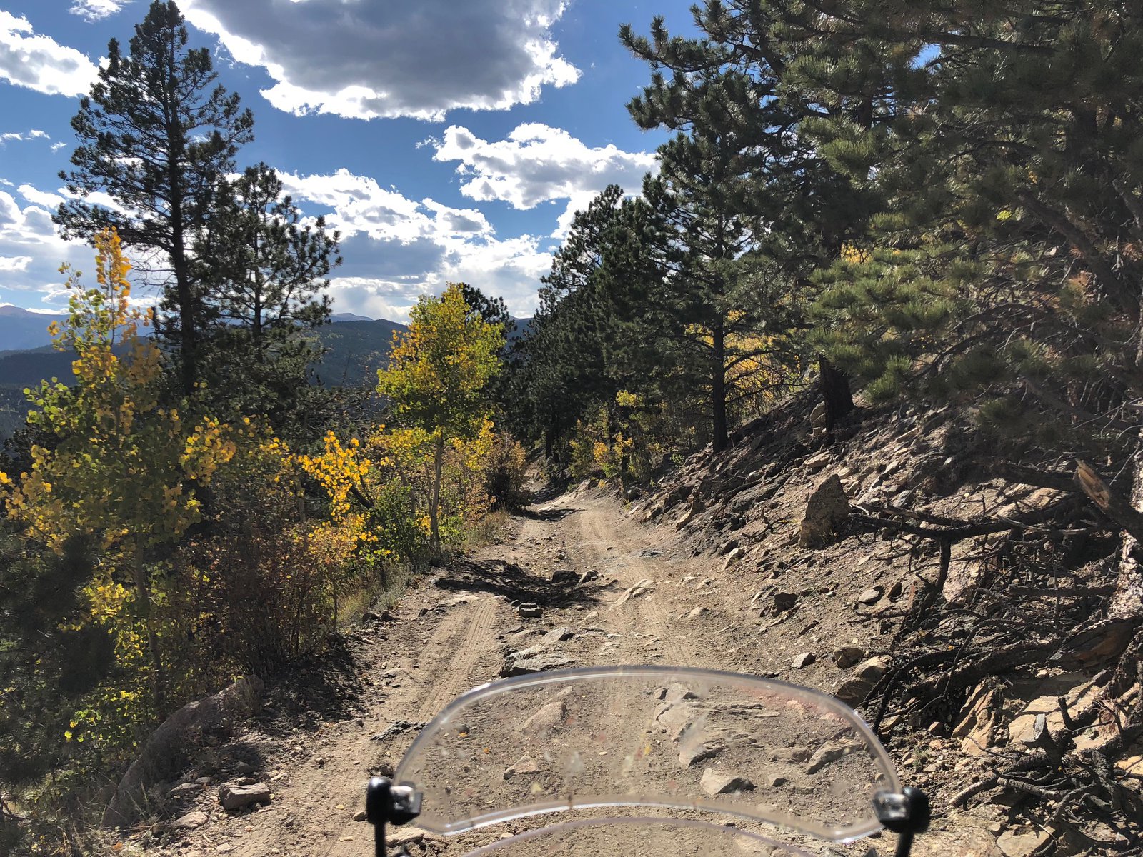
A beautiful day in the 60s at the end of December demands an all-day motorcycle ride to the mountains. It’s some kinda law.

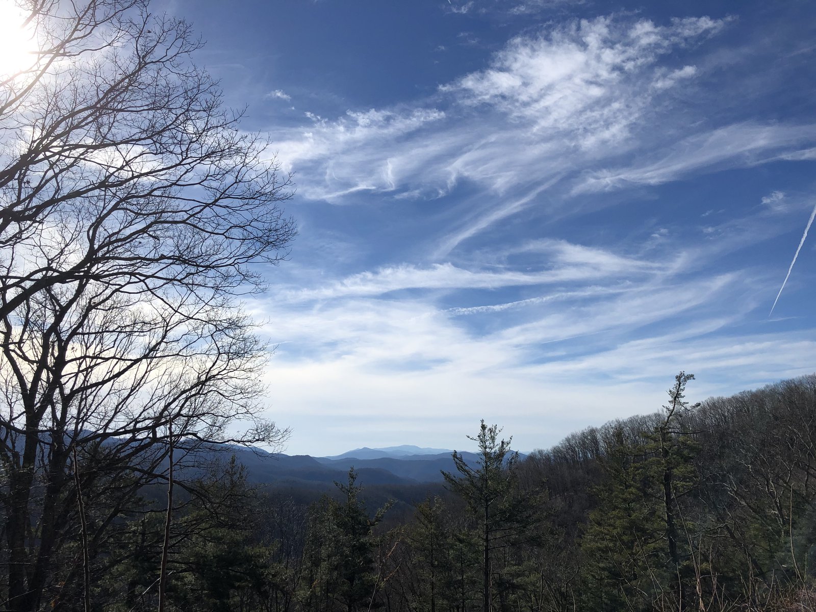
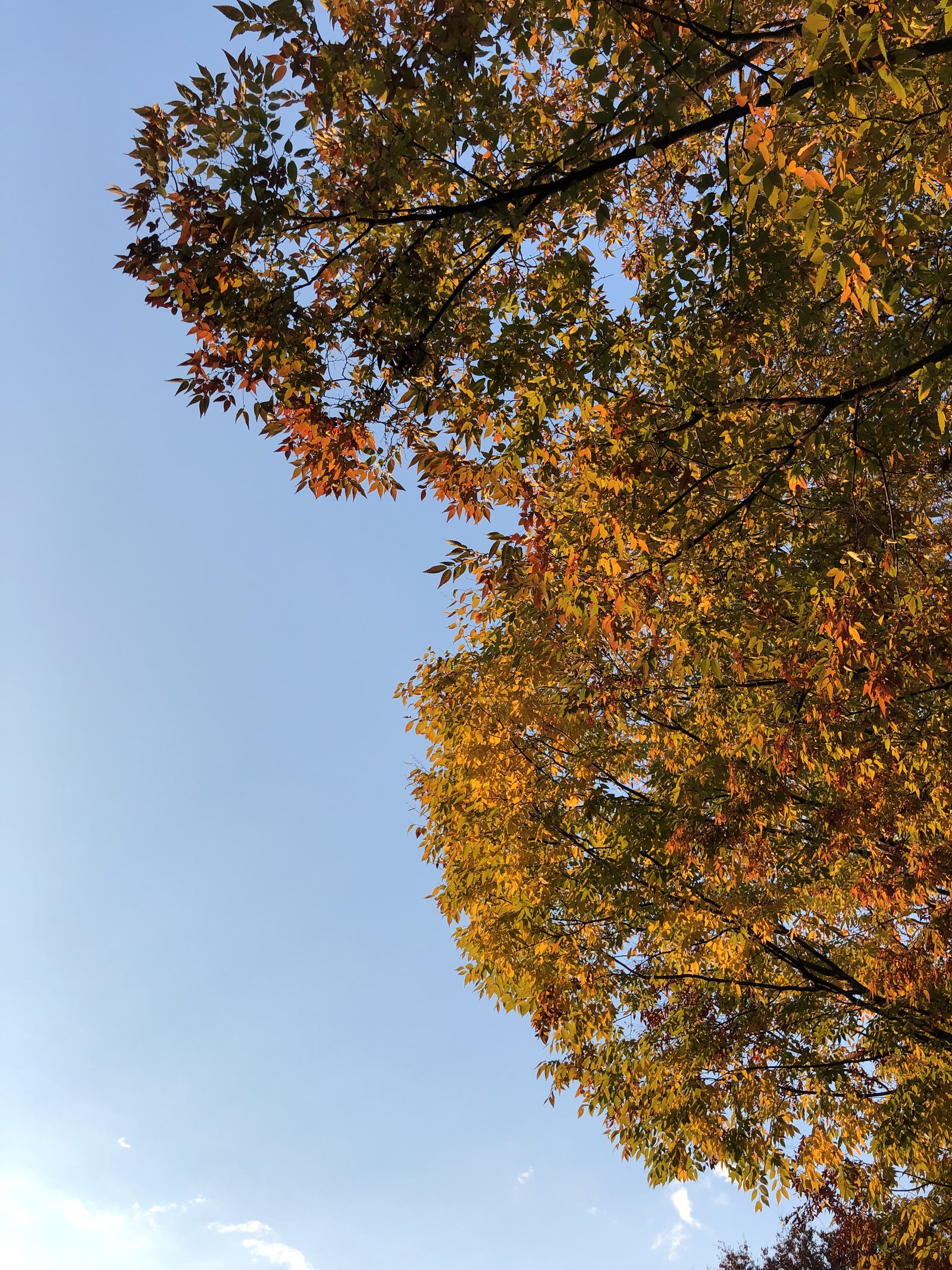
It’s still Fall

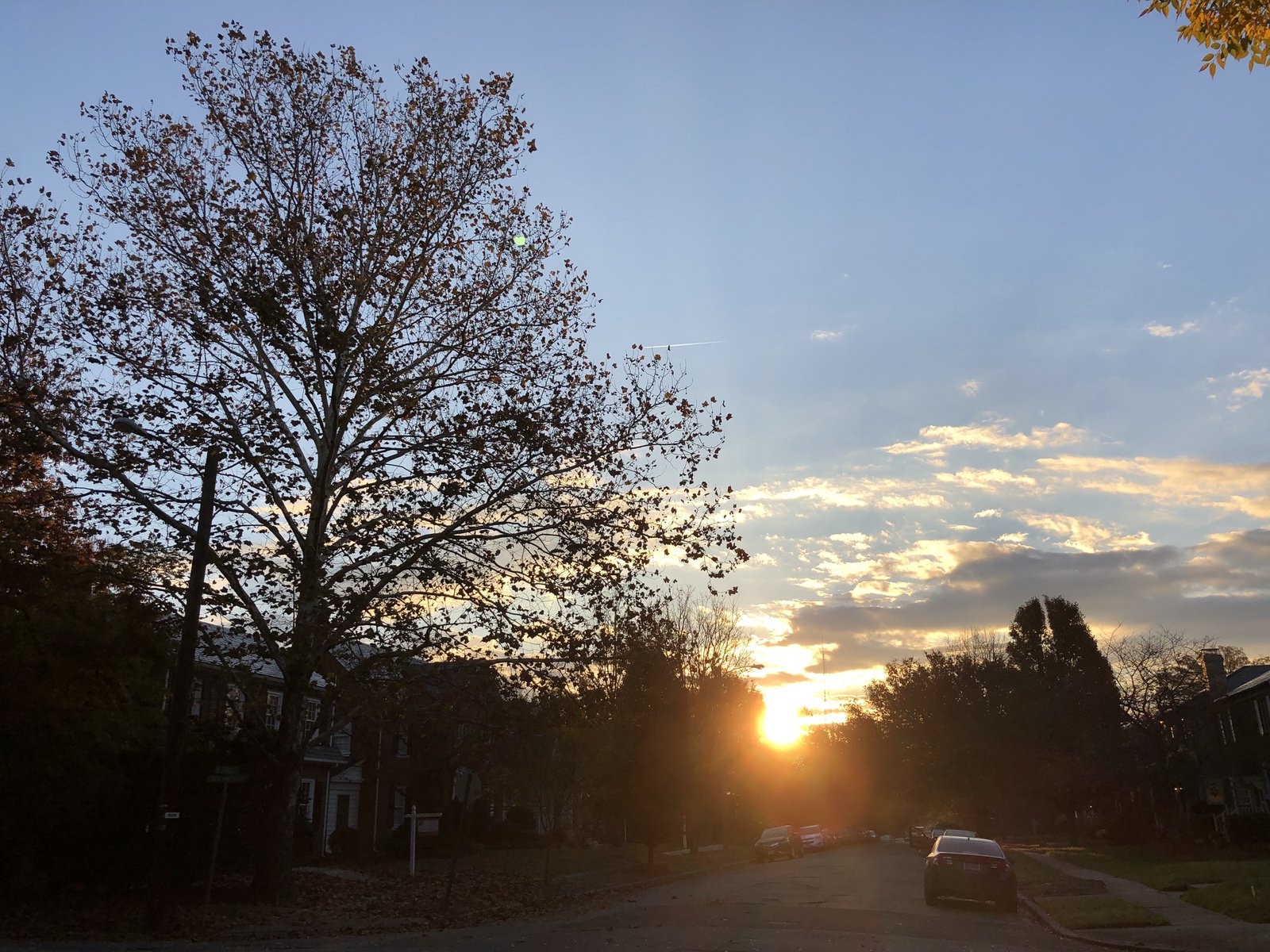
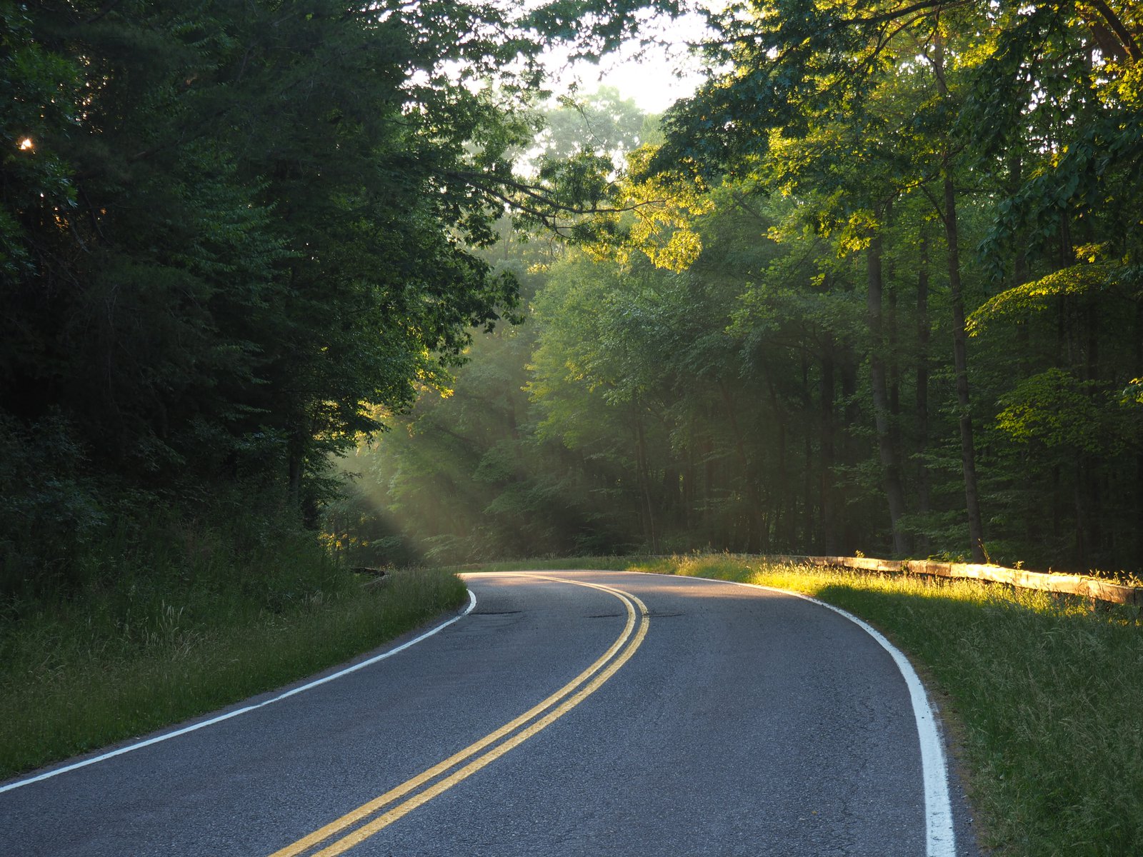
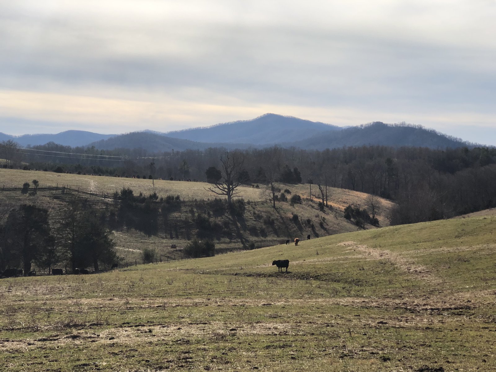
Early morning ride
I took an early-morning ride up toward Lake Anna, just to get a little helmet time on the VFR. It was a nice and cool and the fog was high enough to provide some atmosphere but not too low to restrict visibility. Fall really is one of my favorite times to ride.
One more to go!
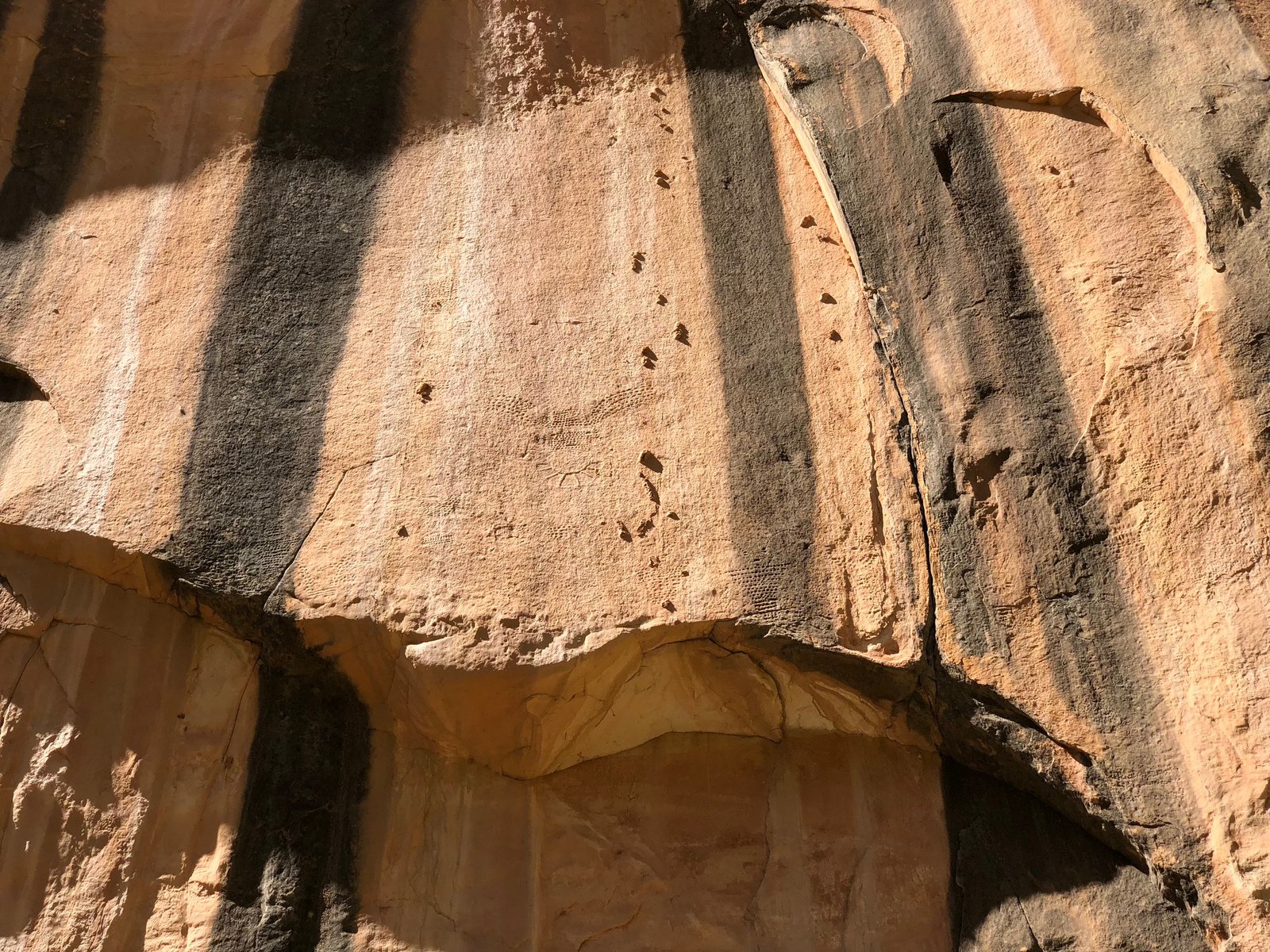
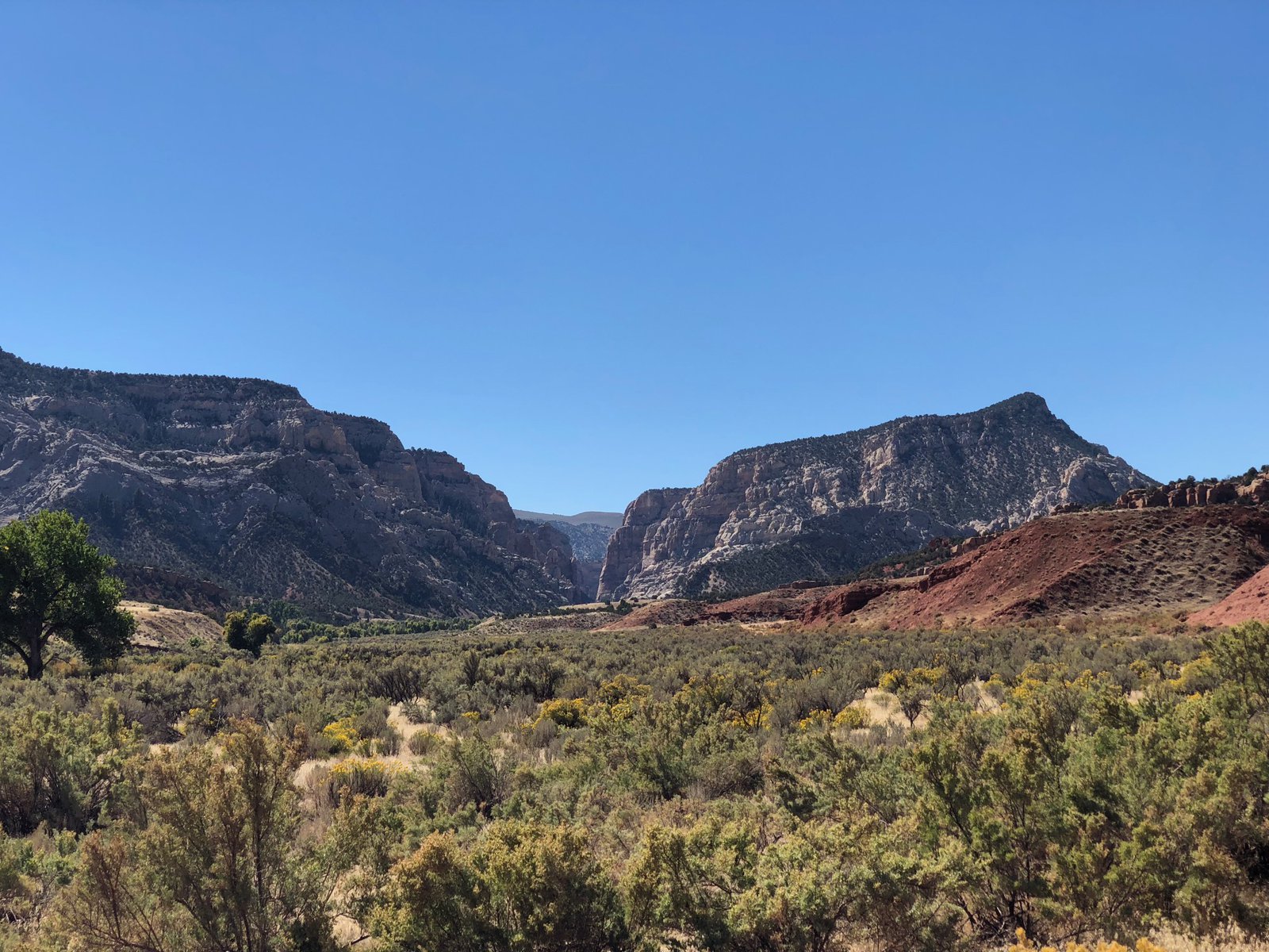
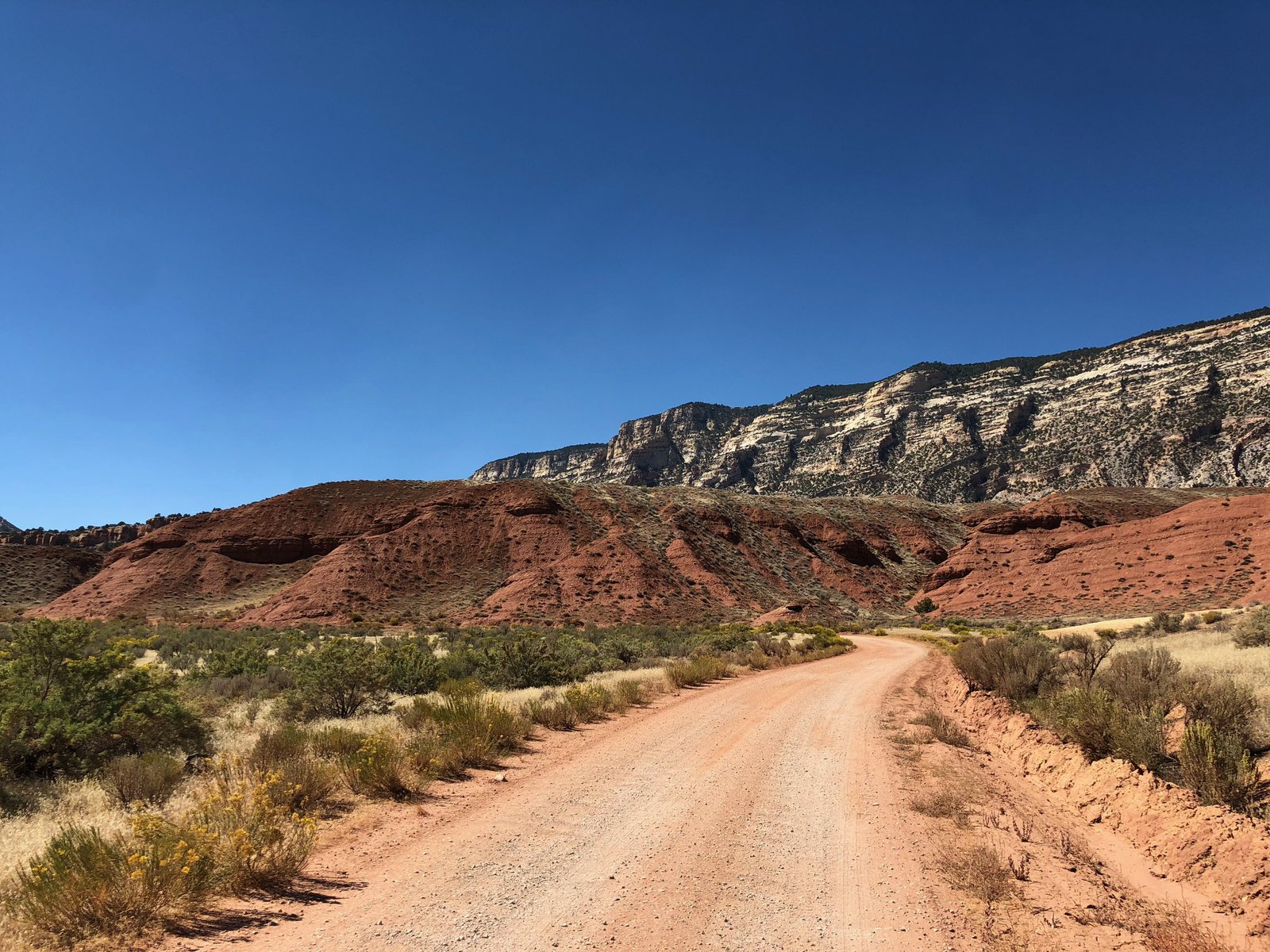
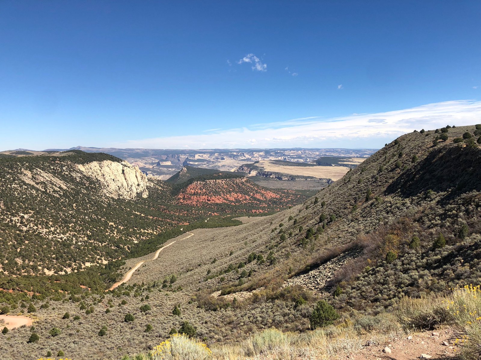
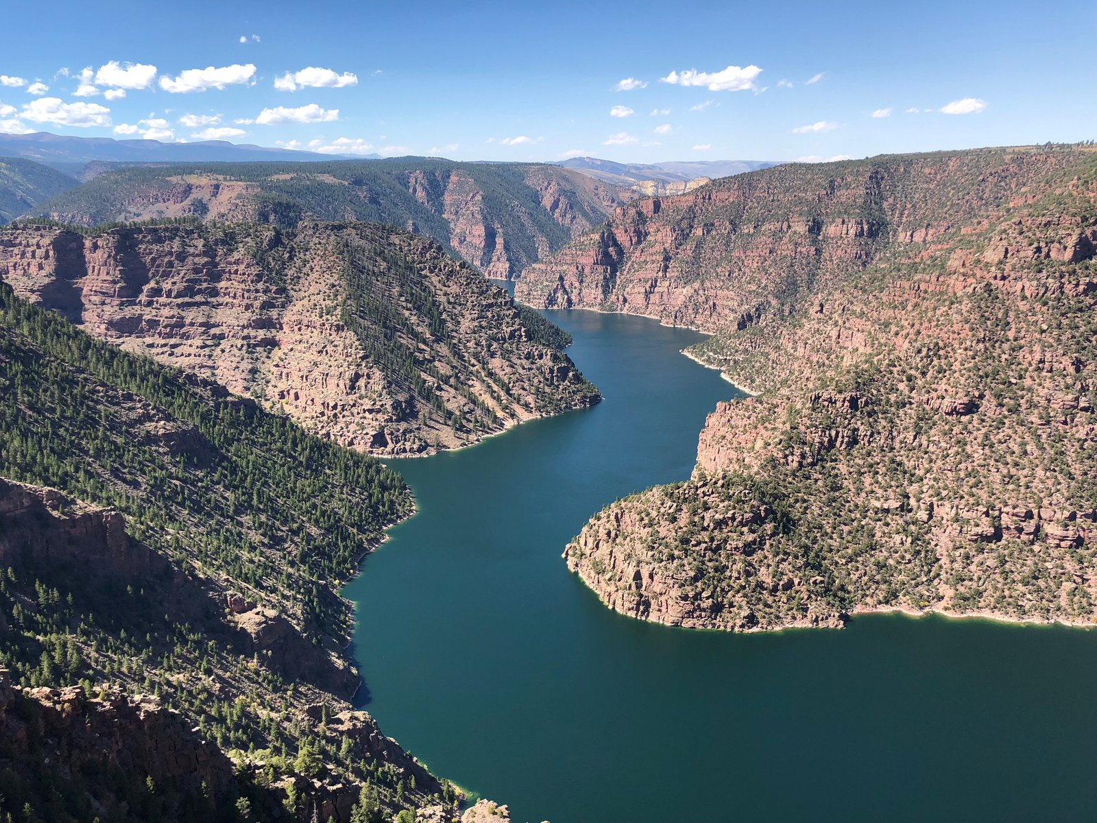
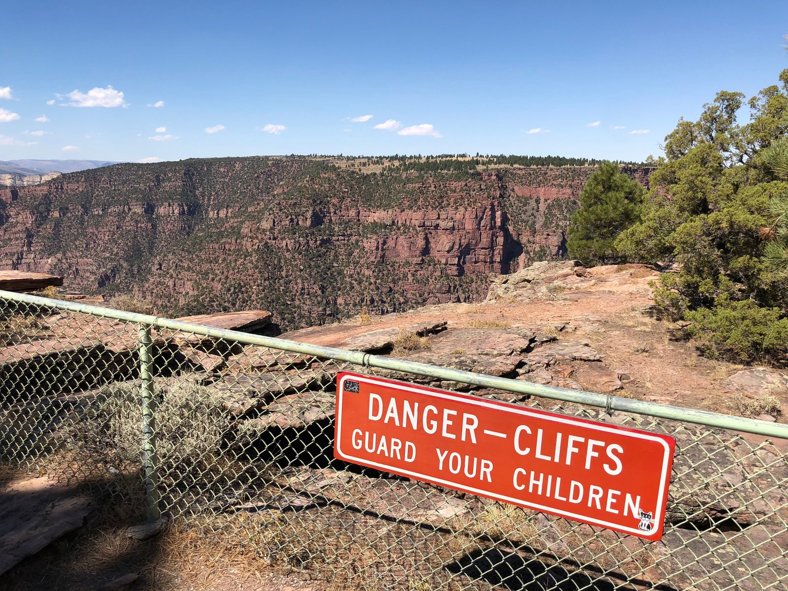
🦕 Nat’l Monument: The Canyons
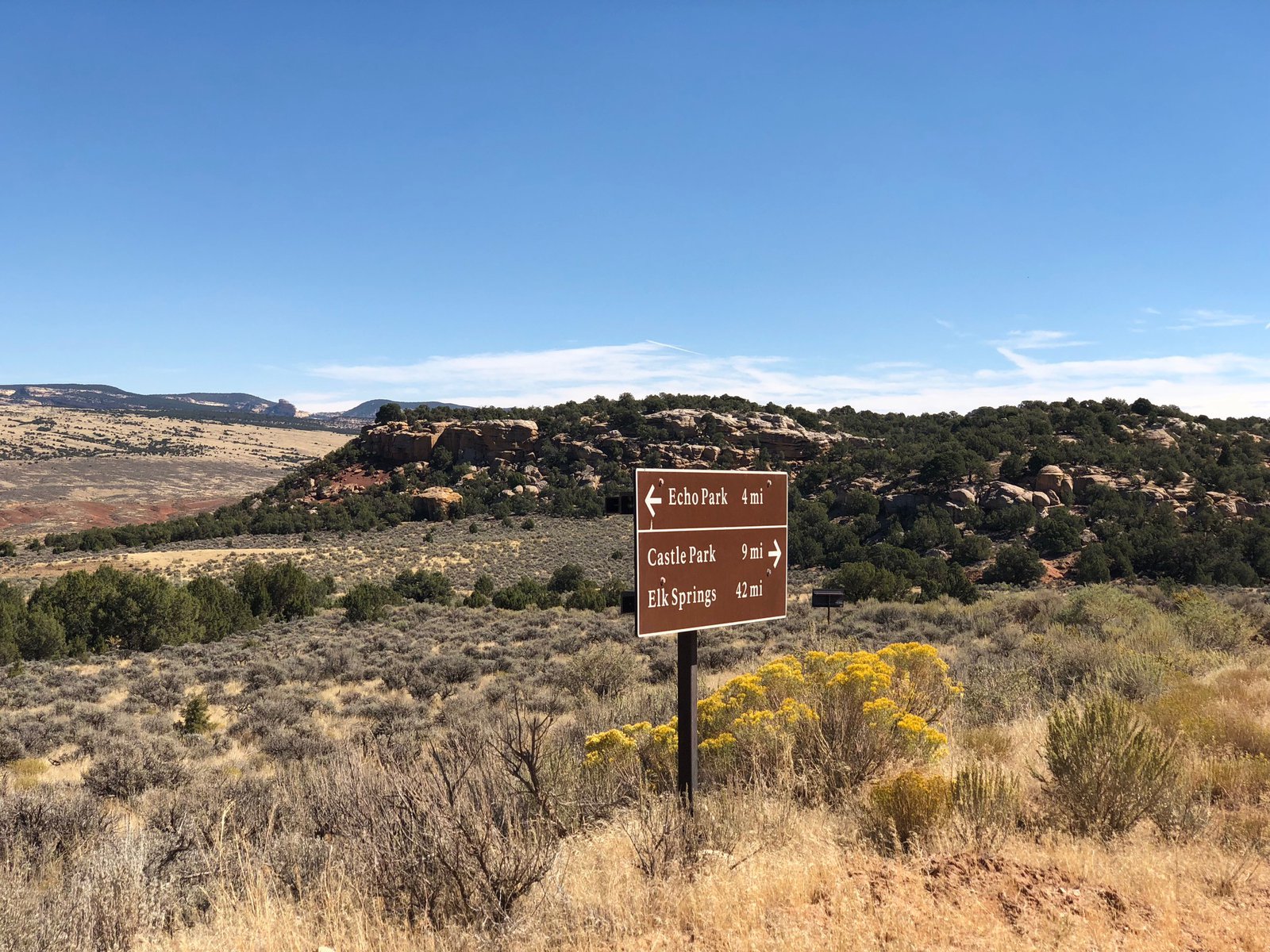
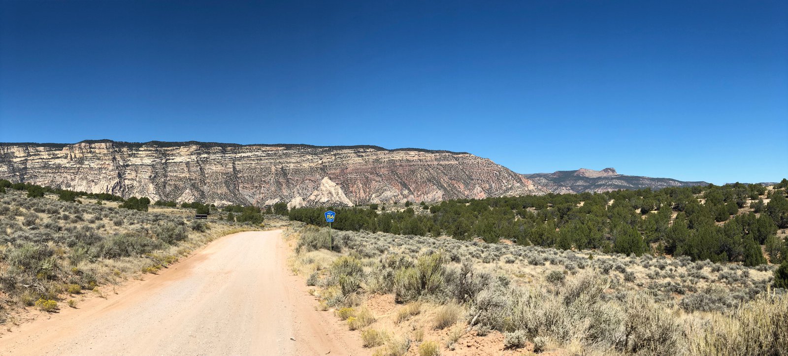
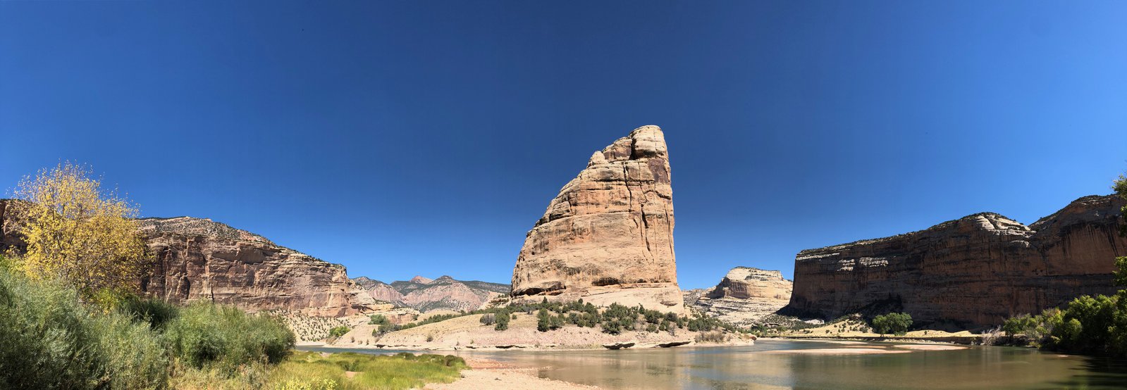
I’d received a few recommendations to check out the non-fossil part of the monument, particularly Yampa Bench Road, which runs about 50 miles east from the Utah border and apparently has amazing views down into the Yampa River. I had some trepidations about getting that far off the beaten path, somewhat bolstered by conversations with some other riders and a ranger. Ultimately I just didn’t have time: the quarry took a bit longer than expected (the theme for this trip, apparently) and I needed to start heading East and home. I did go down the tight, switchback-y Echo Park Road and into Echo Park proper, where the Green and Yampa rivers come together at Steamboat Rock. The water was fairly low (the drought out here is no joke), but I was able to wade out onto the rocks and listen to the river gurgle. It was so peaceful. There’s a primitive campground down there, and if I’d planned better I would have loved to stay there for at least a night. Next time. There are also some petroglyphs on one of the walls; a photo in this post will show them if you zoom in.

🌈🌈!!

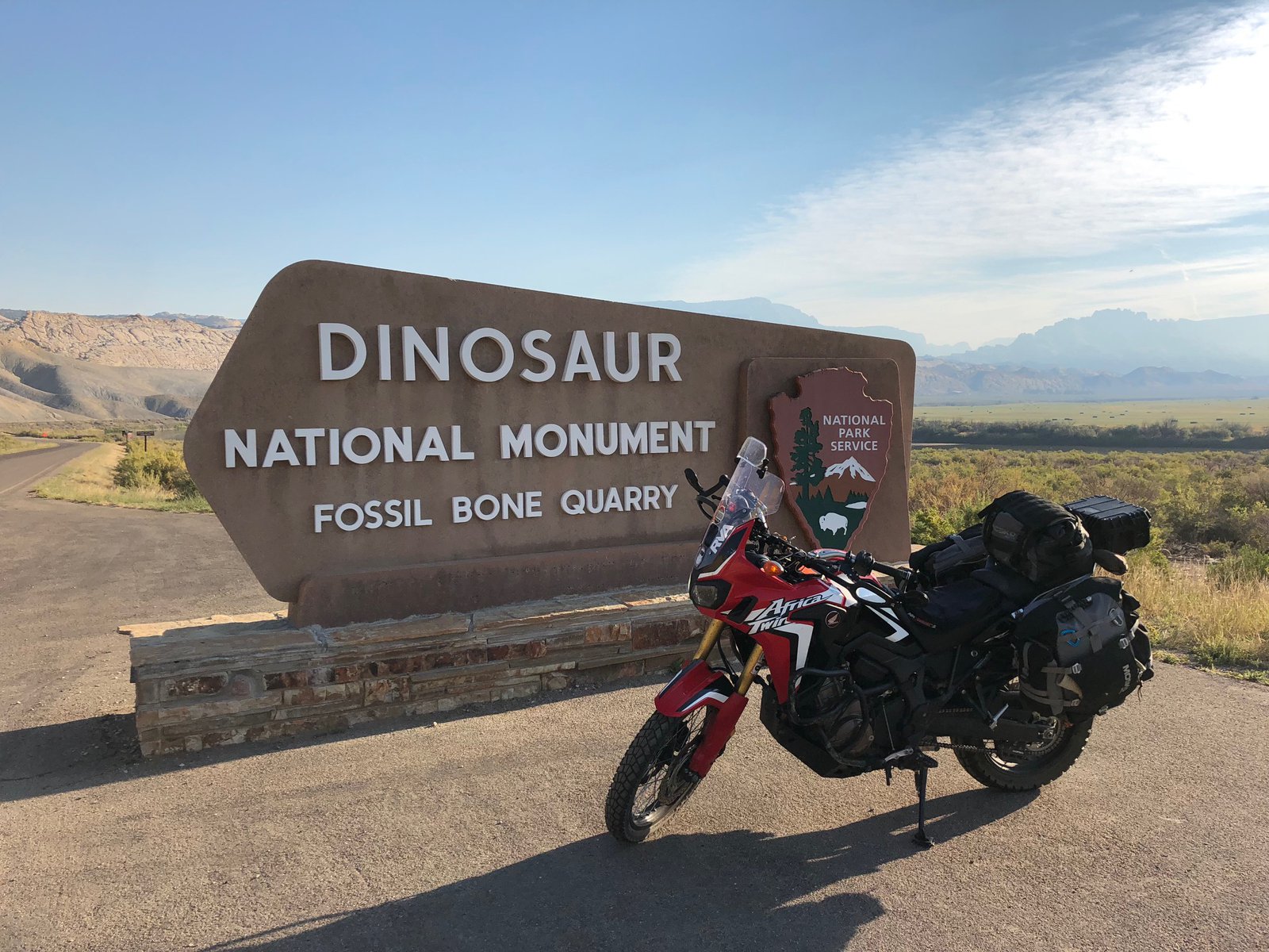
🦕 Nat’l Monument: The Quarry
Hard to believe today was my last day of touring. I started off with an obscenely large breakfast from Bettie’s in Vernal. It’s an old-school greasy spoon that’s mostly populated by locals at 7:30am. I’m pretty sure the “slice” of ham I got was a pound.
One of the neat things about Vernal is all of the potted and hanging flowers. They line the streets, hanging from nearly every streetlight and lamp post, and overflow the planters on the sidewalk to the point that you have to turn sideways to get past some of them. They’re a beautiful hazard.
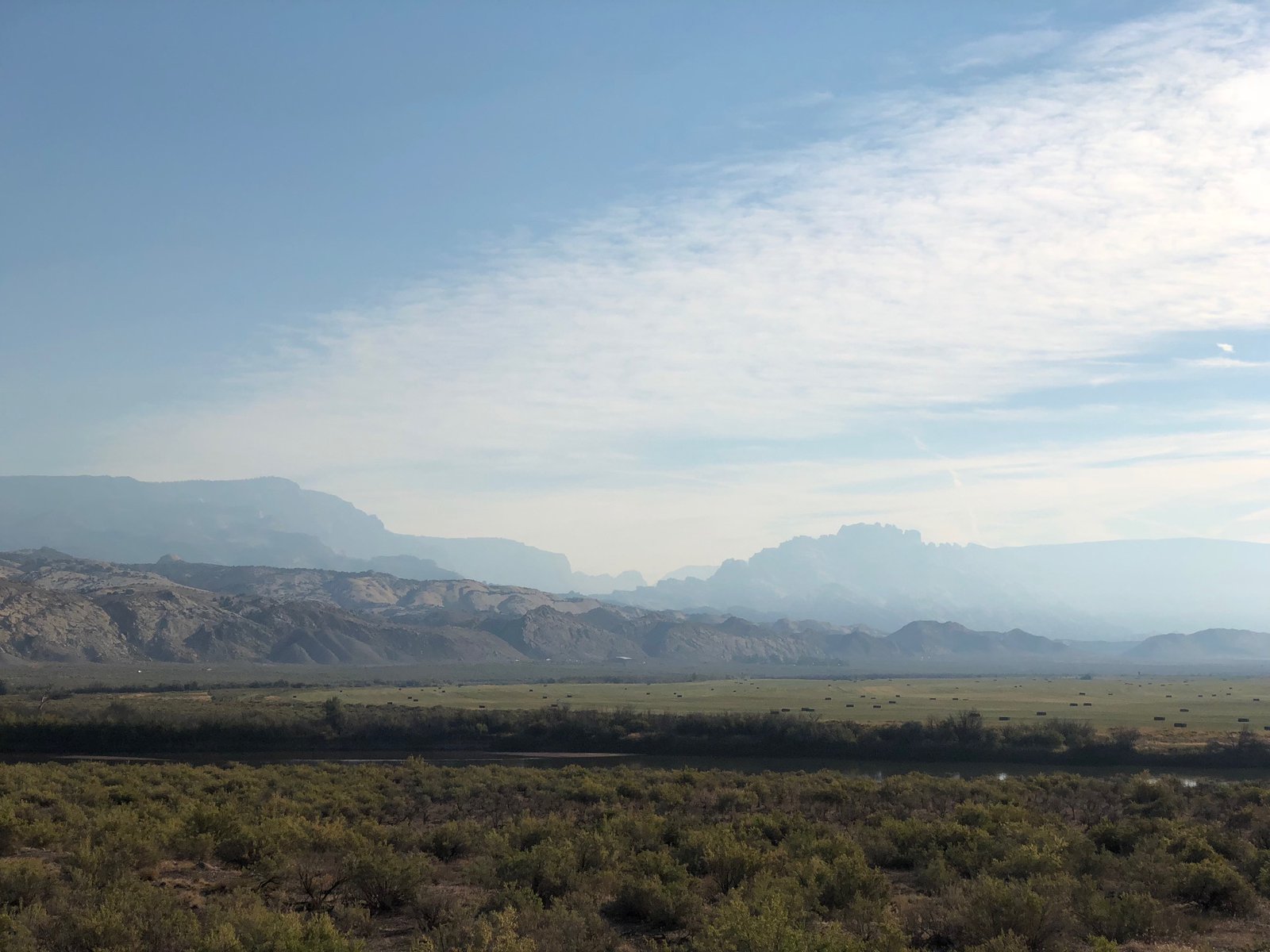
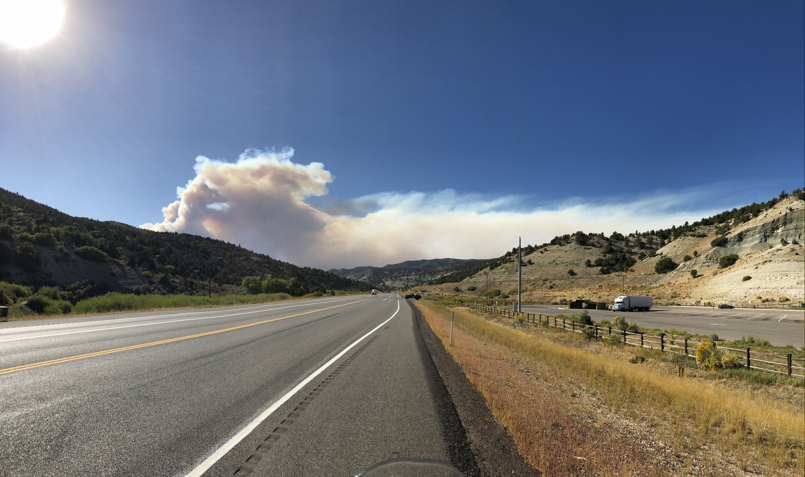
From Vernal I headed to the quarry area of Dinosaur National Monument. It’s a pretty (and chilly) ride, once away from the city, but there was a ton of smoke in the air from the wildfires, in particular from the Pole Creek Fire I rode past last week.
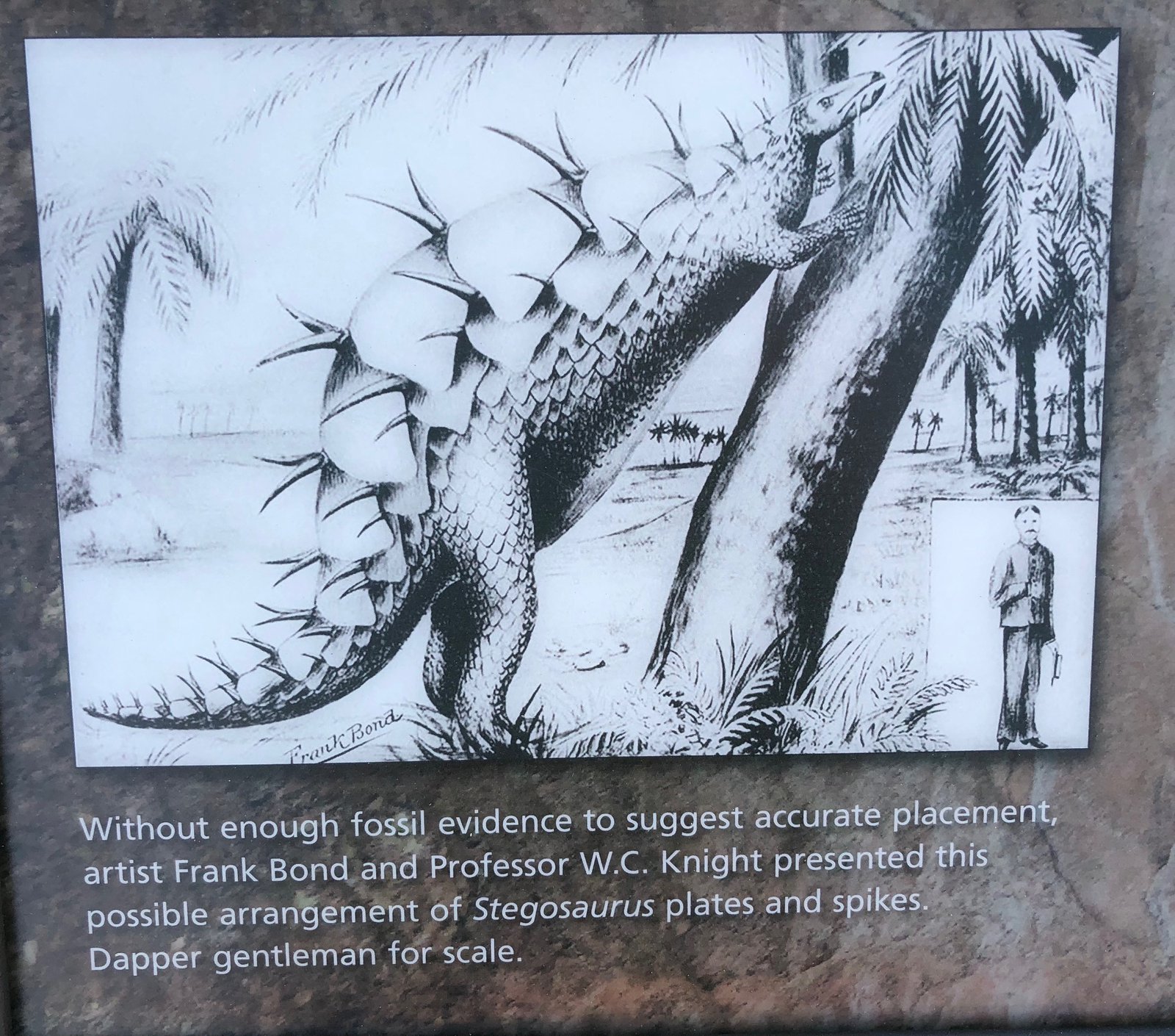
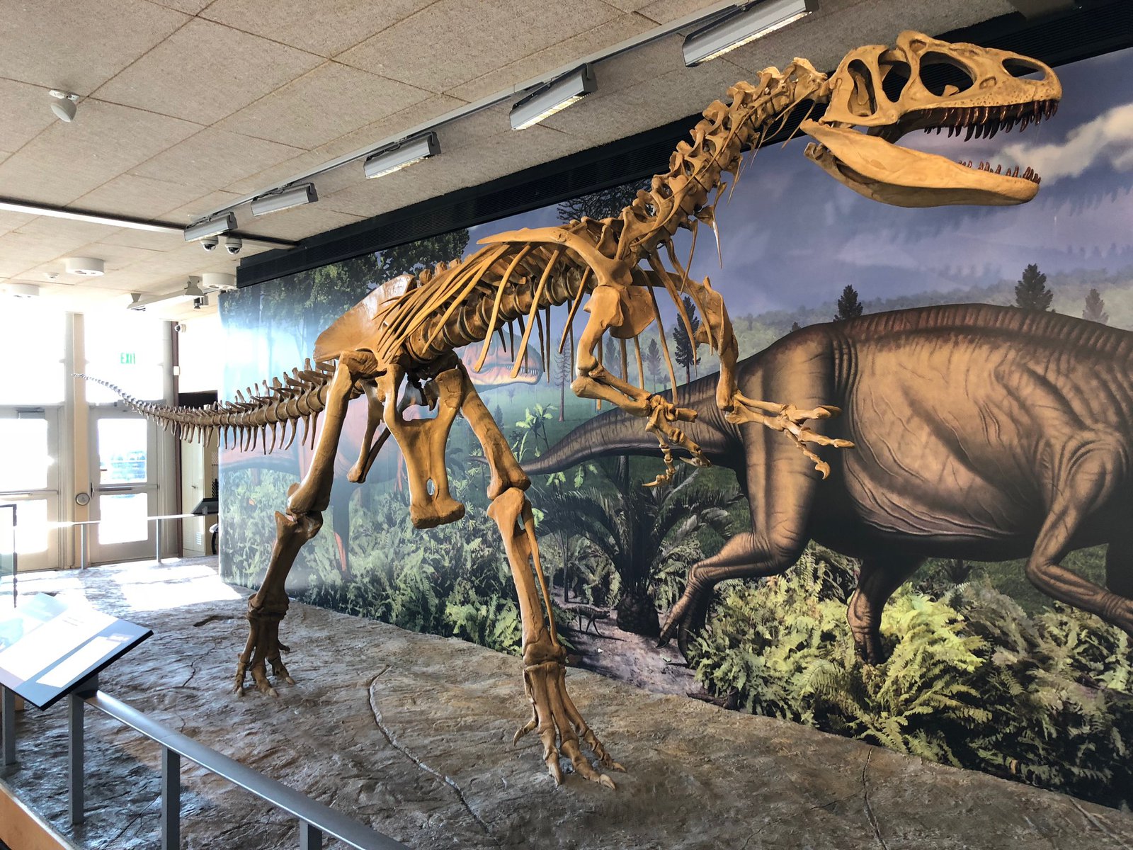
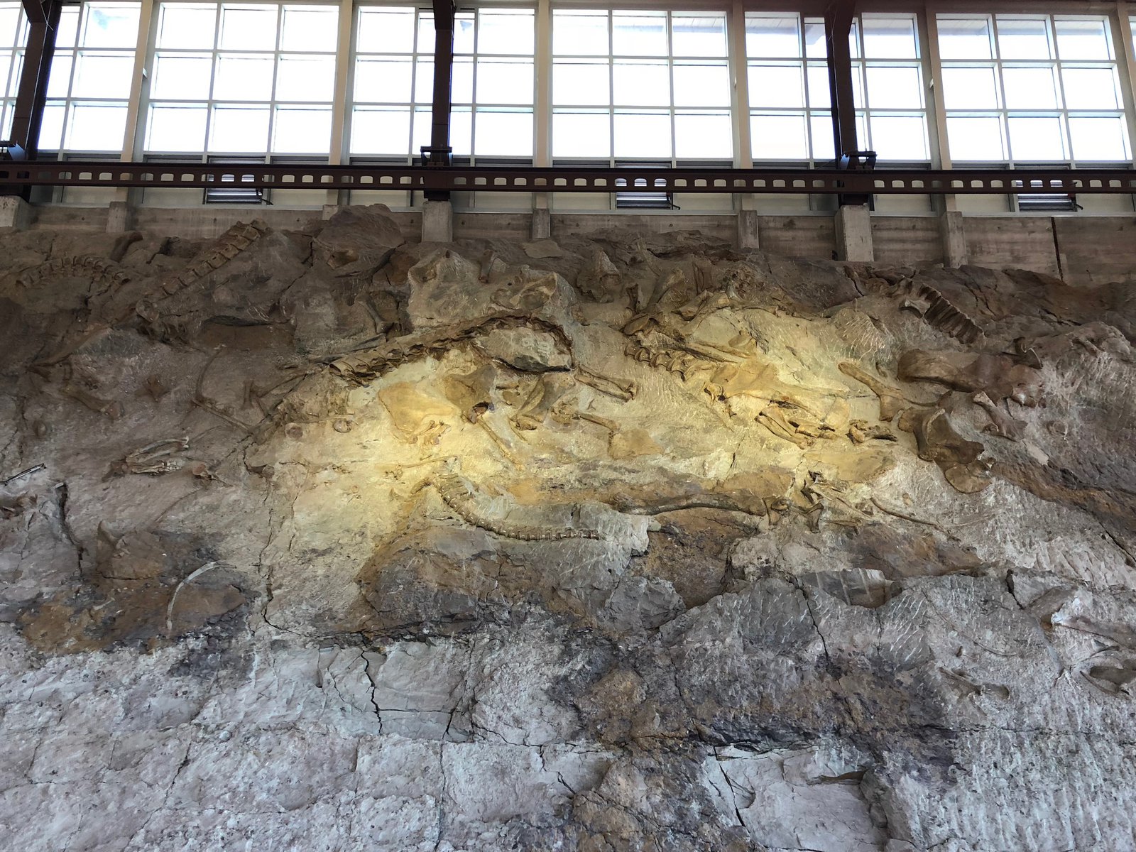
I am something of a 🦕 enthusiast (I’ve got a post dedicated to them coming up), but facts and figures don’t really stick with me when it comes to geology and paleontology. They were big, and they died a long time ago. But the (more recent) history of the quarry is interesting to me in that they started digging over a century ago, and Earl Douglass (the paleontologist who made the discovery of all the fossils) envisioned a place where people could come see them “in the wild”. And that’s what the Wall of Bones exhibit is all about: it’s a 25ish-foot-tall section of quarry wall that appears as though digging were interrupted, leaving dozens of fossils exposed to view. It’s really something to see.
Flaming Gorge: WY & UT
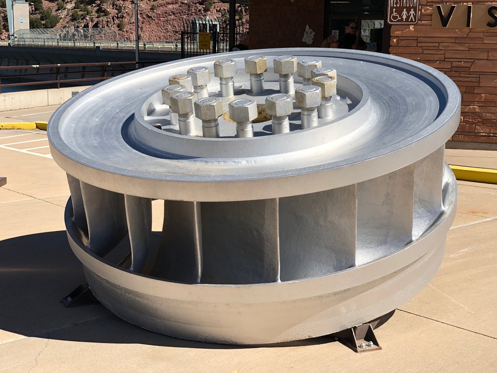
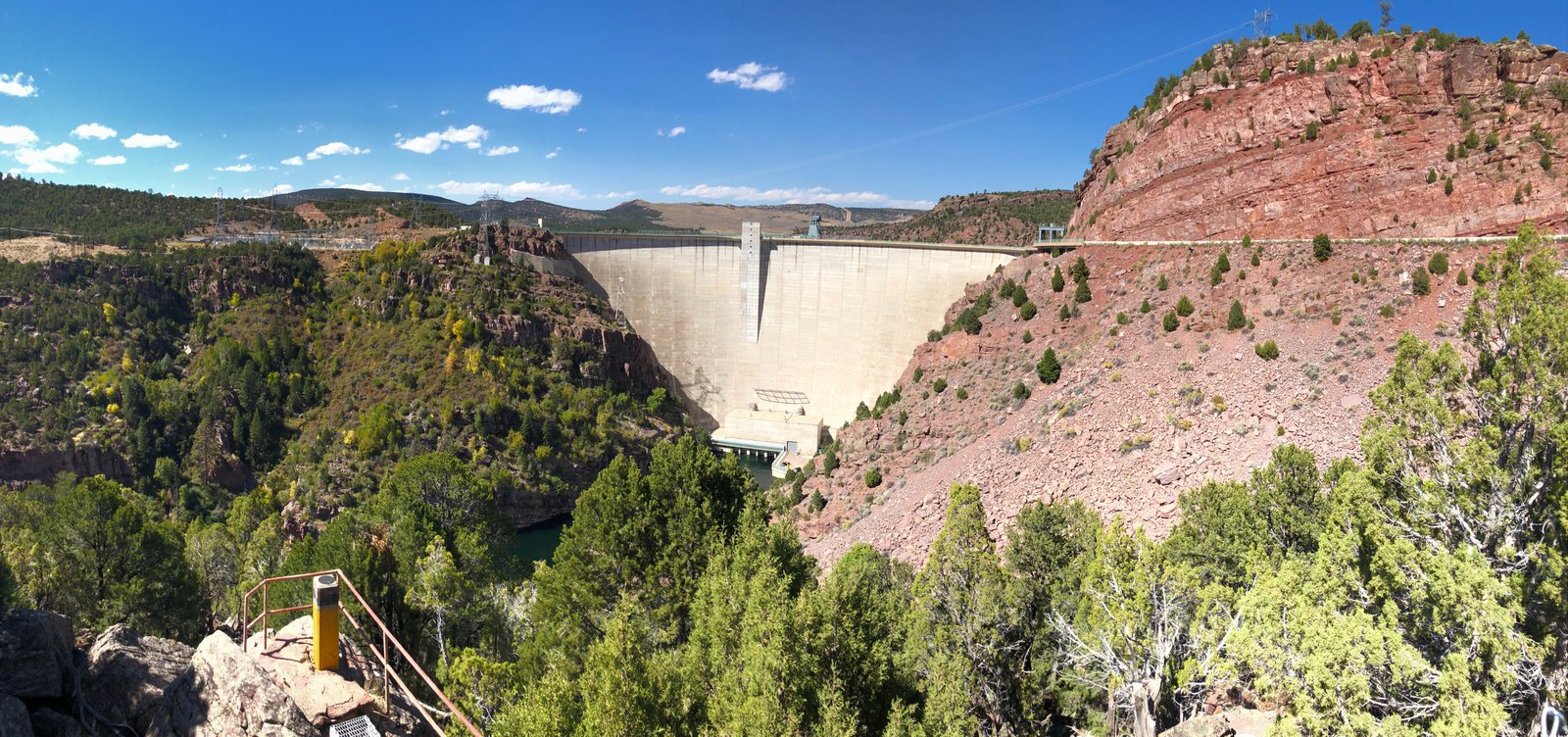
Today was fairly short, only about 5 hours, from Rock Springs, WY to Vernal, UT through Flaming Gorge. I was fairly unimpressed (or jaded, if you will) for the first 45 minutes down 530 toward Manila: the landscape is postcard Wyoming, big and flat with hints of awesome, but always in the distance. Then the road starts to drop into the canyons and it’s awe-inspiring. But that’s pretty much when I entered Utah. See yesterday’s commentary on the scenery changing at the state lines.
The Green River is dammed behind the Flaming Gorge Dam and I’m guessing the signs of the drought are further upstream because the river looked full and high and healthy all the way to the dam. I tried to find some promising overlooks using a topo map before I left and I mostly succeeded. The winner was Red Canyon Overlook, which is completely innocuous from Rt 44: you’d never know what a view you could have without that research because the signs say nothing of it, even though there’s a seasonal visitor center there. The bummer was a dirt track I took, marked by a sign for the landfill, that turned sandy about a mile from the main road. It wasn’t long before I wiped out and ended up with the bike on top of my right ankle. Have I mentioned how much I live my Sidi Adventure 2 boots? They squeak, but they’re tough. I extricated myself by removing one of the bags, stood the bike back up, dropped both saddle bags on the side of the trail and kept going. Then the sand got deep and I bailed, frustrated. I really need to build some skill on a smaller (or at least lighter) bike.
The rest of the ride was easy, twisty and scenic, without much traffic. I’d hoped for a tour of the dam, but their elevator was broken. They were still doing walking tours along the tip filled with “fun facts”, but I mostly wanted to ogle the machinery. Facts don’t really stick with me.
I’m now in Vernal, UT, which has a fantastic 🦕-kitsch quotient: they’ll get their own post. I’m staying at an Airbnb tonight because I really am pooped and wanted a good meal (hard to find in Wendover) and a beer. Tomorrow I’ll explore Dinosaur National Monument and start making my way toward Denver, preparing for the long blast back home.


Wyoming
I’m staying in Rock Springs, WY tonight. It was an uneventful — if windy — ride from Wendover. I’m always fascinated when I see the landscape change around state lines. Even without seeing the border on the map I knew I was approaching Wyoming as the terrain changed from red mesas and desert to rocky buttes and huge sweeping vistas. The fires in Utah (I’m presuming mostly the Pole Creek Fire I saw last week, which continues to grow) are sending smoke over 150 miles to this area. It’s making for some beautiful skies, but at a cost.
I was disappointed that the Greater Green River Intergalactic Spaceport doesn’t have a sign.
The last day on the salt
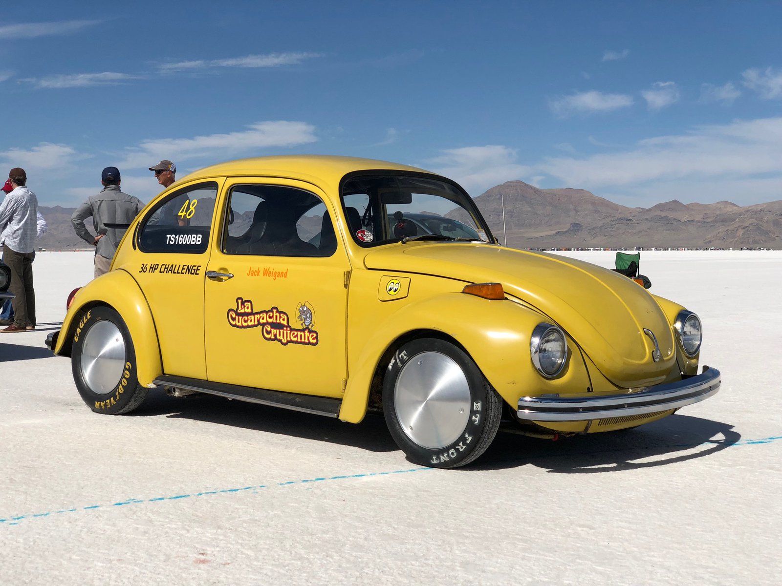
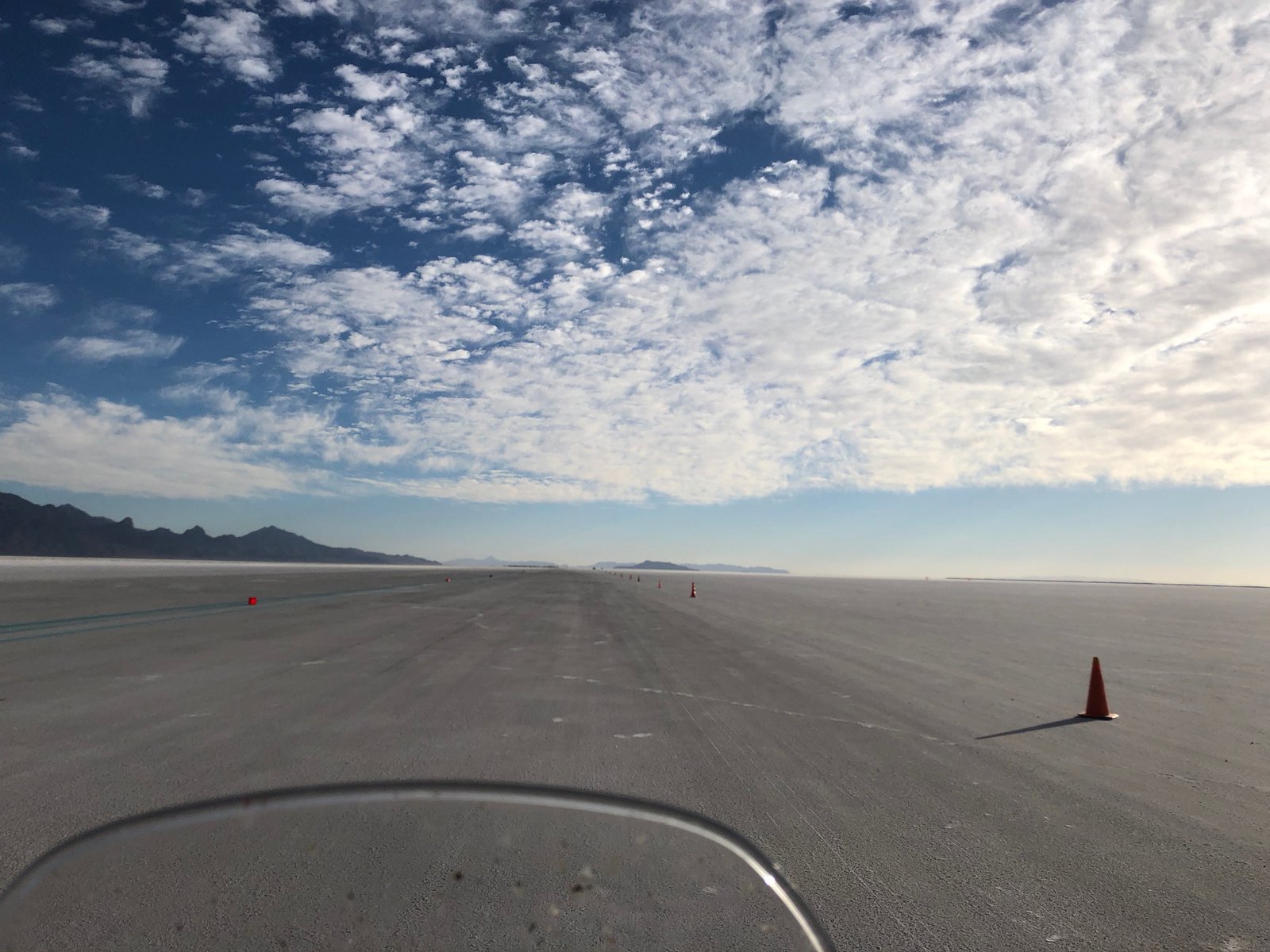
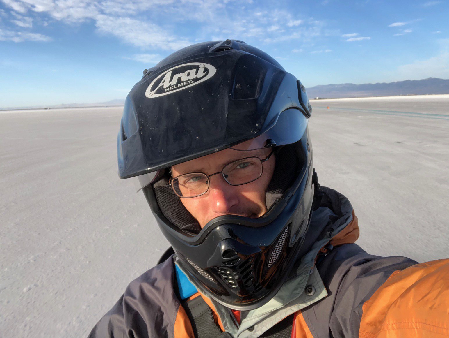
All good things must come to an end, or do they say. Today was a short one at Bonneville, with racing wrapping up around noon. I got there at 7:30 with the hope of knocking out my two remaining runs quickly, but the LSR folks (Land Speed Racing, as opposed to the less stringent club folks such as myself) took priority. I finally got to run about 9:30, but the timing lights malfunctioned (something the staff was struggling with a bit this year) and my pass didn’t register. But aside from getting a do-over I know from my GPS that I was 1mph faster than the misfired one. My final two passes were at 120.86411 and 120.85874, and I think that’s really all she’ll do!
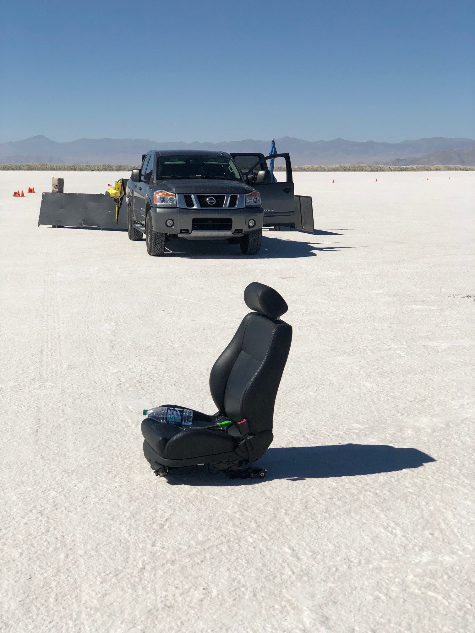
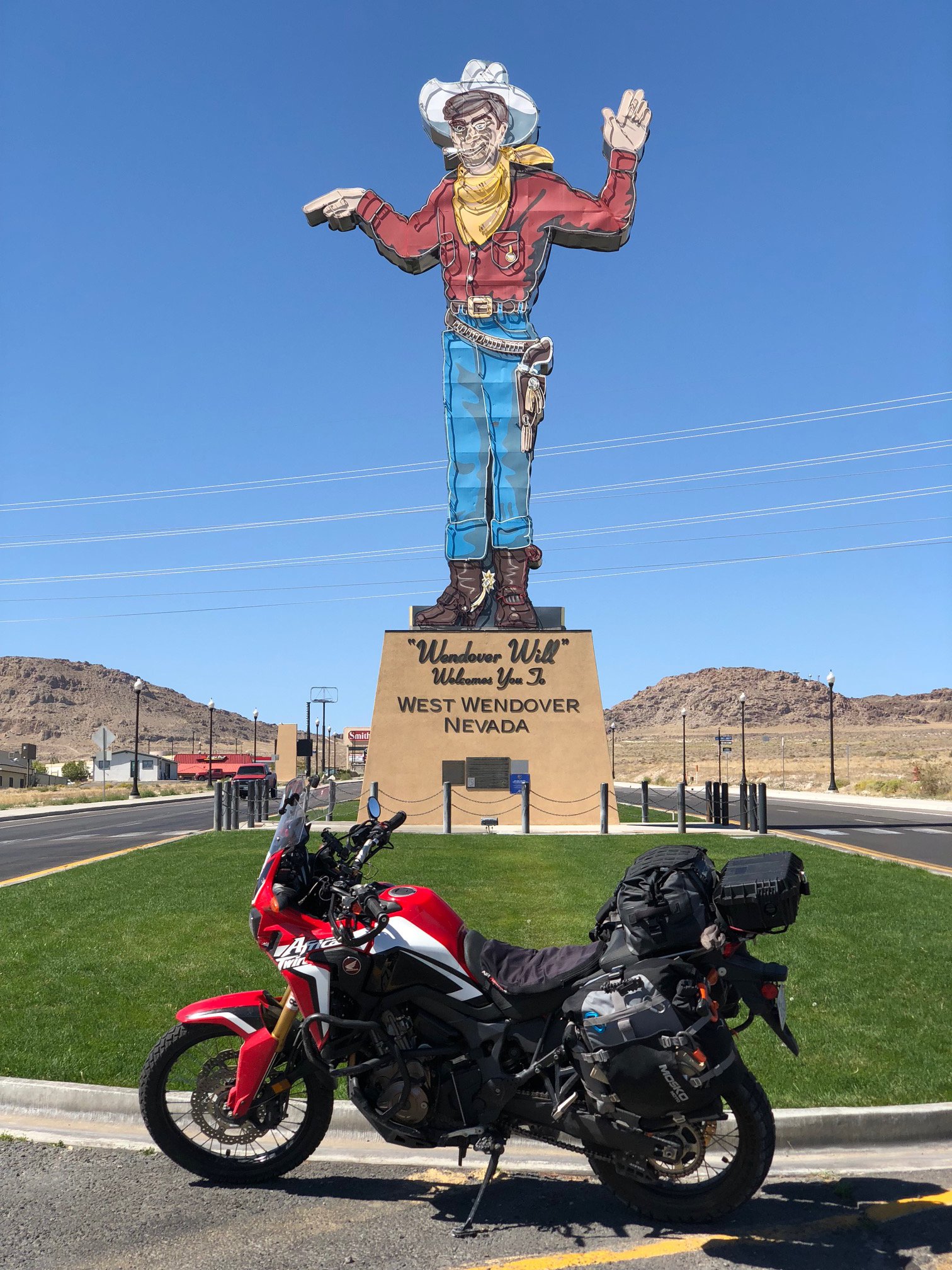
It took me a little while to return the bike to non-racing trim. By the time I boxed up my leathers (thanks Dave and Stephanie), put the regular sprocket back on (thanks Vacationing Overlander Québécois Guy for the ratchet), reattached the mirrors and windscreen, and loaded all my gear back on, it was about 12:30. I went back into Wendover to get gas, a bite to eat, and grab a picture of Wendover Will. As I was leaving Will behind I saw the Citation X11 on a trailer and turned around to talk to the owner: he improved his best speed from 139 to 145, pretty good for a nearly 40-year-old econobox.
Among the pictures here you should be able to see the abandoned passenger seat, a sure sign that the owner of the car (a VW R32, I think) was serious about getting that last 0.25mph. You can also see the last car on the start line of the short course, a 2-stroke Saab Sonnet that sounded mean and looked properly fast.
That’s it for World of Speed 2018. I’m really looking forward to going back next year, with at least one different bike. 😁


Time to head back East
It’s almost over
Today was the last full day of racing. The line for the 130 club was longer than any other: that’s great for the organization, and a little frustrating for those of us in it (it took 3+ hours to get in each of my two runs). But I spent the downtime chatting with my fellow racers, and they’re a fun bunch.
My first run today was 118.7mph with zero wind, a touch faster than yesterday. I removed the wind deflectors for the hand guards and the top box. With all the time I had before the next one I swapped to a -1 tooth sprocket and removed the windscreen. The result: 118.8. But there was a 9mph headwind. The bike definitely pulled harder all the way through 5th gear and into 6th.
I have two runs left tomorrow and my plan is to be on the salt at 7:30am to make them count. Racing is done at noon, however, and I need to start heading back East.
Thanks to Reia for the photo; to Jonathan, JJ, Augie, Jimmy, Carlos, Sam, Steph, and Dave for keeping me entertained; and to the folks from San Jose BMW for the tool loan.

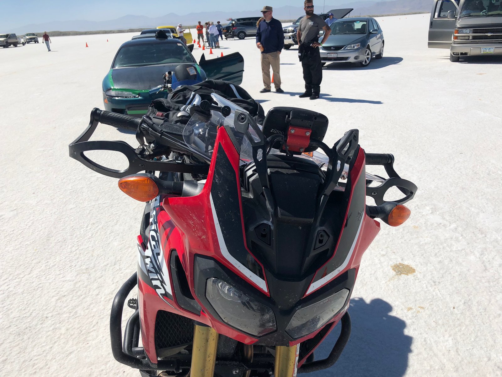
As aerodynamic as a closet
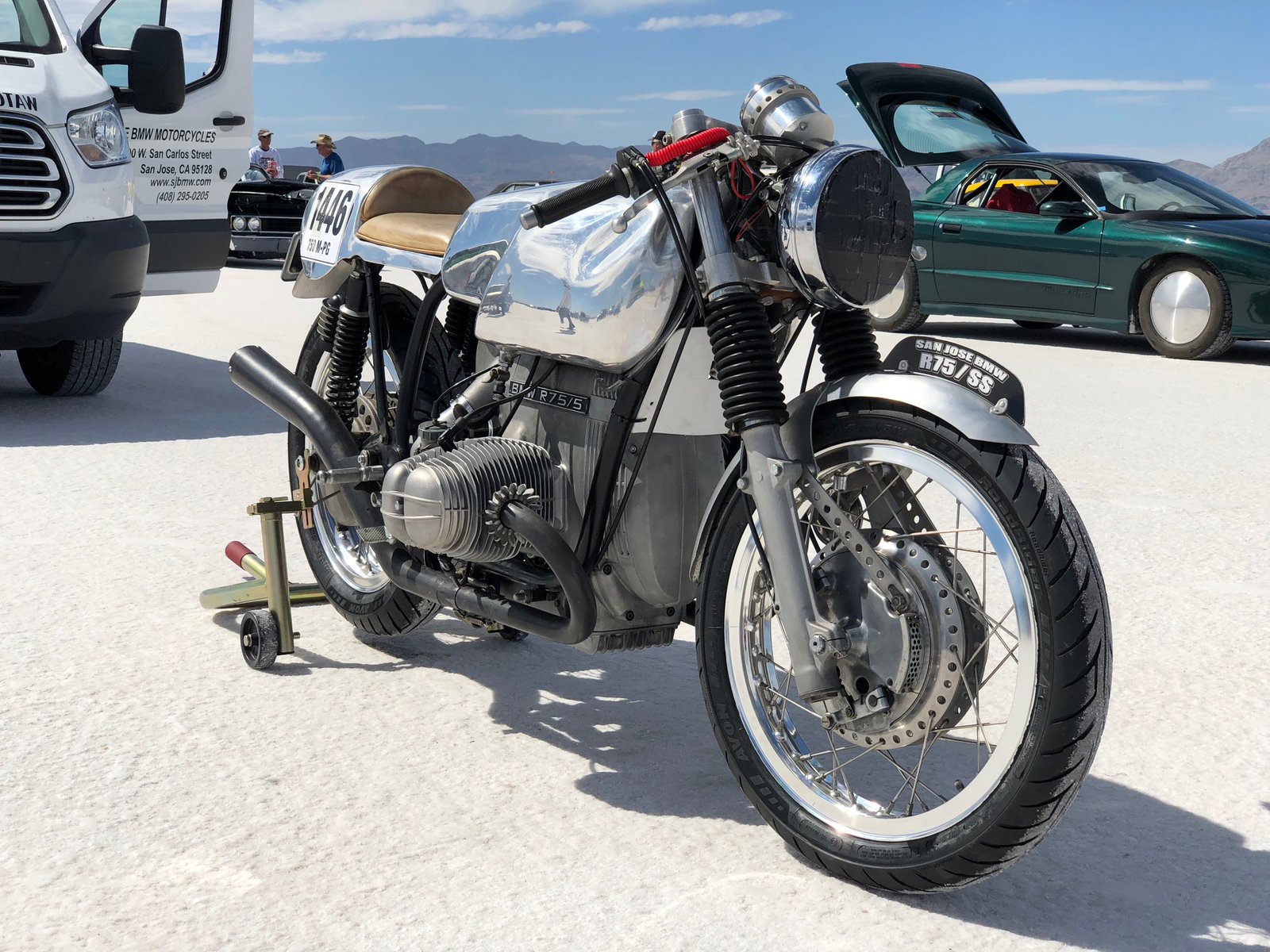
I only got one run in today before racing was put on hold due to the wind (and I suspect it’s done for the day). My GPS and the timing slip agree, which is nice. I was at 117 in 5th gear but not accelerating much, and lost 1mph after shifting into 6th. I have a few bits to remove to try to make the closet — I mean bike — a little more sleek. And I have a -1 tooth front sprocket that I’ll put on to attempt to make 6th usable, but I really don’t think anything will make up that 13mph difference. That’s ok, though. It’s still something to have gotten it out there, and the reactions have been awesome.
double take “Wait, you’re racing that?”
Yeah, I rode it from Virginia.
double take “Virginia?!”

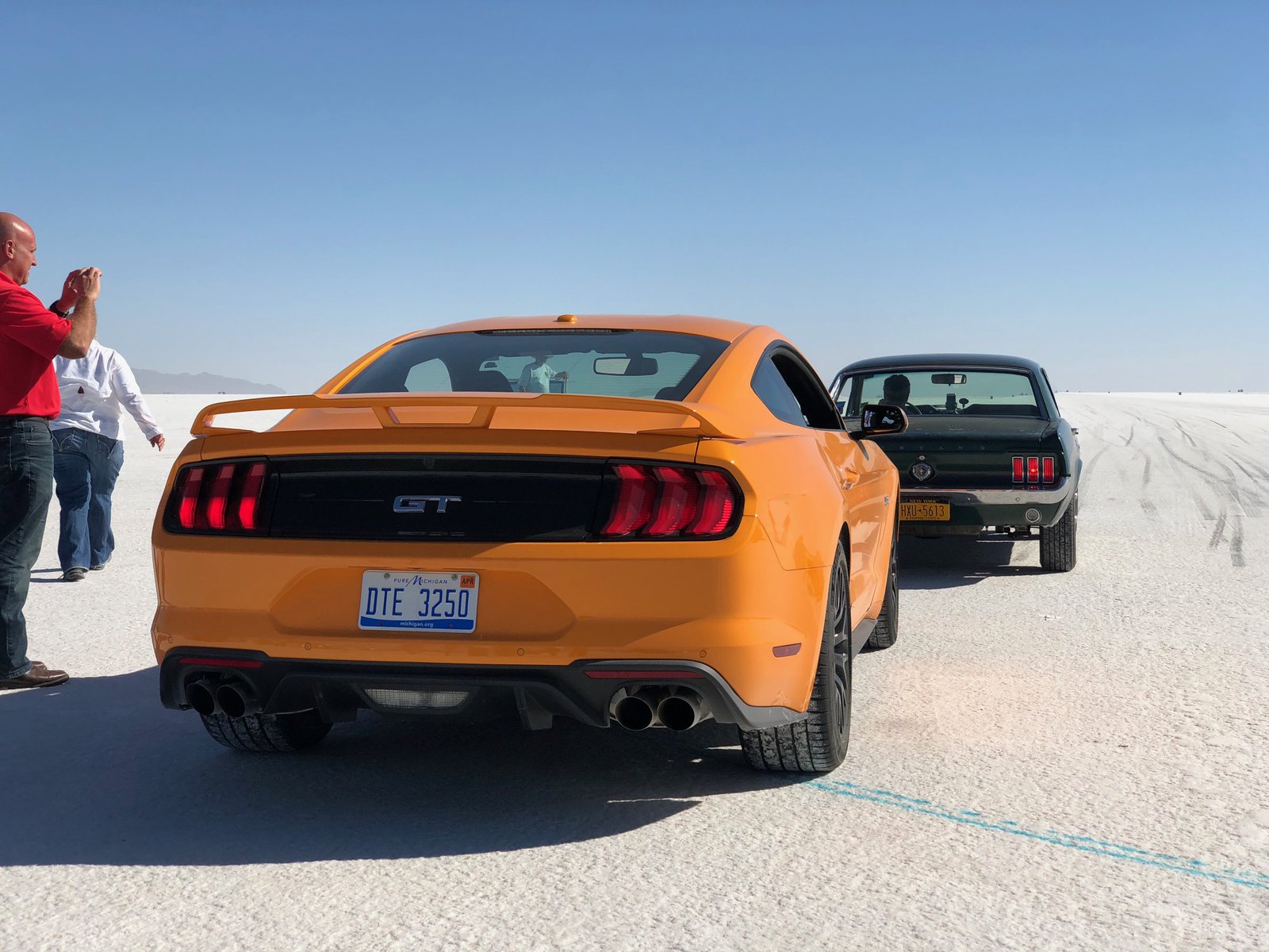
Let’s go racing! 🏍💨

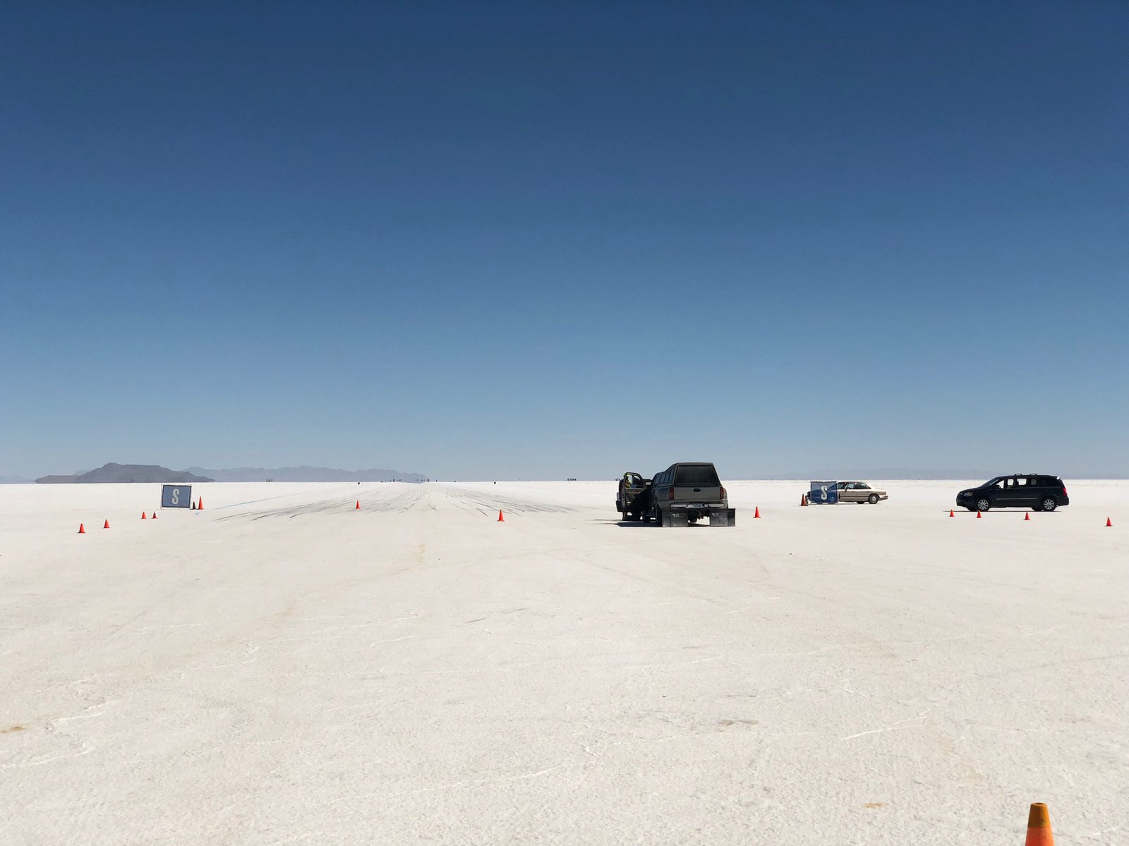
A few from the salt today
Great turnout today, but it was hot hot hot!
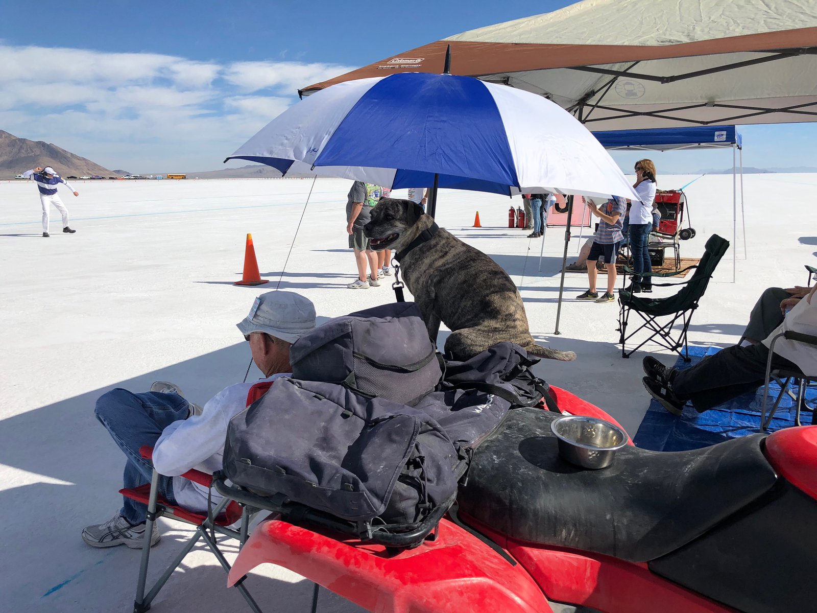
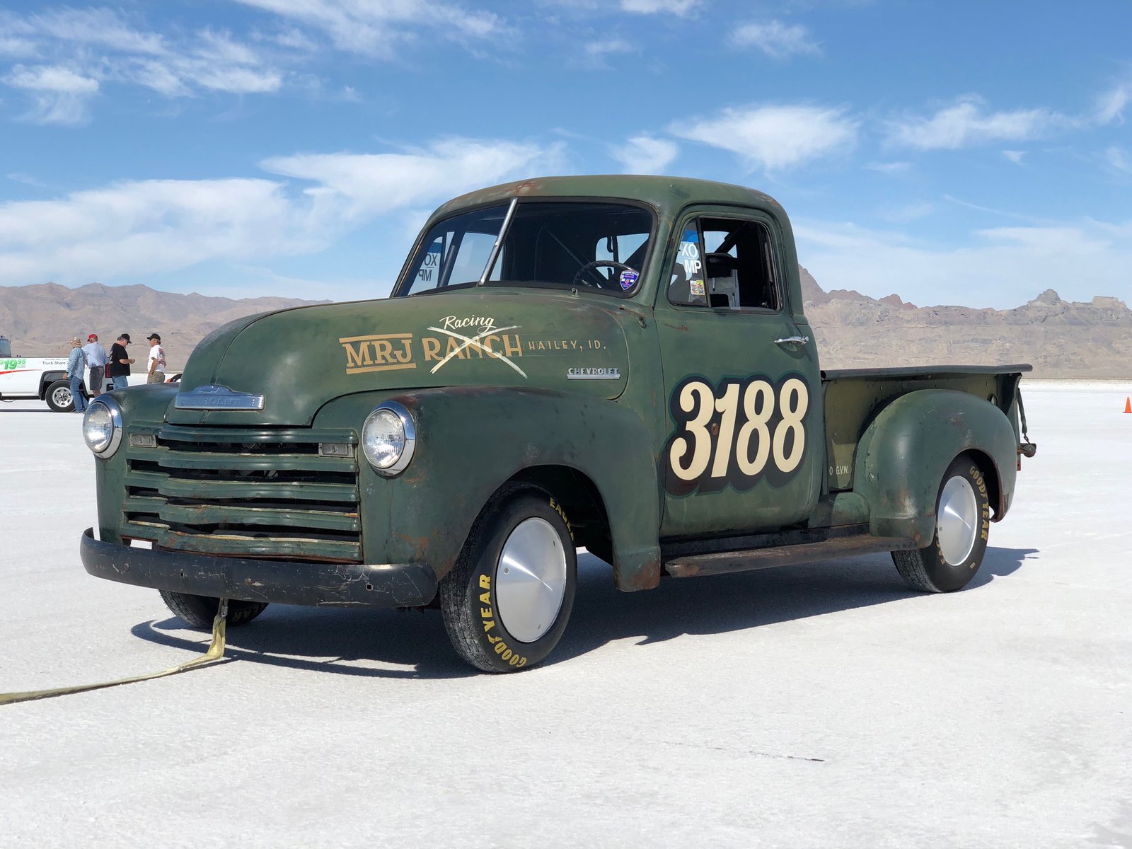
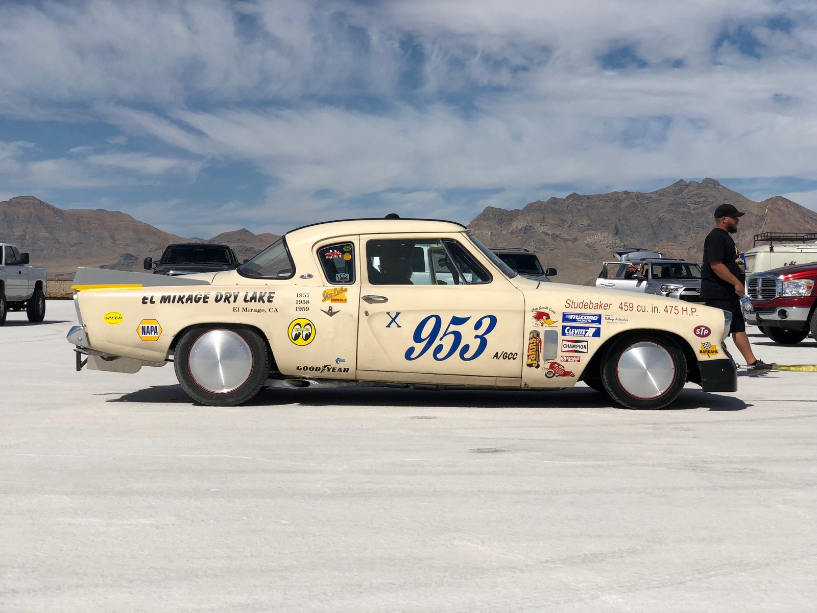

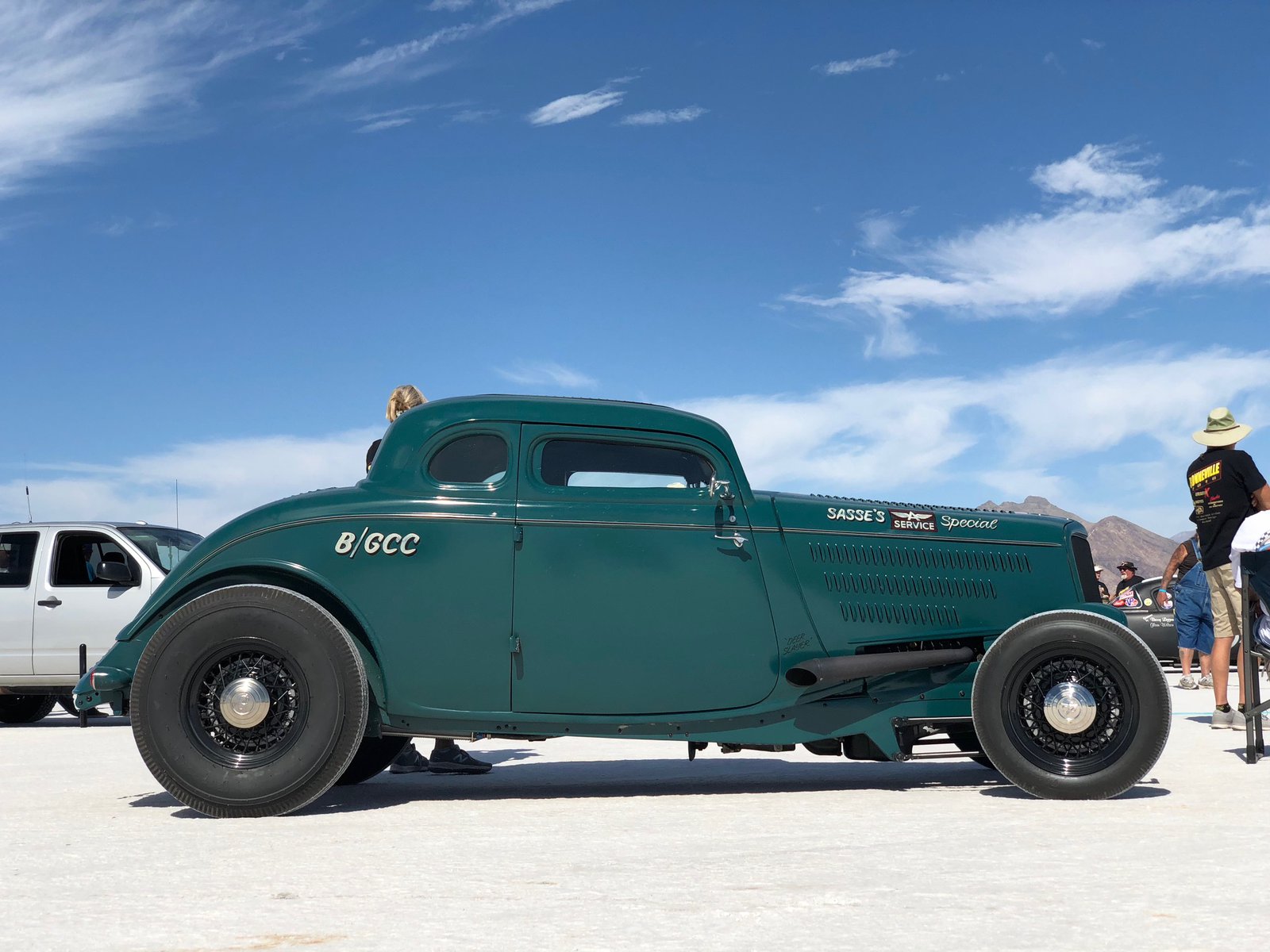
On the salt!

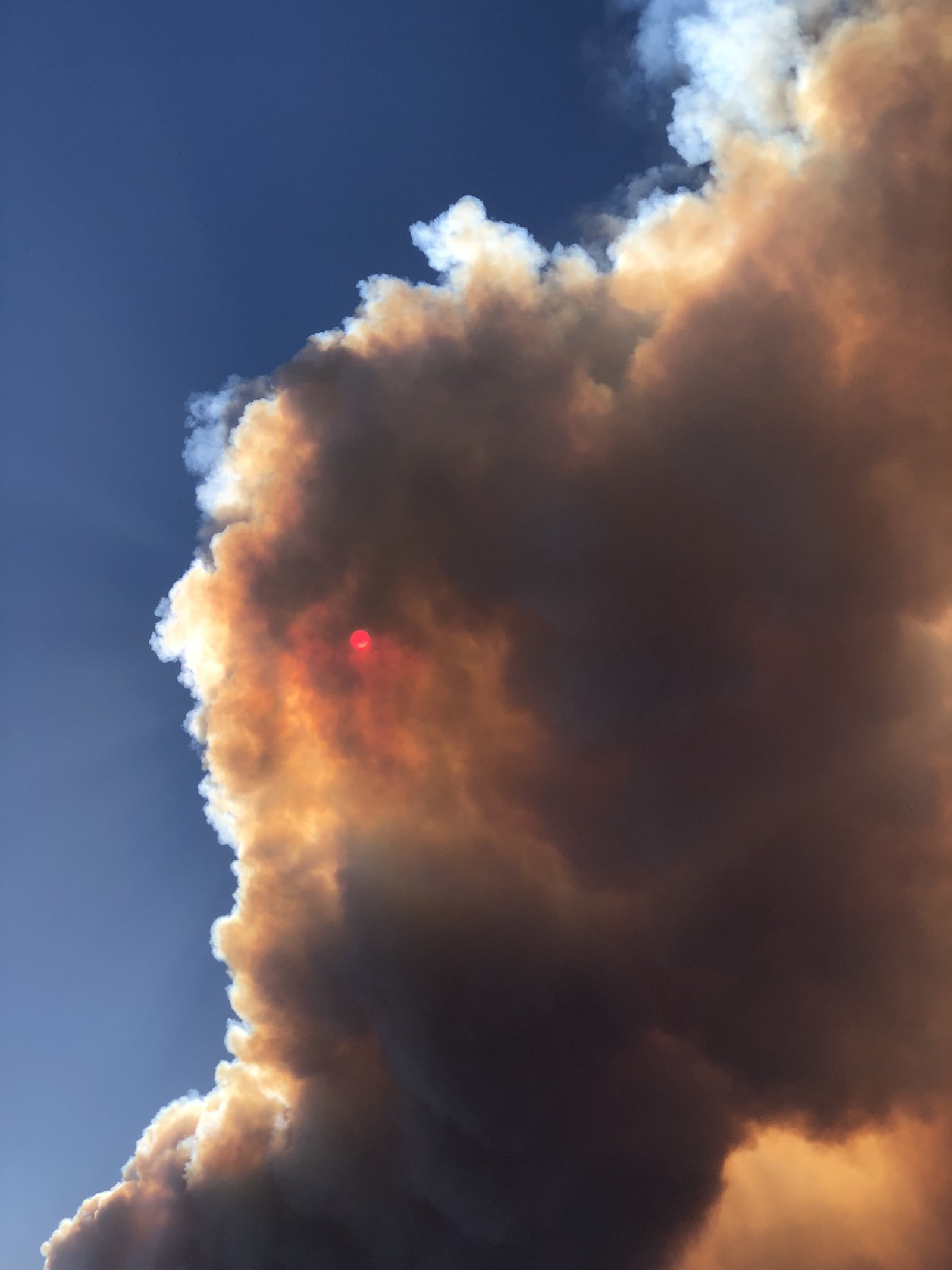
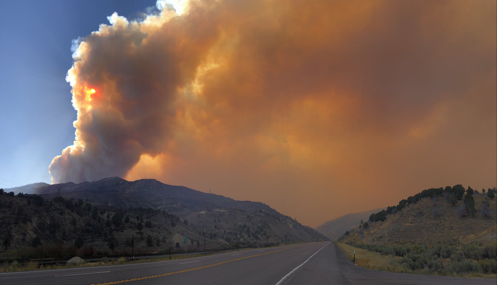
Pole Creek Fire
My route today took me up routes 191 and 6 through Price, Helper, and into Spanish Fork. The Pole Creek Fire started a week ago from a lightning strike and is only 2% contained and is about 20,000 acres. The theme for the day was 💨💨💨 and more 💨; the fire crews have their work cut out for them.

Desperado 🦕

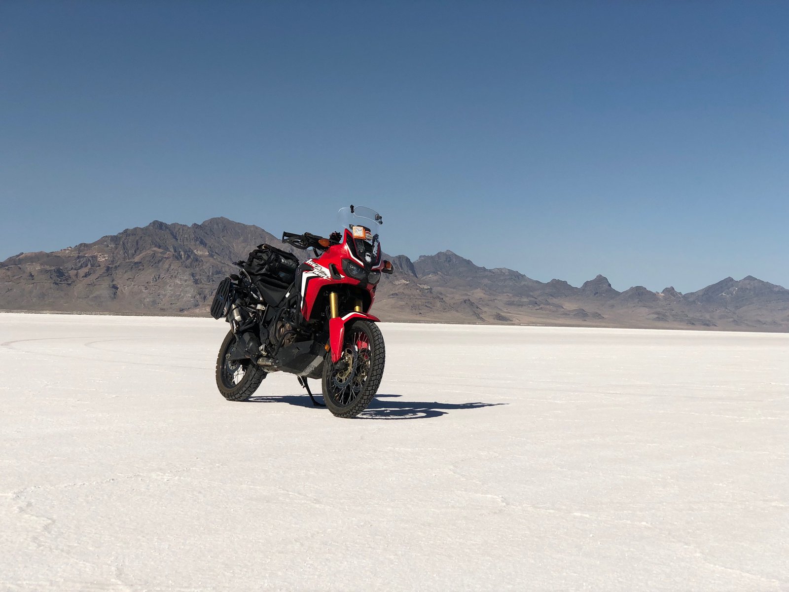
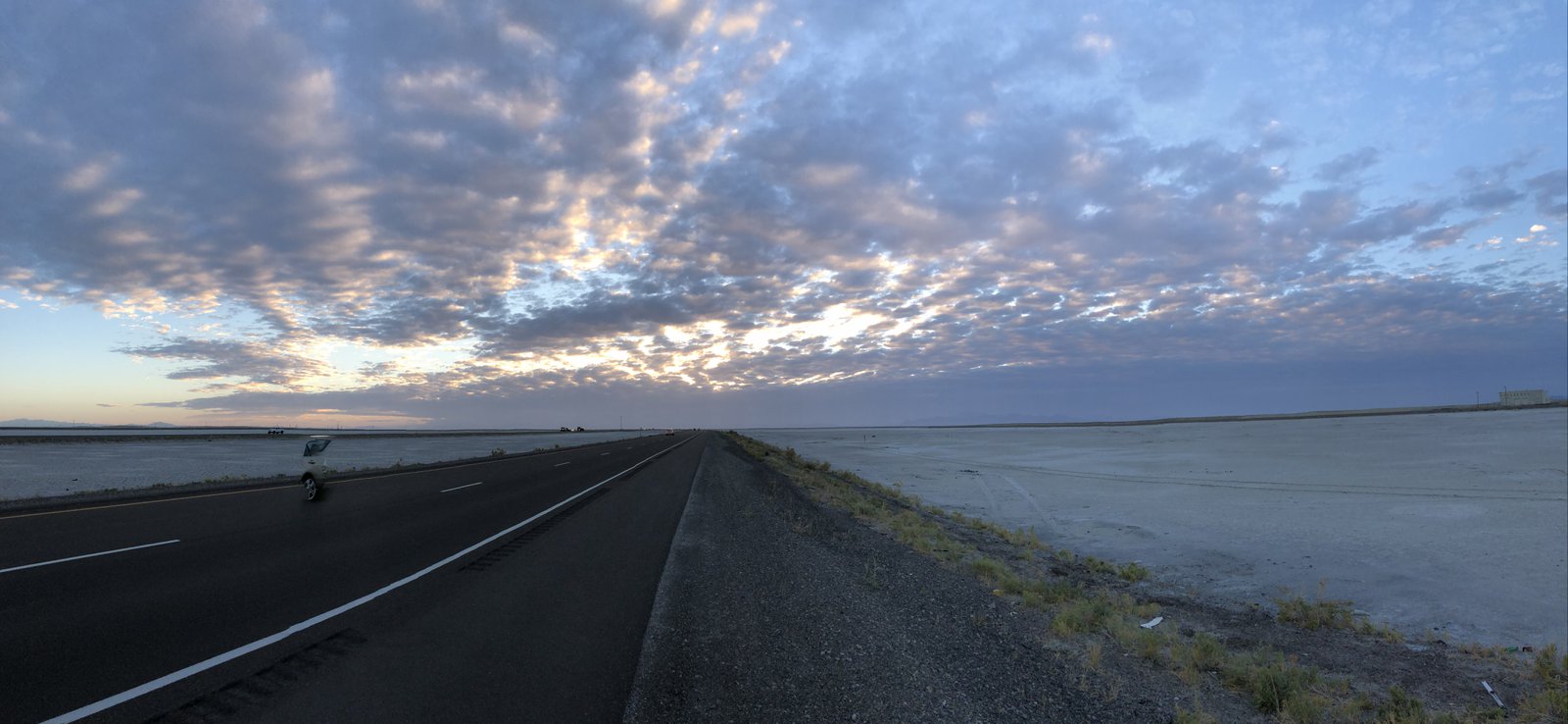
Big skies in Utah
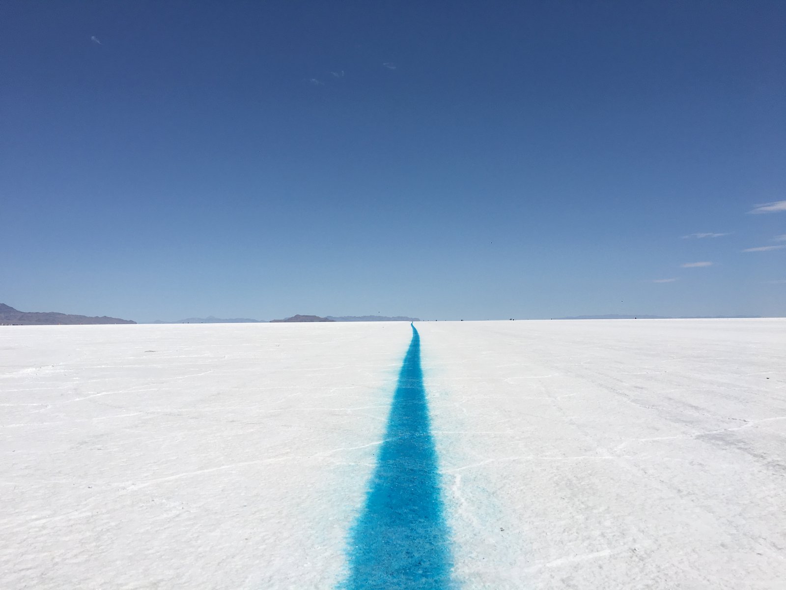
I know it’s right in the name, but the Bonneville Salt Flats make Kansas feel hilly. This was the first time my throttle lock would actually hold a speed (no cruise control; this widget just clamps to the throttle tube and rests on the brake lever).
Anyway, not long after the sun finished blinding me it made for a very pretty sunset, and the pattern in the clouds stretched so far across the sky I really couldn’t see the whole thing at once. This part of Utah is just so wide open and vast.

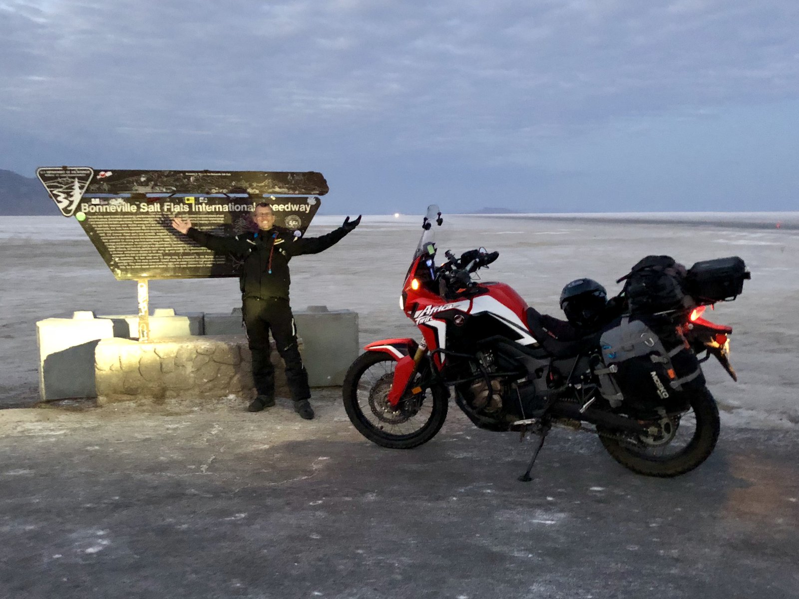
Made it!
I almost skipped the speedway tonight. It’d been a long, hot day, and I have been looking forward to a bed, shower, and air conditioning for most of it. But I couldn’t resist.
Thanks to Lori working security for not just letting me get to the sign, but for taking this otherwise-woulda-been-a-selfie.
Still going!
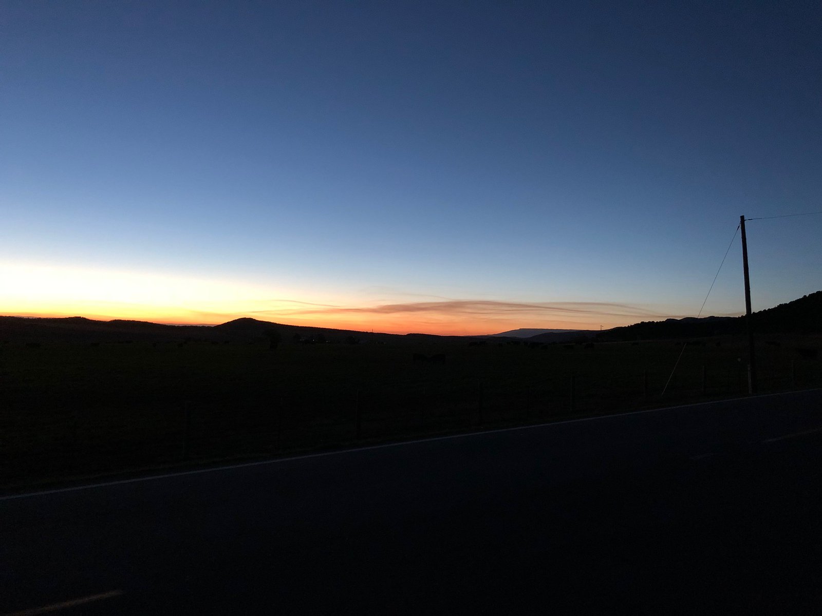
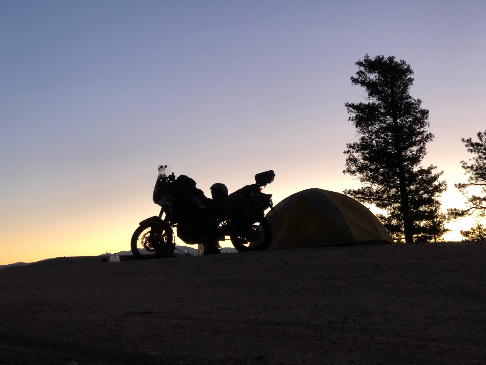
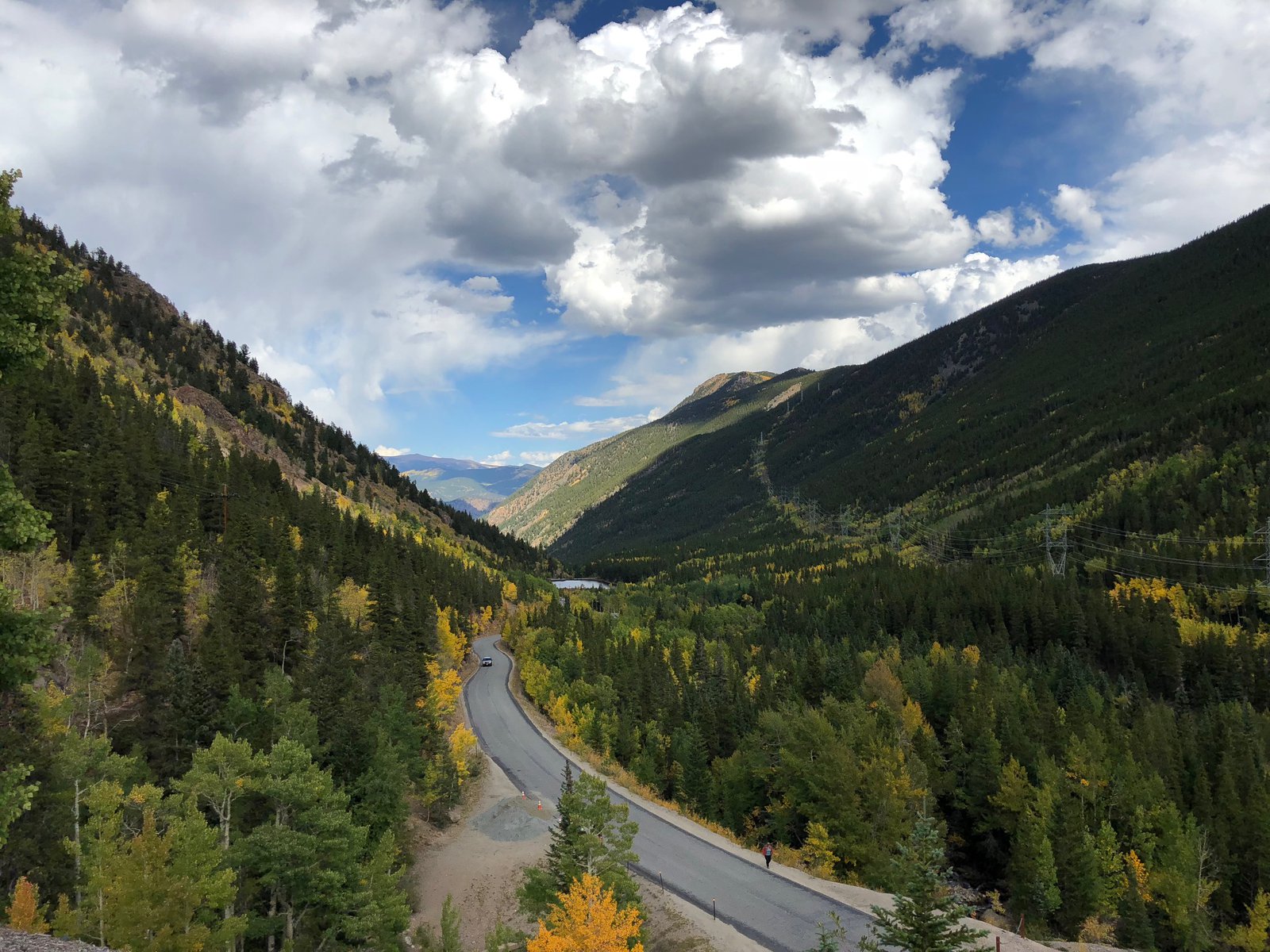
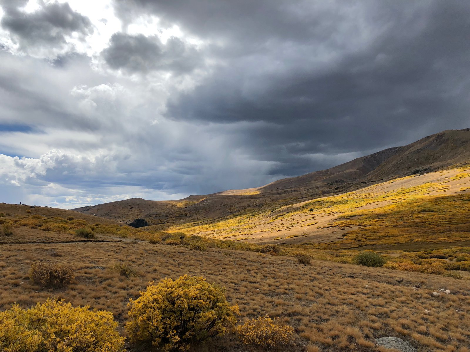
Long day yesterday and no service in Black Canyon National Park where I camped last night. Today’s destination is Wendover, UT and the Bonneville salt flats (and a bed, and a shower). There is SO MUCH more to see in Colorado, another trip is warranted. But I’m afraid today will be mostly interstate. The altitude, dry air, and high temps (plus 5 straight days in the saddle) are taking their toll.
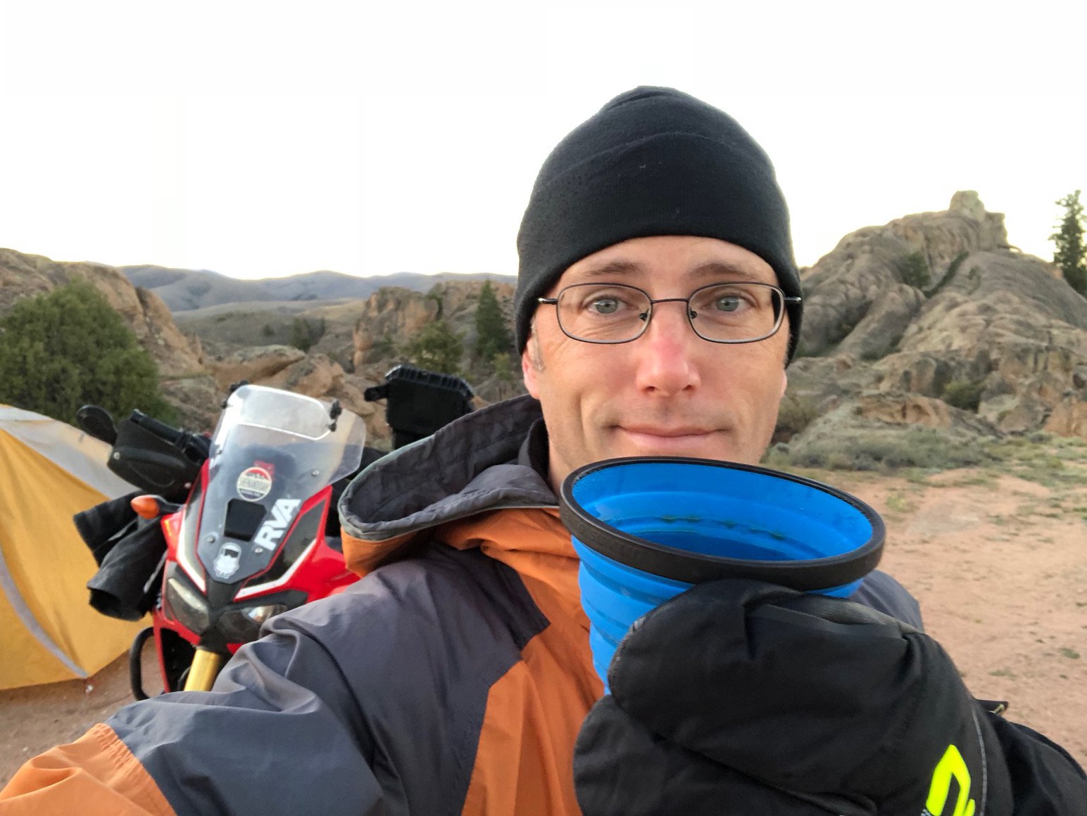
My ☕️ tastes like 🐔, and other joys of ⛺️
Bedding down in Gunnison
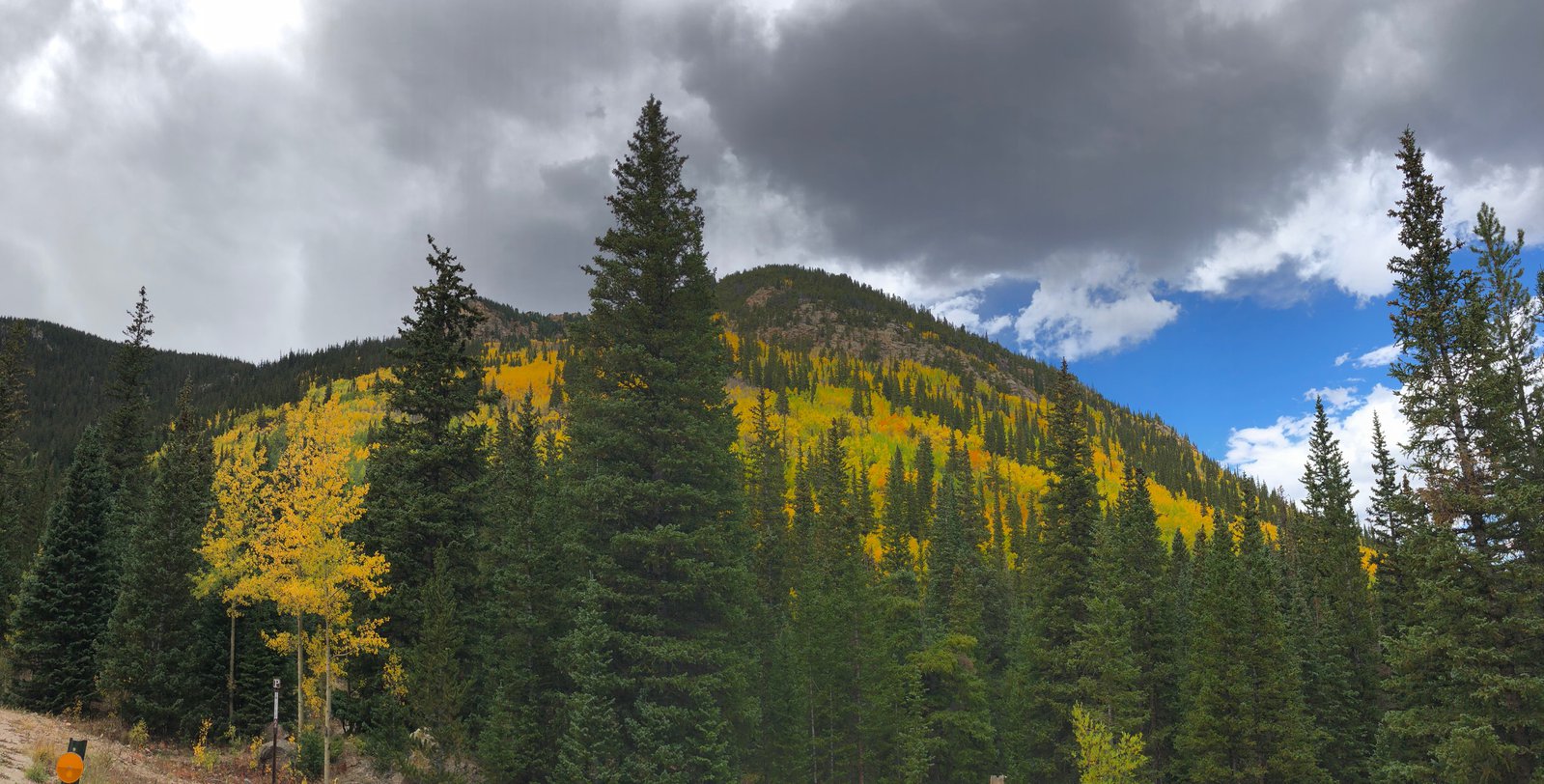
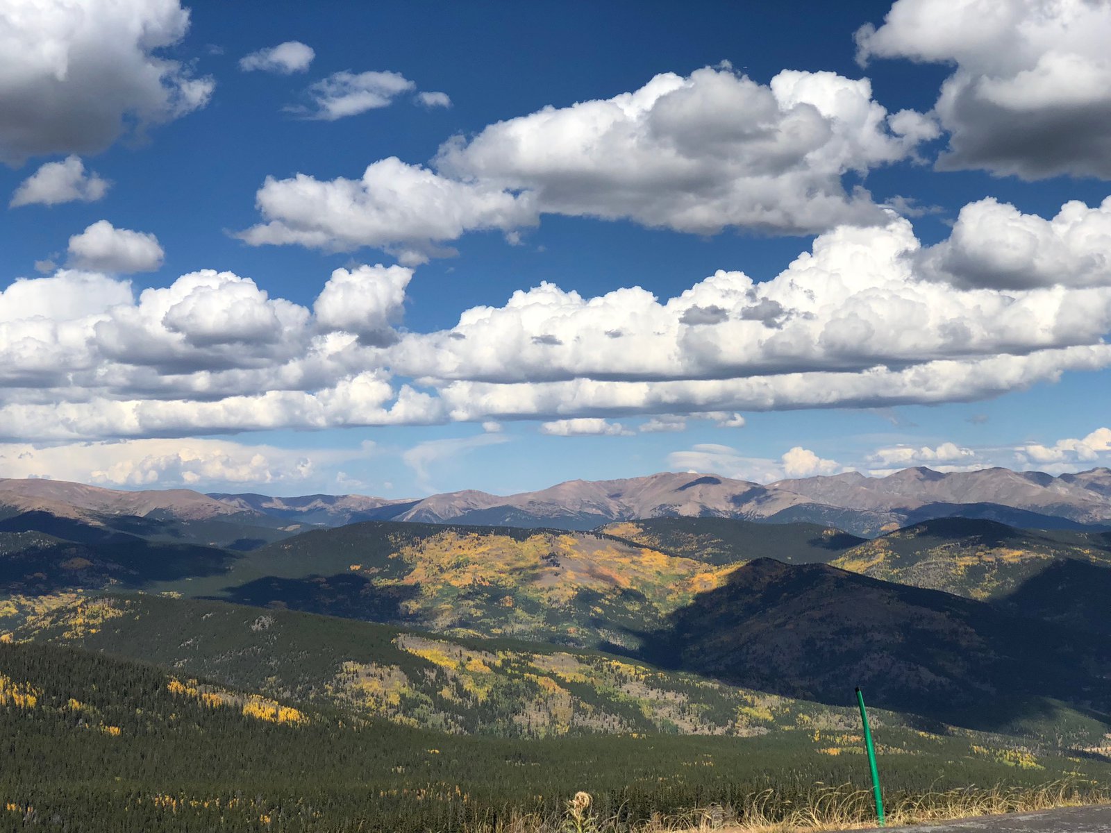
After all the rugged terrain from the last couple of days it was sort of a shock to pop out into a huge, flat valley south of Jefferson. There is all manner of geography here, and sometimes they run into each other. The flat land continued through Buena Vista (where I removed a layer) and gave way to another mountain pass on 50 west of Salida (where it was cold and wet and I wished for that layer again).
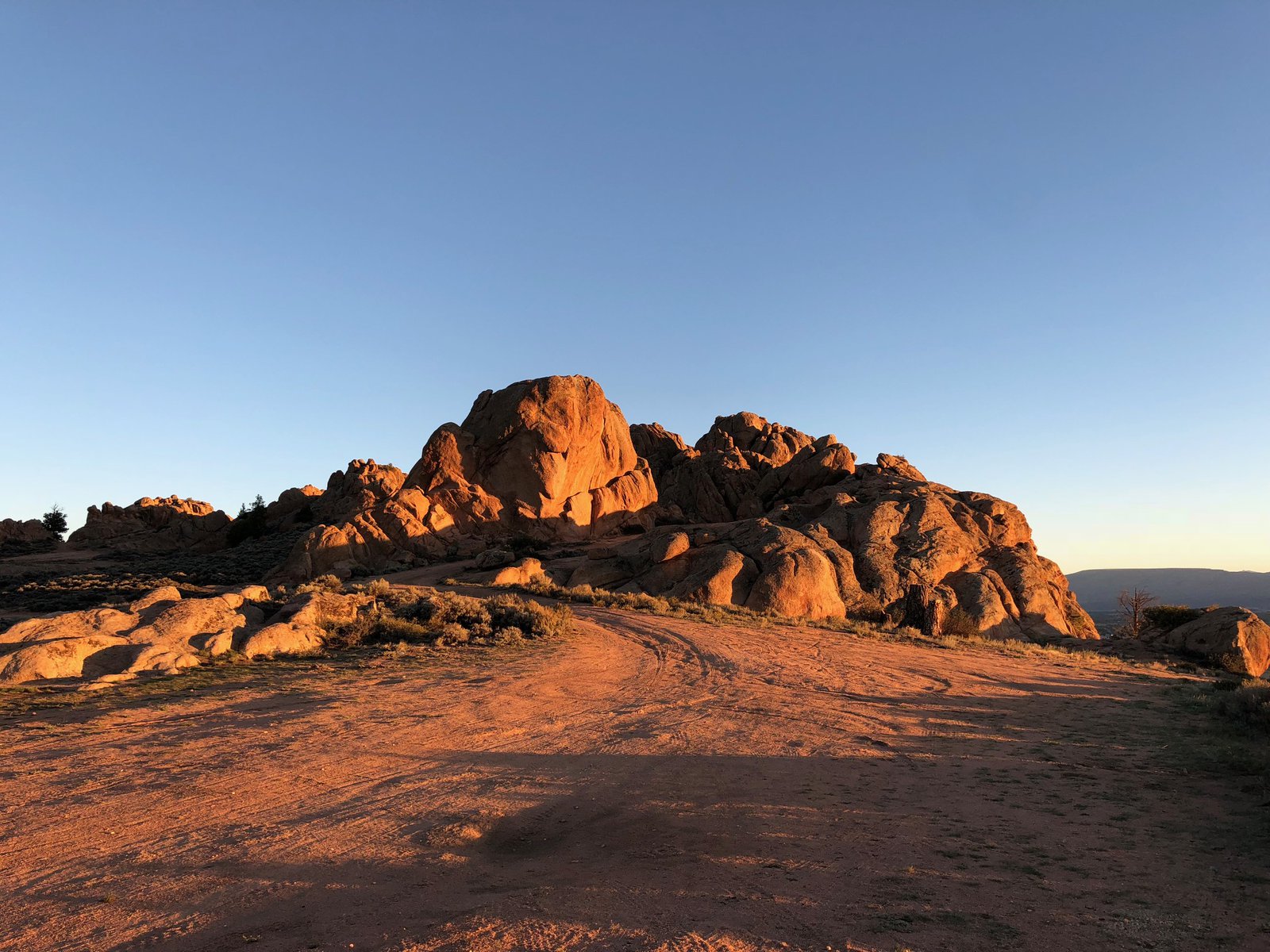
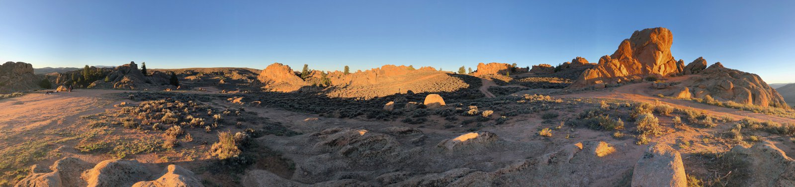
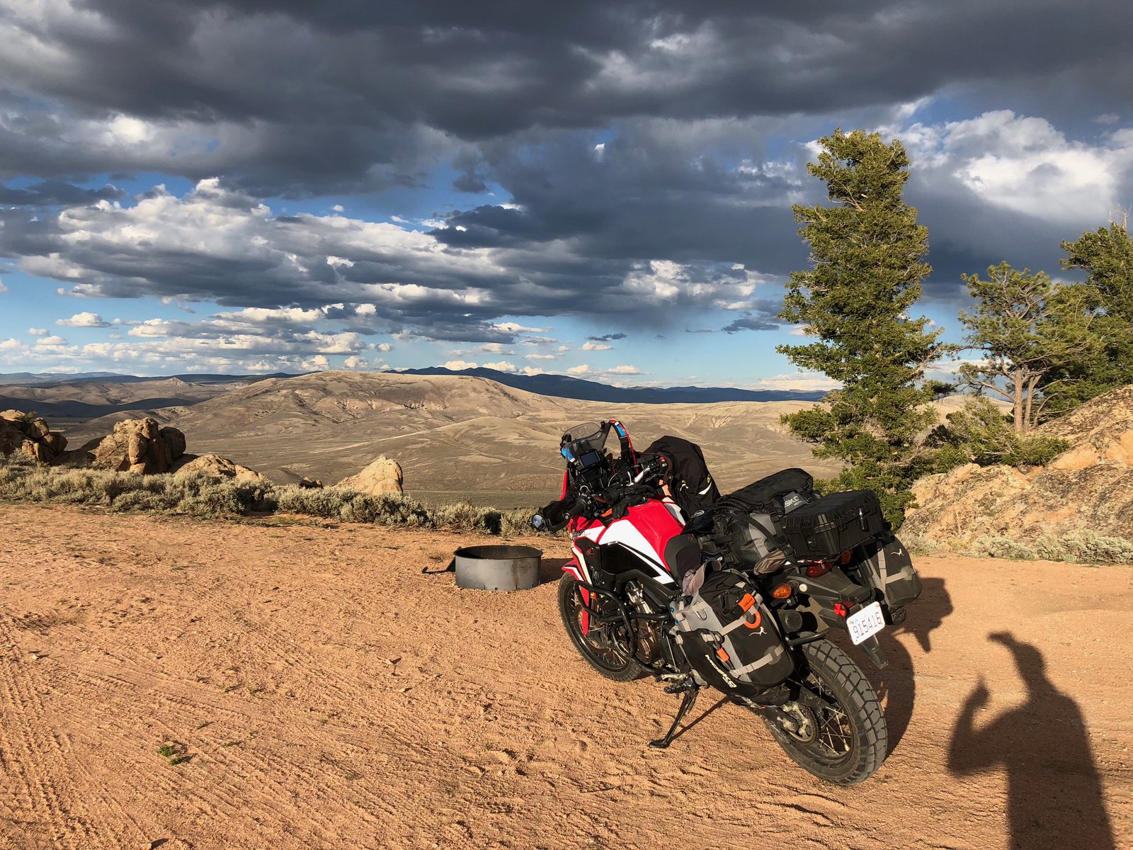
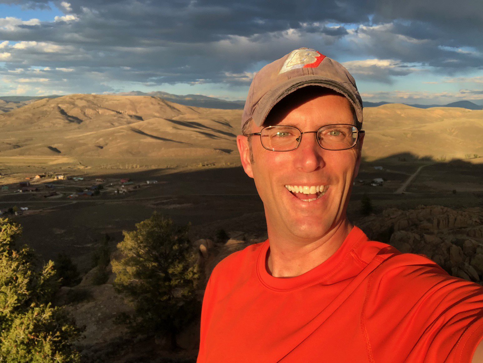
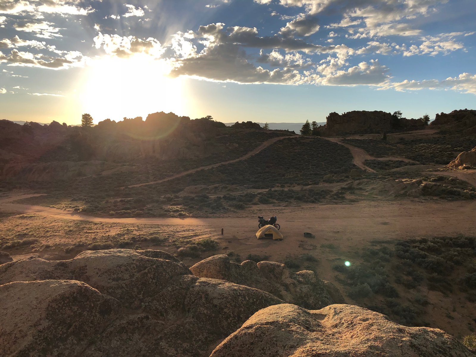
The lodging has been more expensive than I wanted, and I’ve been lugging my camping gear for 2,000 miles, so it was time to sleep under the stars. Freecampsites.net turned up Hartman Rocks recreation area, a BLM-managed area mostly for mountain bikers, but it seems pretty much anything goes. There are a few dozen primitive campsites here, and mine is on a ridge overlooking the valley to the east. I’m looking forward to the sunrise.
A few random shots
Coming out into the valley in Buena Vista; rain shrouding Guanella Pass; beautiful silvery water in a creek along Guanella Pass Road.
I’m trying to balance some technical limitations to how I’m posting these photos with making the trip at all interesting to anyone other than me. Not sure if it’s working. But hey! More photos!
Guanella Pass
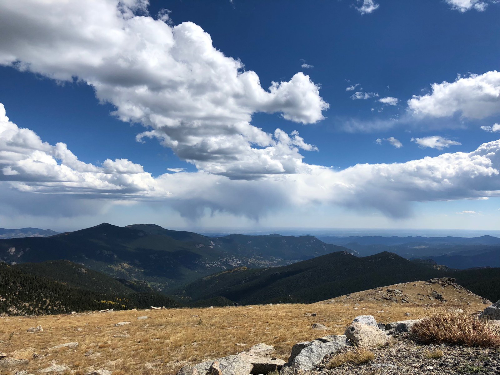
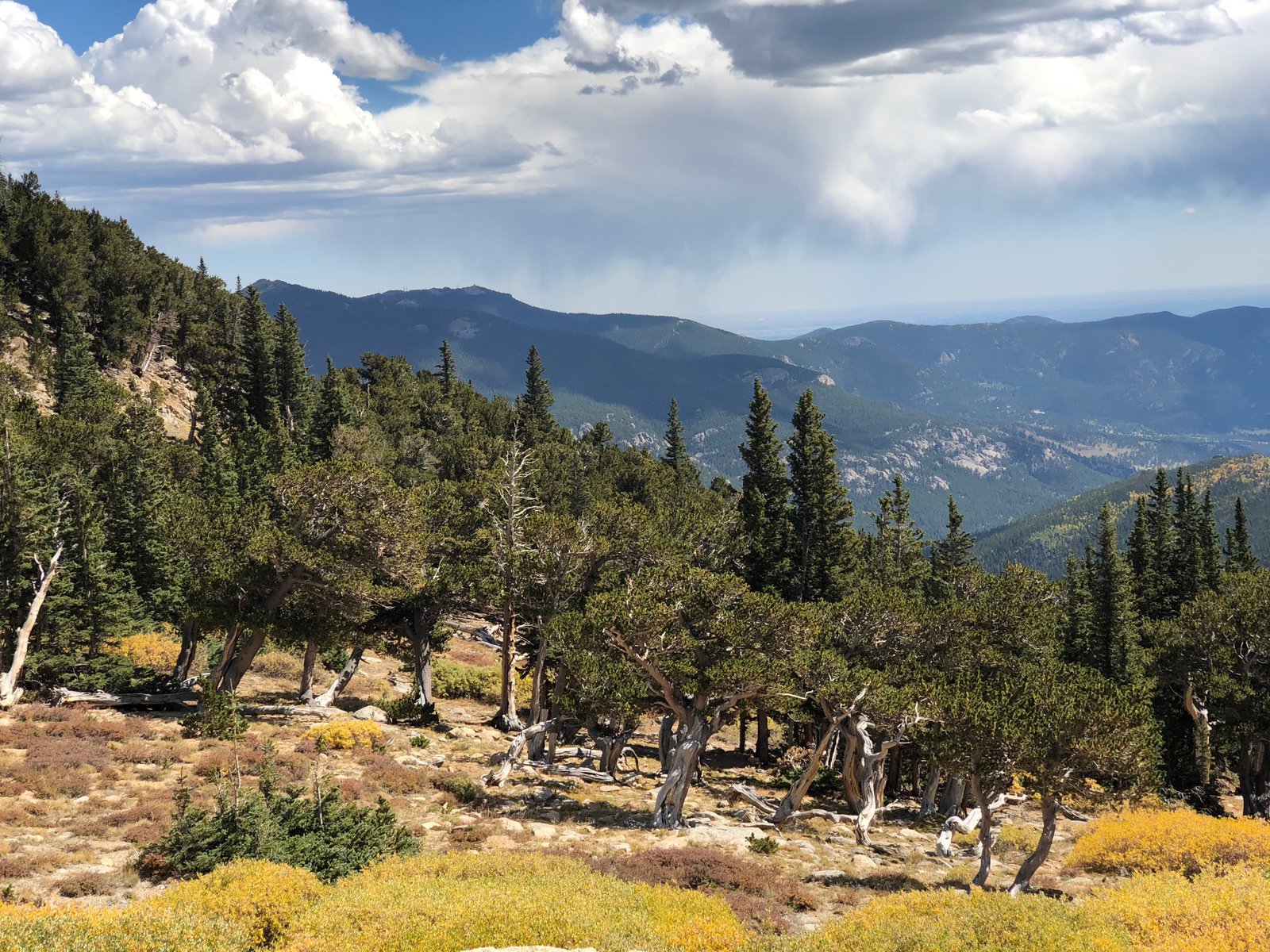
After Mt Evans I headed back down into Idaho Springs and jumped over to Georgetown via I-70. I must have loaded the bike poorly today because the front end was really unsteady: it followed every rut, seam, and tar snake. I had a bit of that on the first 800mi day to St Louis, but it was better after moving a few heavy things lower from the seat bag to the saddle bags. Wind doesn’t help, either, and today was GUS-TY. It didn’t feel unsafe, but wasn’t comfortable, either.
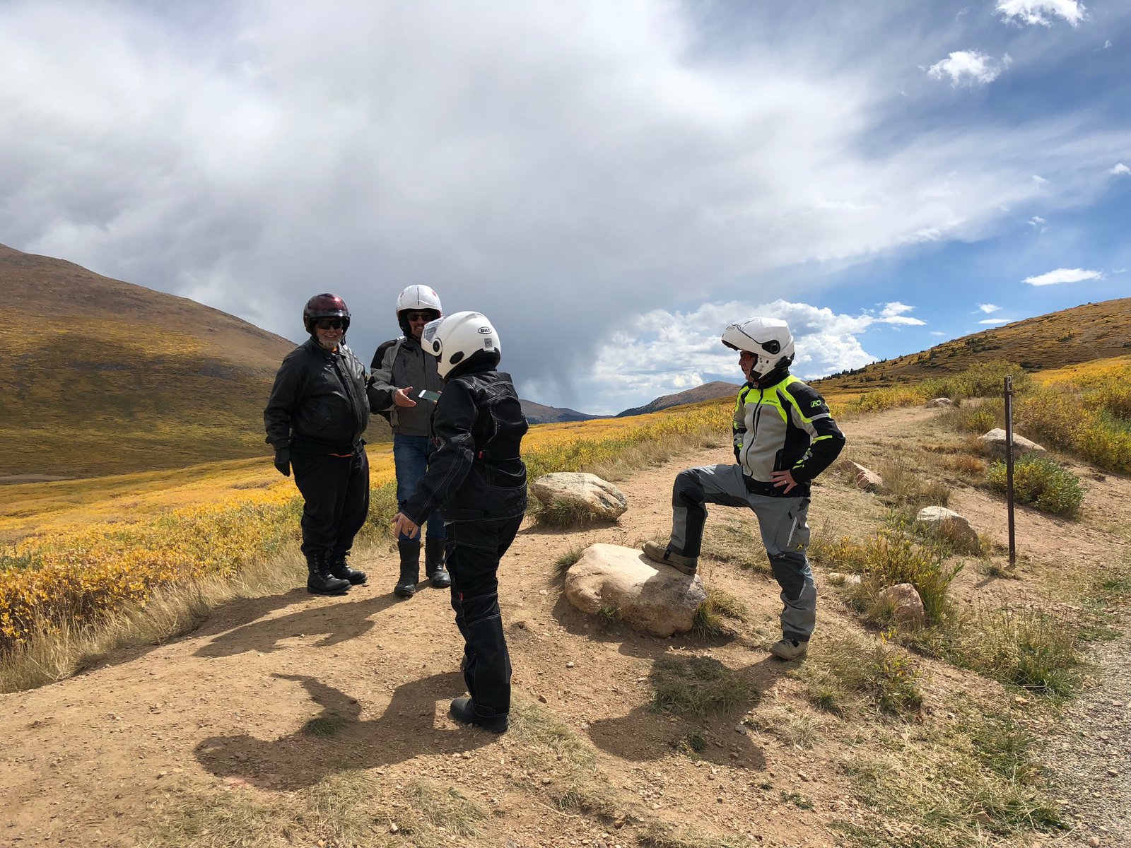
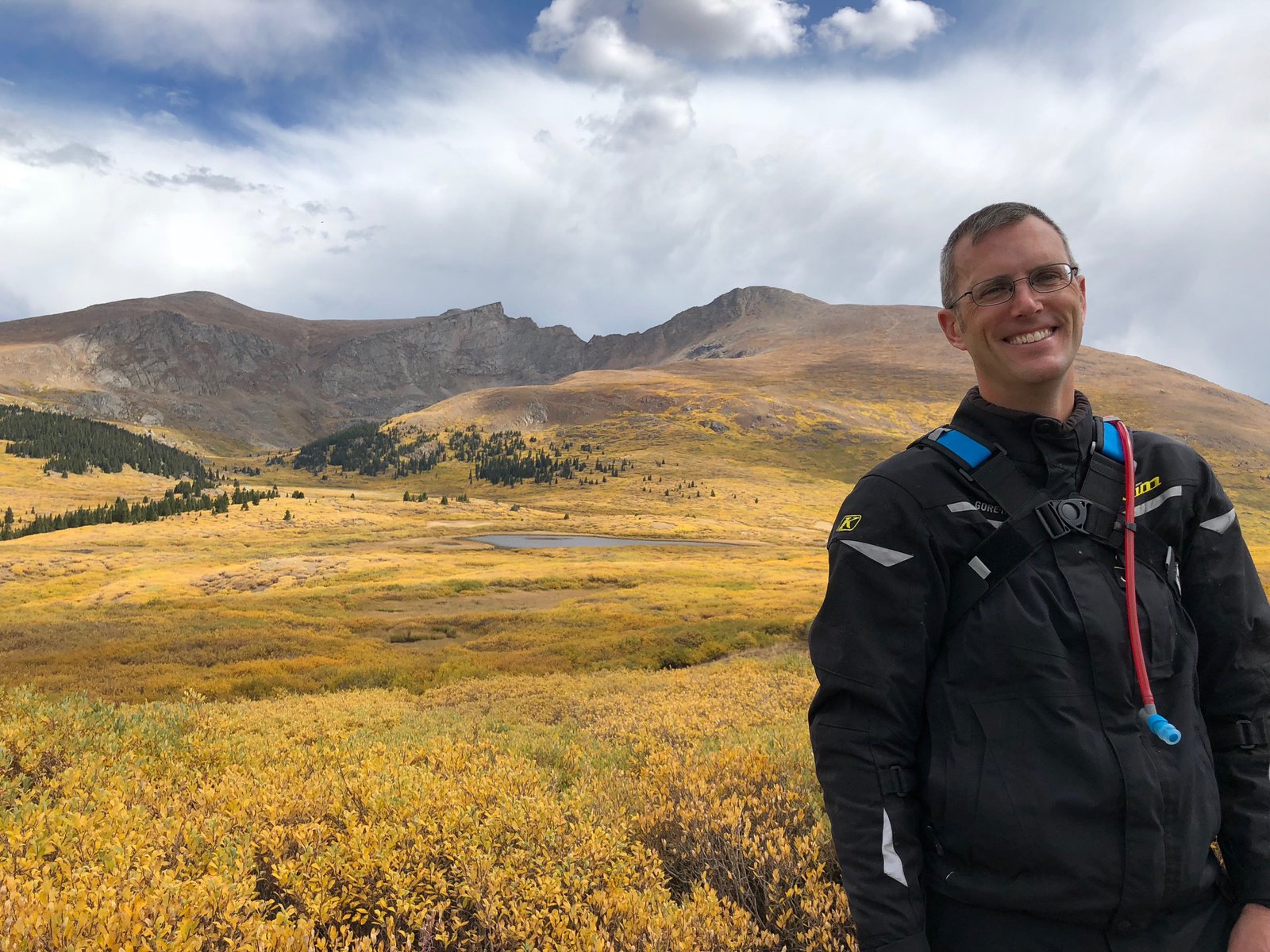
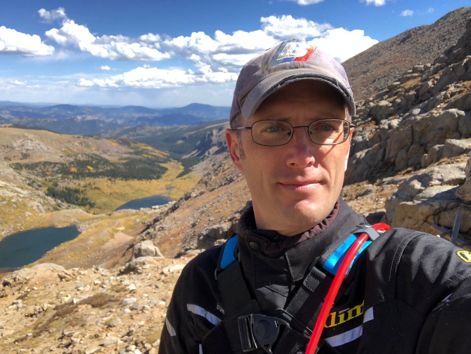
Anyway, from Georgetown I took Guanella Pass Rd south to 285. I’d never heard of the pass or the road (great job I did with all that research, right?) but it went in the right direction and looked properly twisty and mountain-y. I’d waved to a couple on a Tiger and we passed each other when stopping to take photos. I pulled up next to them at the summit and we chatted bikes for quite a while. Then another couple guys - one on a Harley and the other on an F650 - joined us. The AT gets a lot of attention, which kind of surprises me, but I do like it. It probably helps that it’s obviously not been pampered. The pillion rider took the photo of me, after being coached on composition by Mr F650, who is “in media” per the Harley dude. It was a fun impromptu biker gathering, and not the first of the trip. It seems we like talking bikes as much as riding them.
I must have put on and taken off my down jacket 6 times today and each time I was at the perfect temperature until I wasn’t. I saw low 80s and upper 50s, bright sun and rain. Usually the rain accompanied the colder temps, of course.
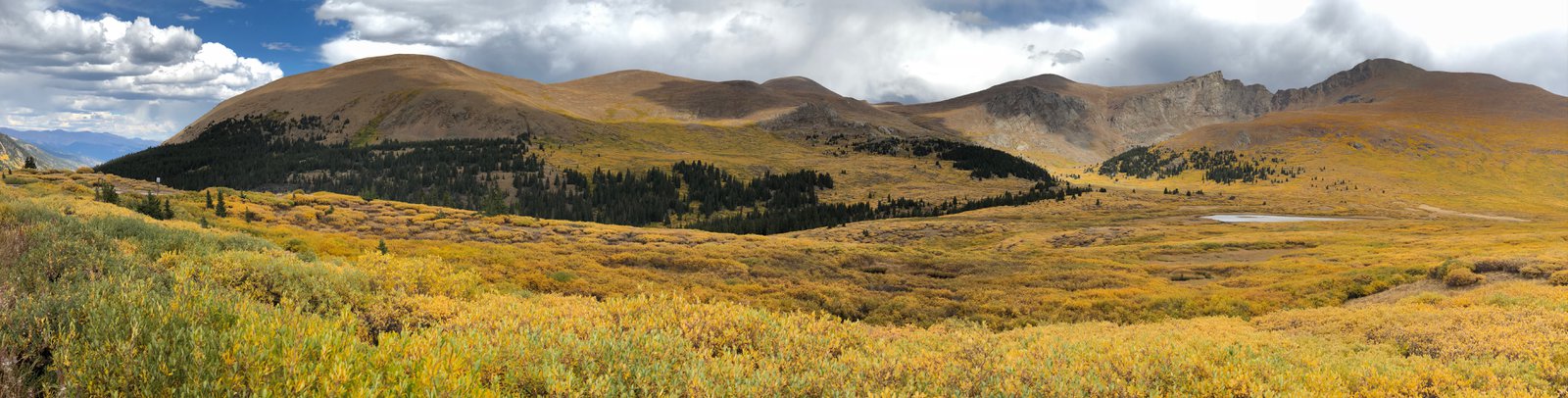
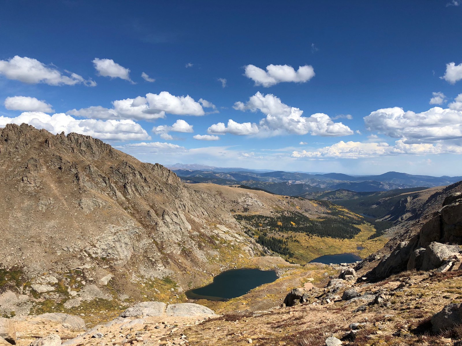
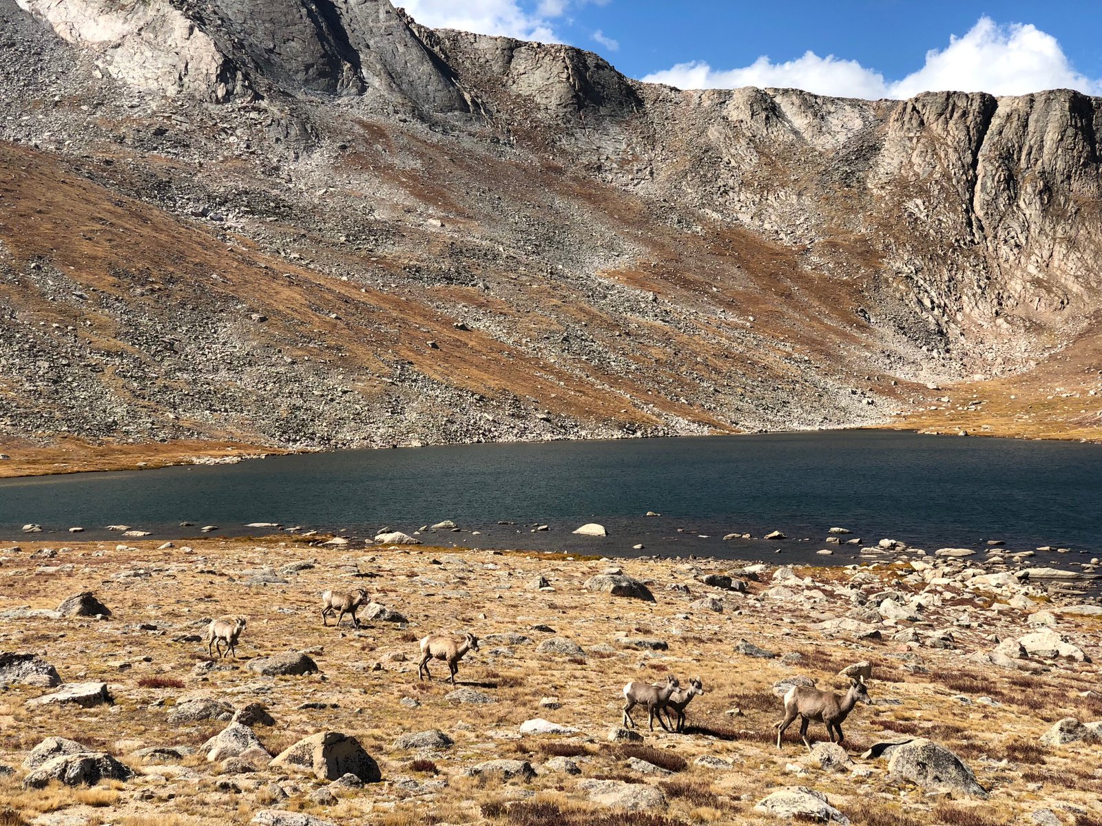
Mt. Evans
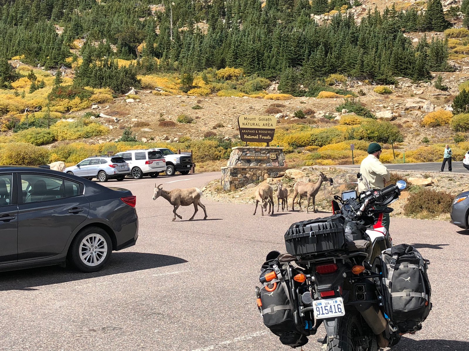
A co-worker suggested I visit Evans, which I hadn’t even heard of before. It has North America’s highest auto road at 14,000’ and change. Unfortunately it closed for the season just a few days ago and you can now “only” get up to 12,800 at Summit Lake. It’s still a breathtaking view, and not a little windy and cold. There was a small herd of wild goats wandering around, completely unperturbed by the people. A ranger was walking around telling people to stay 30+’ back from them, but the goats made that hard. I wonder if they knew the power they possessed.
Roadside oddities
The adventure has begun
I got a bit of a wake-up call today. I heard about St. Mary’s Glacier from Joe at Woody’s, and I’d decided to stay in Idaho Springs already, so with an extra hour to kill it seemed natural to pay it a visit. I followed my GPS out of Denver, past Red Rocks, up Rt. 74 through Evergreen, and through the densest concentration of casinos I’ve seen this side of Vegas, in Central City (right near Nevadaville; how ironic). Once past the casinos you pass through what looks like the old town, and then suddenly the road turns to dirt, and shortly later it’s a rutted sandy ATV trail. But hey, I’m on an ADV bike with fresh ADV tires! Let’s adventure already! The trail got pretty rocky, and then abruptly turned into a mini hill-climb with some pretty big obstacles. I’m … not very good off-road, and the bike’s got the scars to prove it. I got almost to the top and faltered negotiating around a boulder and toppled over. The AT is probably 600lbs or more with all the bags and fuel: once it starts going, there’s not much I can do to stop it. This time it was leaning uphill and pretty easy to right; I got moving again and popped out into a clearing with some nicely maintained dirt roads. Easy. Let’s keep going.
From there the GPS suggested a closed trail, and the next alternative turned out to be a rough, rocky, sandy track with lots of exposed mountain poking out: Woodpecker Gulch, which becomes Hamlin Gulch. The skid plate earned its keep. About ¾ths of a mile later the trail forked and I went right, but found a gate a short while later, near a hunting cabin with a couple of early-90s cars abandoned in the yard. I was on private land. I turned around (awkwardly), hoped I hadn’t heard a shotgun being loaded, and went back the way I came. The turn to the other branch of the track was sharp, downhill, and very loose, so I retraced my path to where I could turn around (again). This time was more awkward and I dropped the bike on the left side, downhill. After a couple of attempts I got it back up after taking two of the bags off and swinging it around on the crash bars. (A Harley guy tried to tell me they were “engine bars” the other day, but I explained that my term was intentional and correct.) Now pointed in the right direction, I took the left track for maybe another half mile and found an old rock slide that looked waaay too sketchy to get over solo, even without the luggage. With a spotter or two, no problem. But not on my own. So another awkward (and somewhat precarious) turnaround commenced, this time without the luggage, and making sure I didn’t accidentally lose the bike down the hillside: the path wasn’t much wider than the bike is long. Once again pointed the other way and the bags reattached, I’m hot, sweaty, a little shaky from exertion at 10,000’, and just about out of water. And it’s about two hours from sunset. Shit.
I rode back up to my nemesis, the fork in the road, put the kickstand down and had a think. The route back the way I came is not fun: lots of exposed, rutted, broken rock without a good line through it. Go too slow and it’s easy to stop or stall, and the footing can be hard, tempting another 0mph topple. Take a bad line with some momentum and, well, that’s a steep downhill on the right. I’m tired. And there’s not a soul around. It’s beautiful, though! I decided to walk back to the cabin next to the gate, hoping I might be able to find (a) water and (b) someone to suggest a route, or provide an escort. I found neither. The gate, however, was not locked, and had a sign saying to close it after going through. The map showed the route past the gate joined up with the route with the rock slide, which didn’t feel super encouraging.
Walking back to the bike I realized that I was less than a mile from the easy road I’d seen before, so not that far. Just that technical rocky stuff to tackle. Another look at the map showed some houses not far from where I wanted to be. It wasn’t as remote as it felt. Time to channel my inner Lyndon Poskitt: pin it. 👊✊ The ascent wasn’t pretty to anybody with a touch more skill than I possess, but it worked, with only a couple pucker moments. Back at the top I still wasn’t sure where to go, but down seemed reasonable, and around the next bend the road became the most well-maintained dirt road I’d ever seen. Figures. Oh, and that “don’t trust your gps sign”? It was at the other end of Hamlin Gulch, about 1,000’ from my last turnaround (and 400’ down).
So, what’d I learn? Carry more water than I think I’ll need (which is usually far more than I actually drink); I’ll be keeping my extra camelbak filled for the rest of this trip. Situational awareness is important, too: the roads (and “roads”) change quickly around here, and things get remote pretty quick. It might not be easy to get back out the same route I took in, so be ready to abort sooner.
I’ll probably keep to the pavement a little more tomorrow, but I can’t wait to keep exploring this beautiful area.


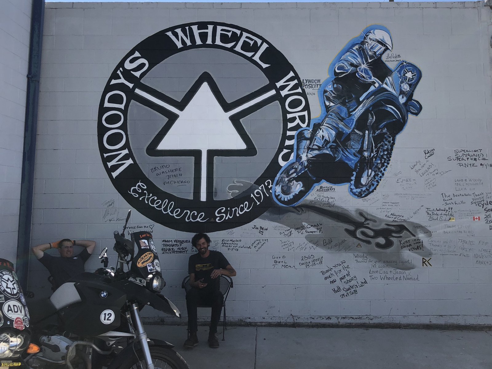
New shoes, and an RVA sighting
Lyndon Poskitt, Eva Hakansson, and now me. But my sponsorship application must have gotten lost in the mail.
Woody’s is a cool place, known (in some circles) for their bomb-proof spoked wheels. But they also mount tires for us plebes. Nice folks, and I was out the door earlier than expected. I’ve now got a new set of V-rated Pirelli MT90s which have already proven themselves in sandy and rocky terrain. But more on that later…

Denver!
I honestly wasn’t sure I could do RVA → Denver in two days. 1600(ish) miles is no joke, especially when punching through a hurricane in the middle of Indiana. (How does that even happen?) Day 2 was a little harder: the wind protection on the AT is not great (it’s more dirt bike than continental tourer), and frankly I was kind of tired from yesterday. Plus all of Kansas was a crosswind. But 14 hours and 850mi after leaving an anonymous St Louis suburb/business park I’m drinking beer in an anonymous strip mall bar in a Denver ‘burb. This part of the trip wasn’t about getting to know the local flora and fauna, it was about getting through the middle of the country to the “good stuff”.
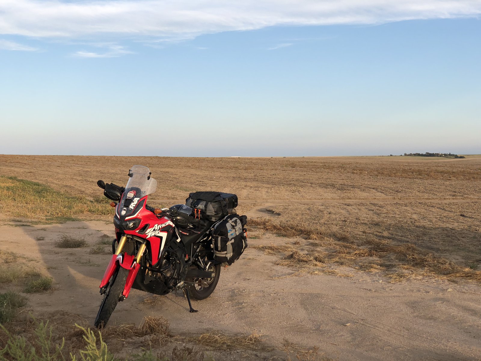
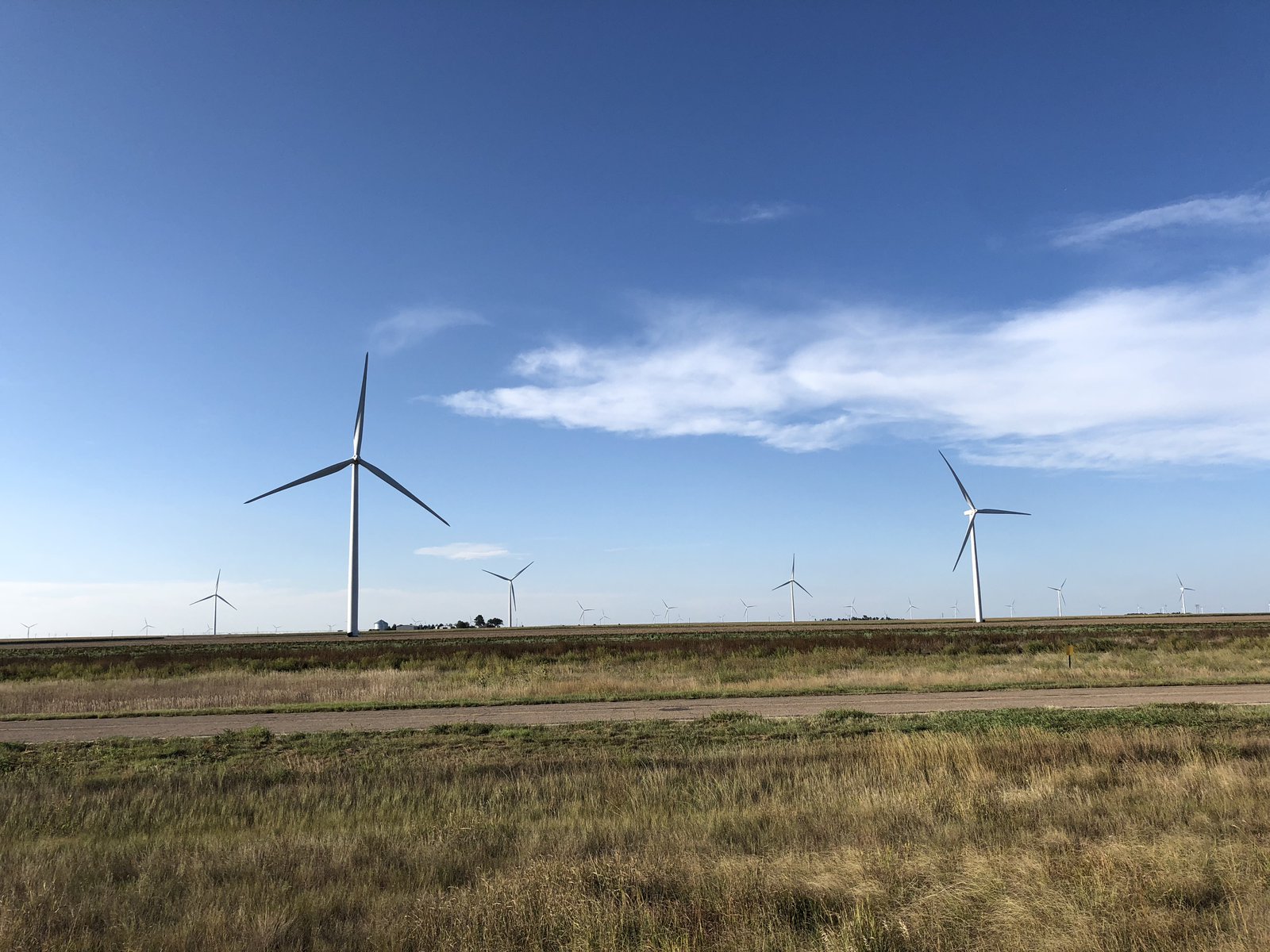
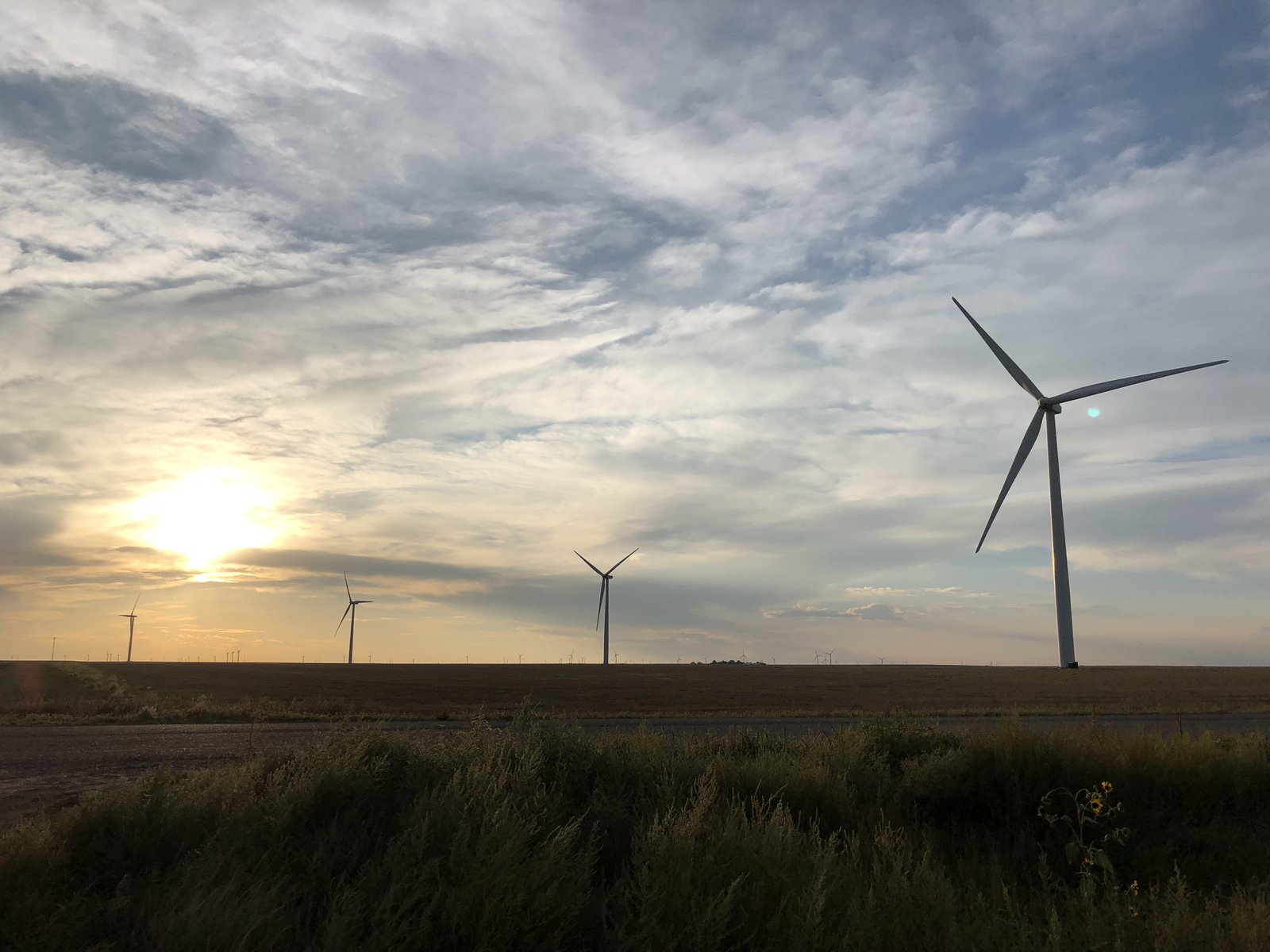
I’d intended to get a photo of every state line, but several of them are inconveniently located on bridges, and then I blew past the Colorado one (ostensibly the most important one). So you get windmills, a motorcycle in a field, and a Mountain Dew sign.
Tomorrow the AT gets some new (V-rated) boots and I’ll figure out my next stop, but bike service will eat up most of the day, so I’ll probably not get very far.

It was a wet one
“Ok, Thanks”. I mean, what else do you do with that? I was making great time until I hit whatever hurricane wandered into southern Indiana. I pulled off in Ferdinand for over an hour when I couldn’t see the highway anymore, and again in Lynnville - about 5 miles further on - when the cell I thought had gone past … hadn’t. At least the rain washed off the Salt-Away I meticulously applied a couple of days ago.


And I’m off!
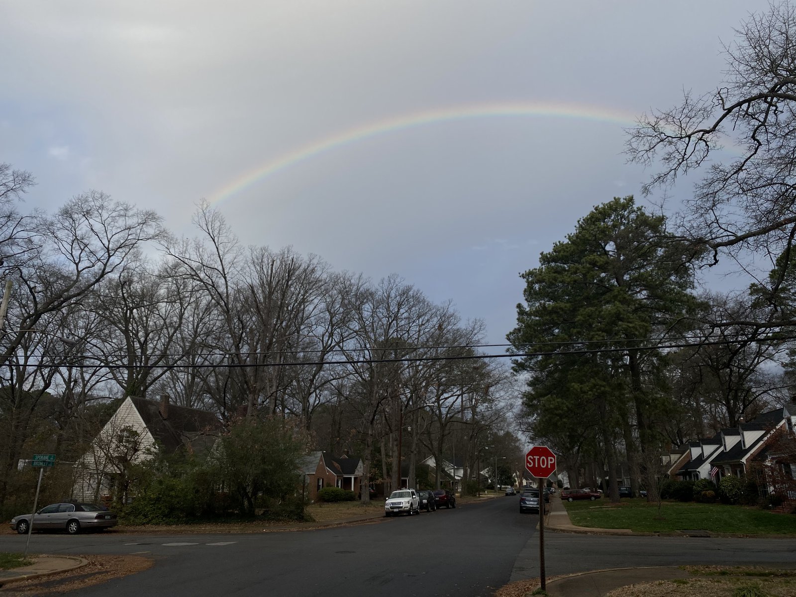
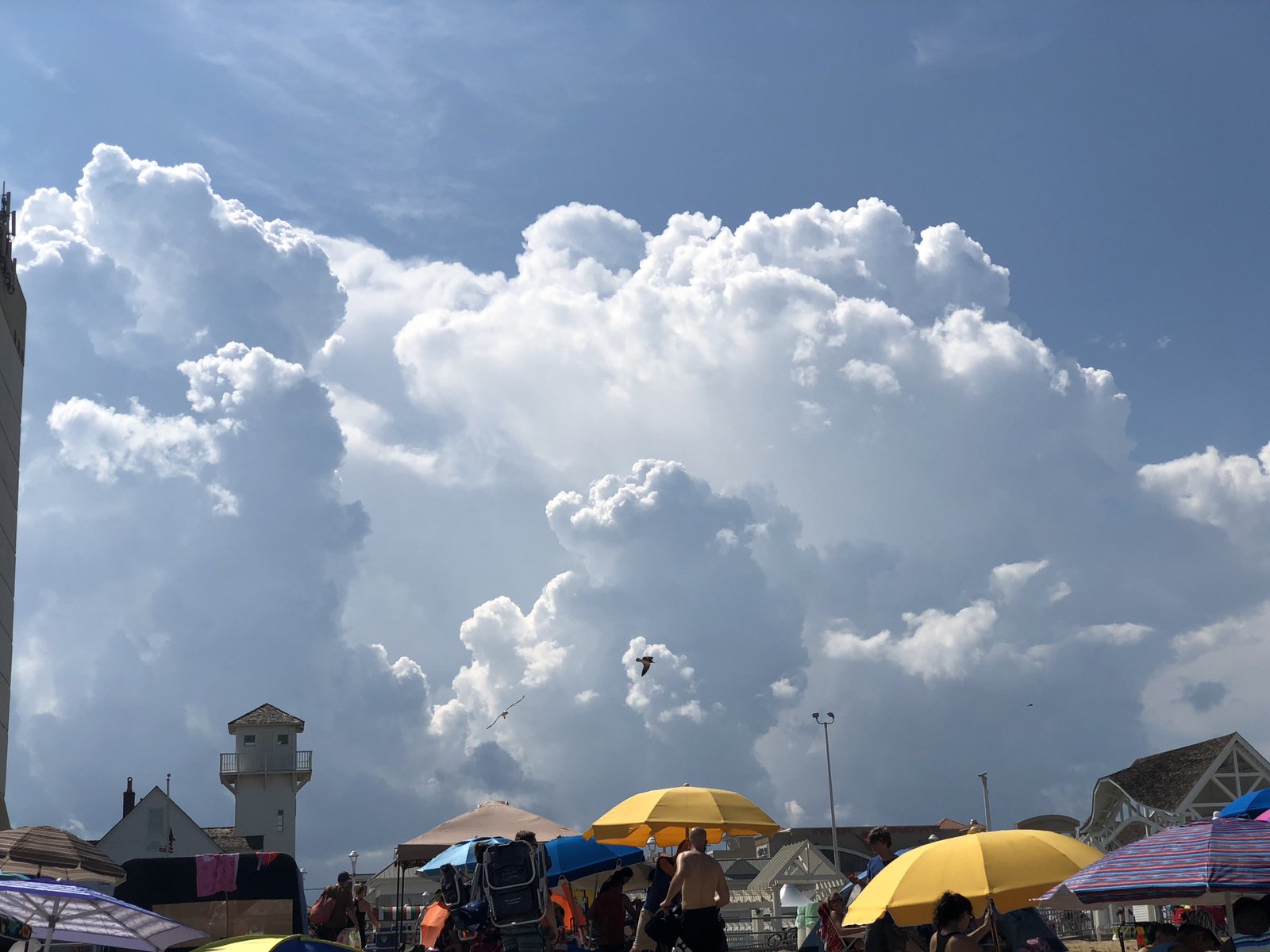
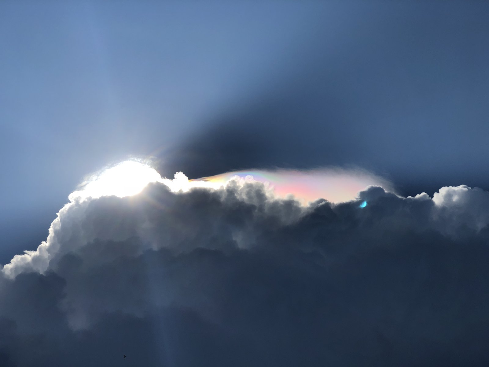
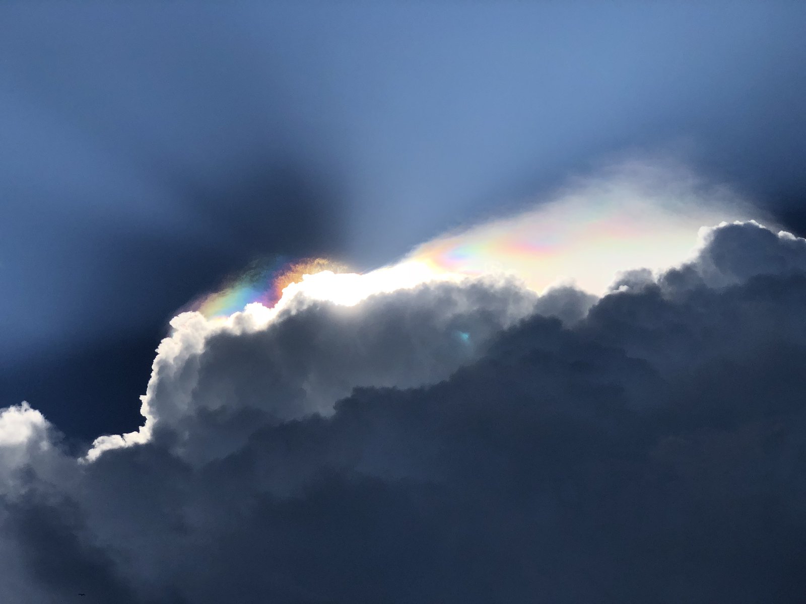
Another storm, another 🌈
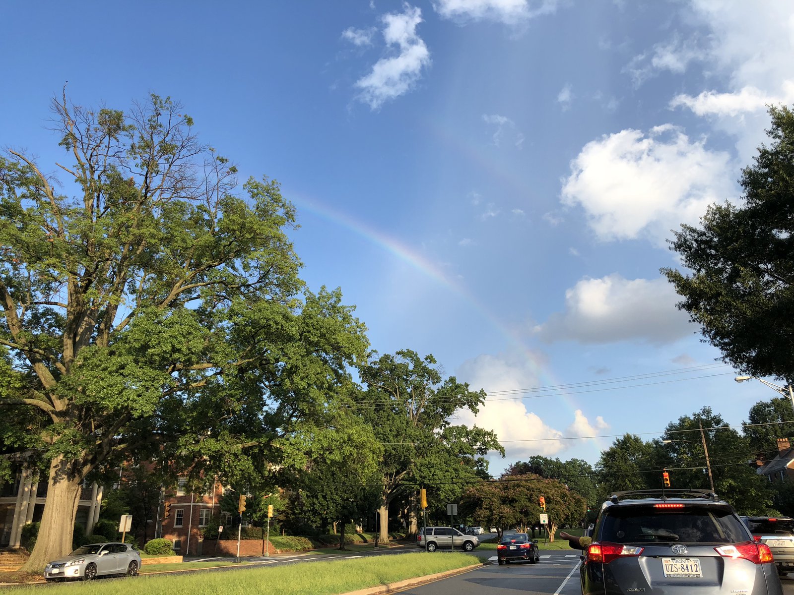
Rainbow clouds over Virginia Beach
We took a day trip out to Virginia Beach, our first trip to the sand this year. I’ve never seen a beach so densely packed with people. We walked north along the water for about a mile and when we turned back these awesome cumulus clouds had grown up out of nowhere. By the time we got back where we started the lifeguards had called everyone out of the water and off the beach, and the clouds had gotten loud. The leading edge of one of the bigger cus had a rainbow in the mist, the first time I’ve ever seen that. We got beer and tacos and waited for the rain, but it never showed. We were greeted by another big pop-up storm over Richmond when we got home, and it brought its friends.


Triple-crossing?

Into the distance
My everything is wet
Big Meadows

Moonlight bike ride
707 HP
Fort Point at dusk

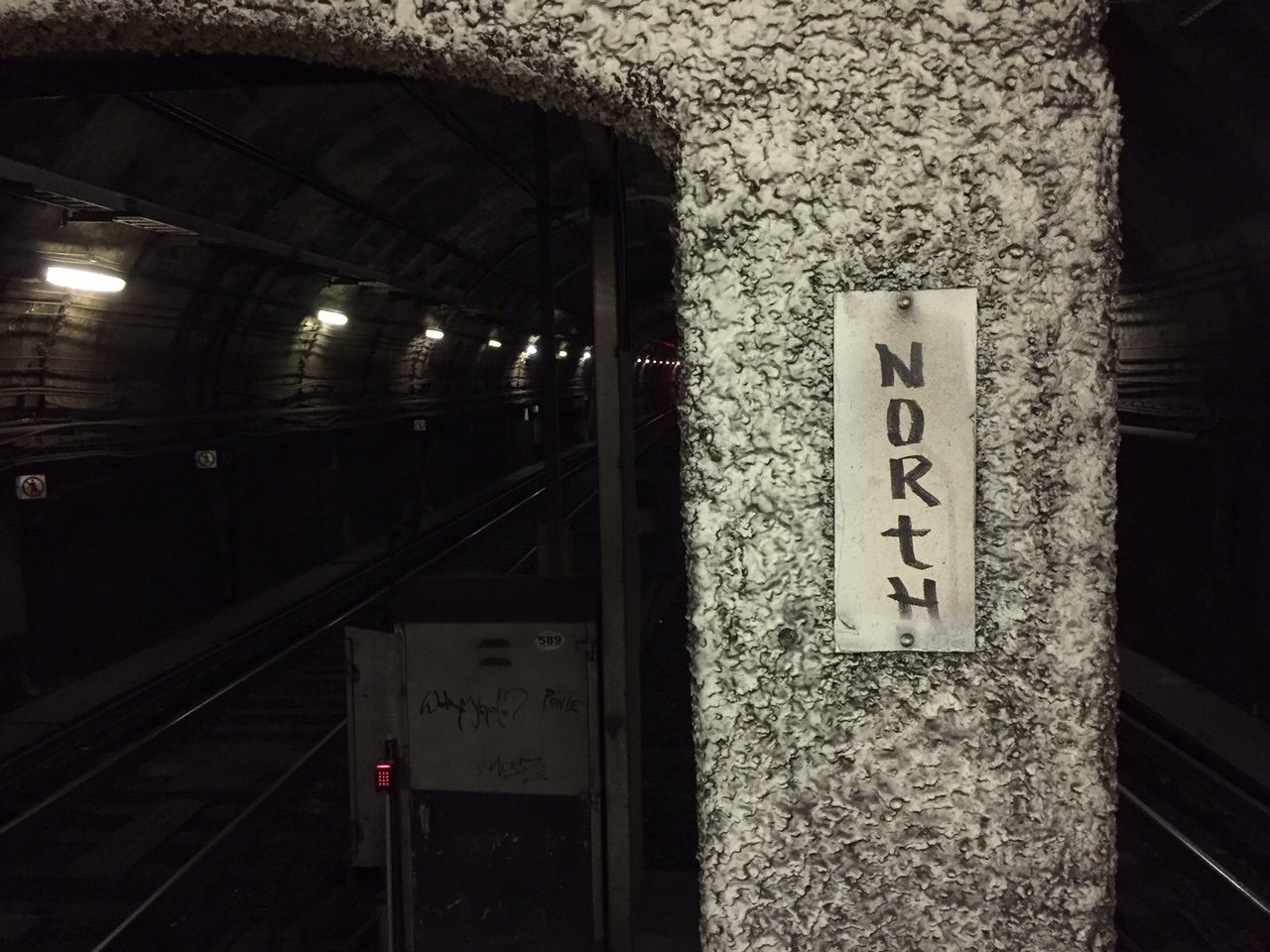
North
Racing in the rain
The hounds
Iceland waterfall

summer2018
One more to go!
Kansas blows
Today was just about pounding out miles. About 850 of them today. And a big chunk was at 95° with a 20mph crosswind, across most of Kansas. I’m beat! No photos because it’s hard to get a picture of wind and heat.
🦕 Nat’l Monument: The Canyons
I’d received a few recommendations to check out the non-fossil part of the monument, particularly Yampa Bench Road, which runs about 50 miles east from the Utah border and apparently has amazing views down into the Yampa River. I had some trepidations about getting that far off the beaten path, somewhat bolstered by conversations with some other riders and a ranger. Ultimately I just didn’t have time: the quarry took a bit longer than expected (the theme for this trip, apparently) and I needed to start heading East and home. I did go down the tight, switchback-y Echo Park Road and into Echo Park proper, where the Green and Yampa rivers come together at Steamboat Rock. The water was fairly low (the drought out here is no joke), but I was able to wade out onto the rocks and listen to the river gurgle. It was so peaceful. There’s a primitive campground down there, and if I’d planned better I would have loved to stay there for at least a night. Next time. There are also some petroglyphs on one of the walls; a photo in this post will show them if you zoom in.
🌈🌈!!
🦕 Nat’l Monument: The Quarry
Hard to believe today was my last day of touring. I started off with an obscenely large breakfast from Bettie’s in Vernal. It’s an old-school greasy spoon that’s mostly populated by locals at 7:30am. I’m pretty sure the “slice” of ham I got was a pound.
One of the neat things about Vernal is all of the potted and hanging flowers. They line the streets, hanging from nearly every streetlight and lamp post, and overflow the planters on the sidewalk to the point that you have to turn sideways to get past some of them. They’re a beautiful hazard.
From Vernal I headed to the quarry area of Dinosaur National Monument. It’s a pretty (and chilly) ride, once away from the city, but there was a ton of smoke in the air from the wildfires, in particular from the Pole Creek Fire I rode past last week.
I am something of a 🦕 enthusiast (I’ve got a post dedicated to them coming up), but facts and figures don’t really stick with me when it comes to geology and paleontology. They were big, and they died a long time ago. But the (more recent) history of the quarry is interesting to me in that they started digging over a century ago, and Earl Douglass (the paleontologist who made the discovery of all the fossils) envisioned a place where people could come see them “in the wild”. And that’s what the Wall of Bones exhibit is all about: it’s a 25ish-foot-tall section of quarry wall that appears as though digging were interrupted, leaving dozens of fossils exposed to view. It’s really something to see.
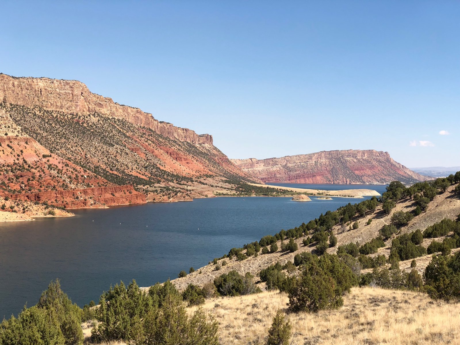
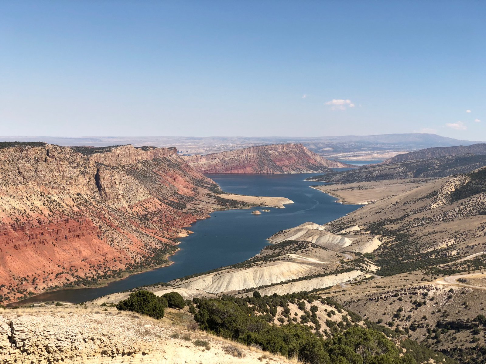
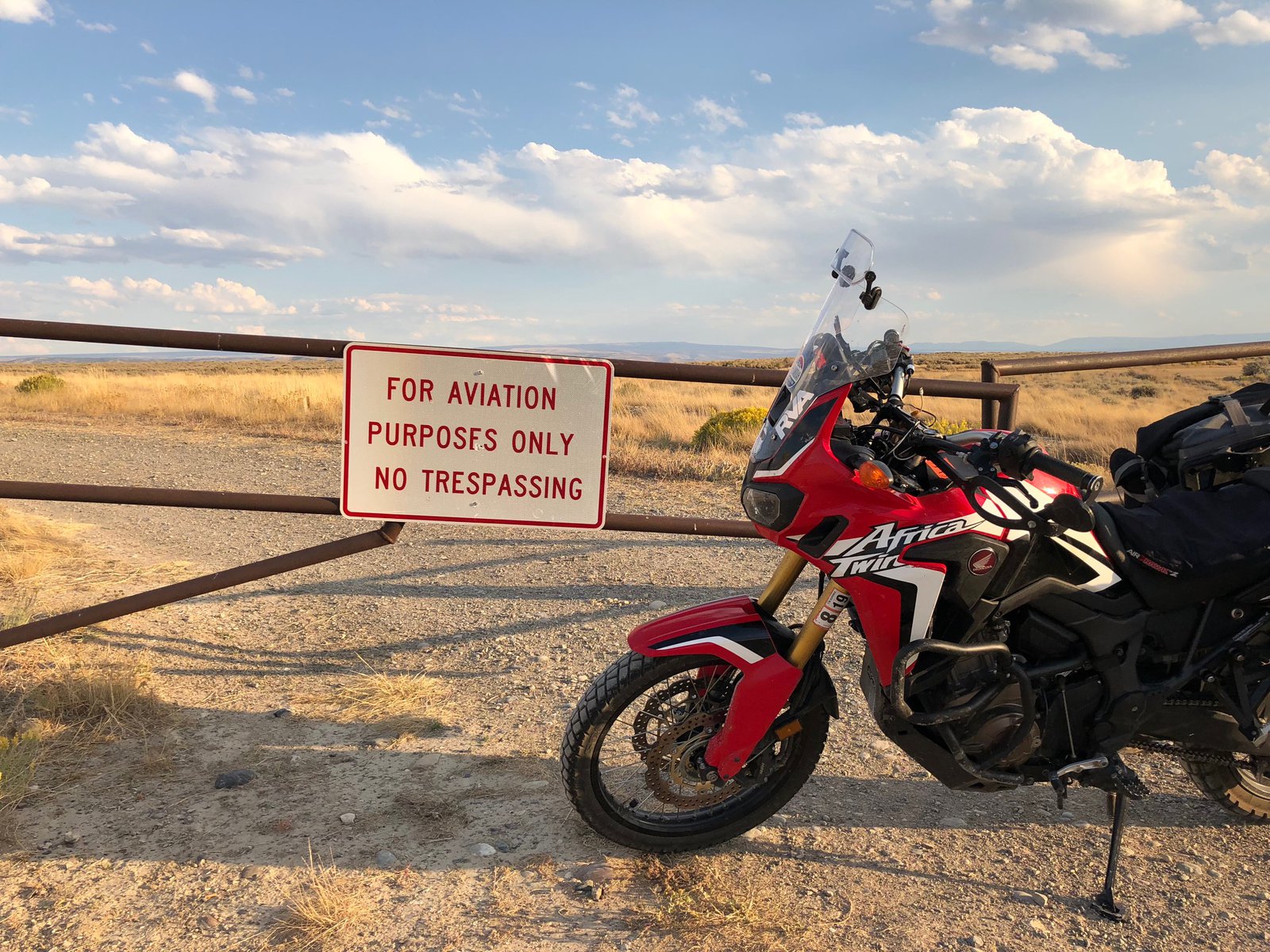
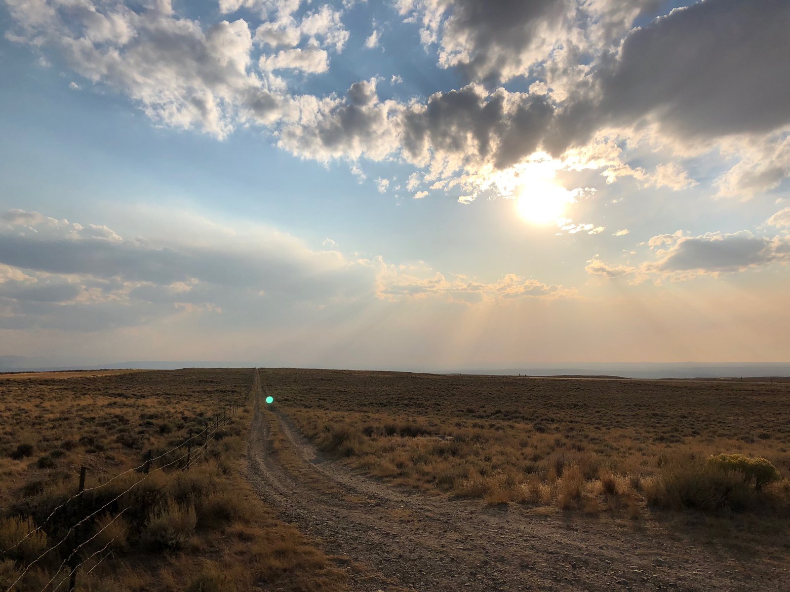
Flaming Gorge: WY & UT
Today was fairly short, only about 5 hours, from Rock Springs, WY to Vernal, UT through Flaming Gorge. I was fairly unimpressed (or jaded, if you will) for the first 45 minutes down 530 toward Manila: the landscape is postcard Wyoming, big and flat with hints of awesome, but always in the distance. Then the road starts to drop into the canyons and it’s awe-inspiring. But that’s pretty much when I entered Utah. See yesterday’s commentary on the scenery changing at the state lines.
The Green River is dammed behind the Flaming Gorge Dam and I’m guessing the signs of the drought are further upstream because the river looked full and high and healthy all the way to the dam. I tried to find some promising overlooks using a topo map before I left and I mostly succeeded. The winner was Red Canyon Overlook, which is completely innocuous from Rt 44: you’d never know what a view you could have without that research because the signs say nothing of it, even though there’s a seasonal visitor center there. The bummer was a dirt track I took, marked by a sign for the landfill, that turned sandy about a mile from the main road. It wasn’t long before I wiped out and ended up with the bike on top of my right ankle. Have I mentioned how much I live my Sidi Adventure 2 boots? They squeak, but they’re tough. I extricated myself by removing one of the bags, stood the bike back up, dropped both saddle bags on the side of the trail and kept going. Then the sand got deep and I bailed, frustrated. I really need to build some skill on a smaller (or at least lighter) bike.
The rest of the ride was easy, twisty and scenic, without much traffic. I’d hoped for a tour of the dam, but their elevator was broken. They were still doing walking tours along the tip filled with “fun facts”, but I mostly wanted to ogle the machinery. Facts don’t really stick with me.
I’m now in Vernal, UT, which has a fantastic 🦕-kitsch quotient: they’ll get their own post. I’m staying at an Airbnb tonight because I really am pooped and wanted a good meal (hard to find in Wendover) and a beer. Tomorrow I’ll explore Dinosaur National Monument and start making my way toward Denver, preparing for the long blast back home.
Wyoming
I’m staying in Rock Springs, WY tonight. It was an uneventful — if windy — ride from Wendover. I’m always fascinated when I see the landscape change around state lines. Even without seeing the border on the map I knew I was approaching Wyoming as the terrain changed from red mesas and desert to rocky buttes and huge sweeping vistas. The fires in Utah (I’m presuming mostly the Pole Creek Fire I saw last week, which continues to grow) are sending smoke over 150 miles to this area. It’s making for some beautiful skies, but at a cost.
I was disappointed that the Greater Green River Intergalactic Spaceport doesn’t have a sign.
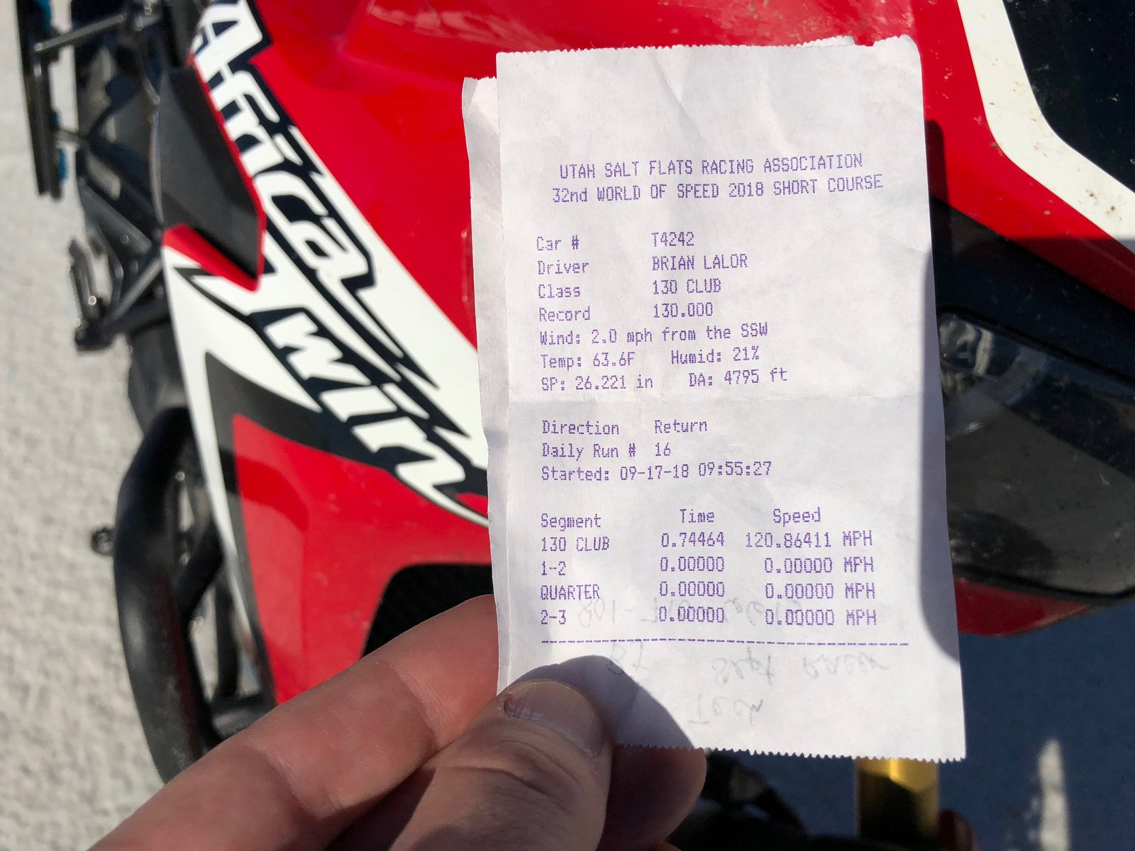
The last day on the salt
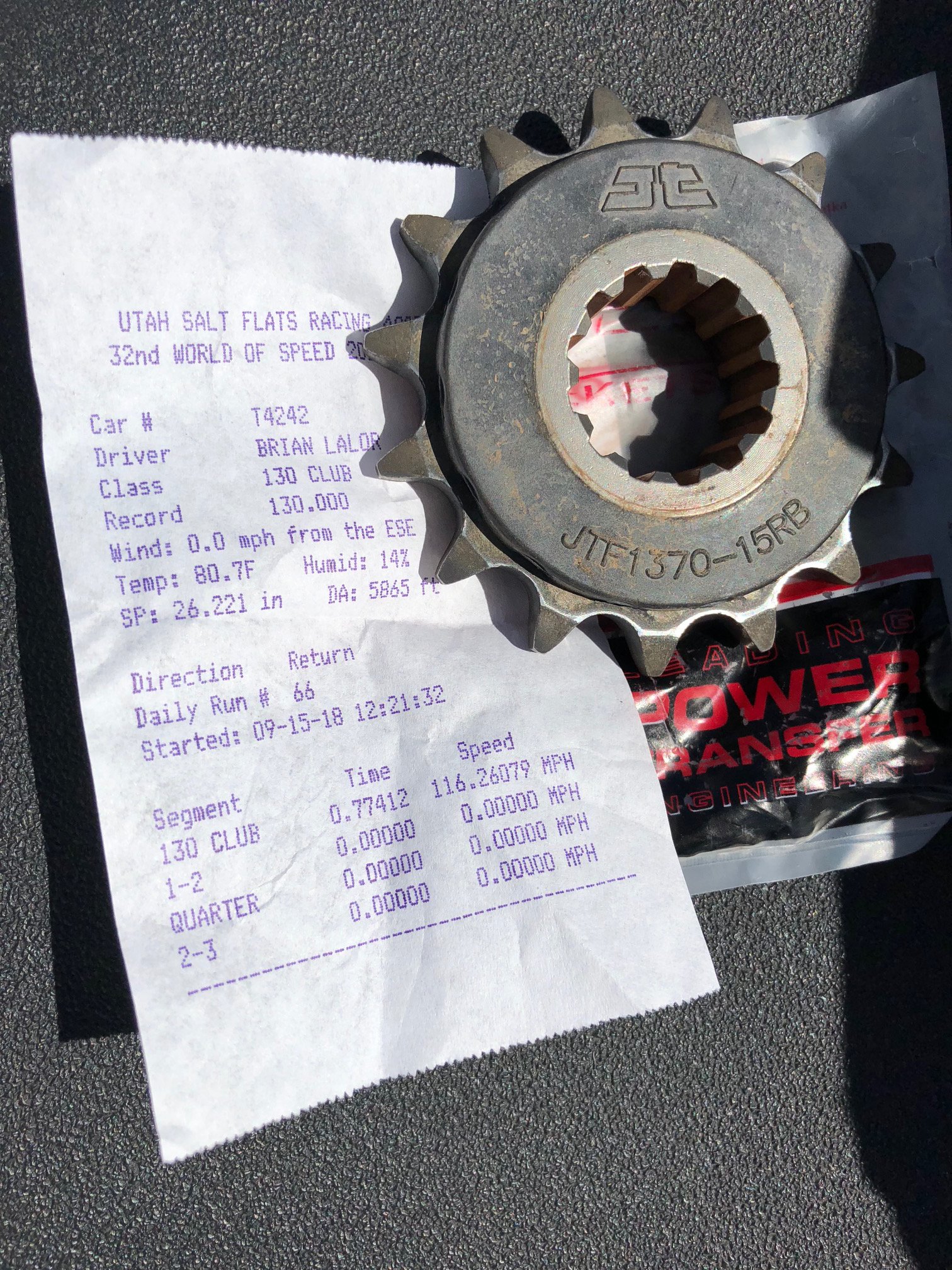
All good things must come to an end, or do they say. Today was a short one at Bonneville, with racing wrapping up around noon. I got there at 7:30 with the hope of knocking out my two remaining runs quickly, but the LSR folks (Land Speed Racing, as opposed to the less stringent club folks such as myself) took priority. I finally got to run about 9:30, but the timing lights malfunctioned (something the staff was struggling with a bit this year) and my pass didn’t register. But aside from getting a do-over I know from my GPS that I was 1mph faster than the misfired one. My final two passes were at 120.86411 and 120.85874, and I think that’s really all she’ll do!
It took me a little while to return the bike to non-racing trim. By the time I boxed up my leathers (thanks Dave and Stephanie), put the regular sprocket back on (thanks Vacationing Overlander Québécois Guy for the ratchet), reattached the mirrors and windscreen, and loaded all my gear back on, it was about 12:30. I went back into Wendover to get gas, a bite to eat, and grab a picture of Wendover Will. As I was leaving Will behind I saw the Citation X11 on a trailer and turned around to talk to the owner: he improved his best speed from 139 to 145, pretty good for a nearly 40-year-old econobox.
Among the pictures here you should be able to see the abandoned passenger seat, a sure sign that the owner of the car (a VW R32, I think) was serious about getting that last 0.25mph. You can also see the last car on the start line of the short course, a 2-stroke Saab Sonnet that sounded mean and looked properly fast.
That’s it for World of Speed 2018. I’m really looking forward to going back next year, with at least one different bike. 😁
Time to head back East
It’s almost over
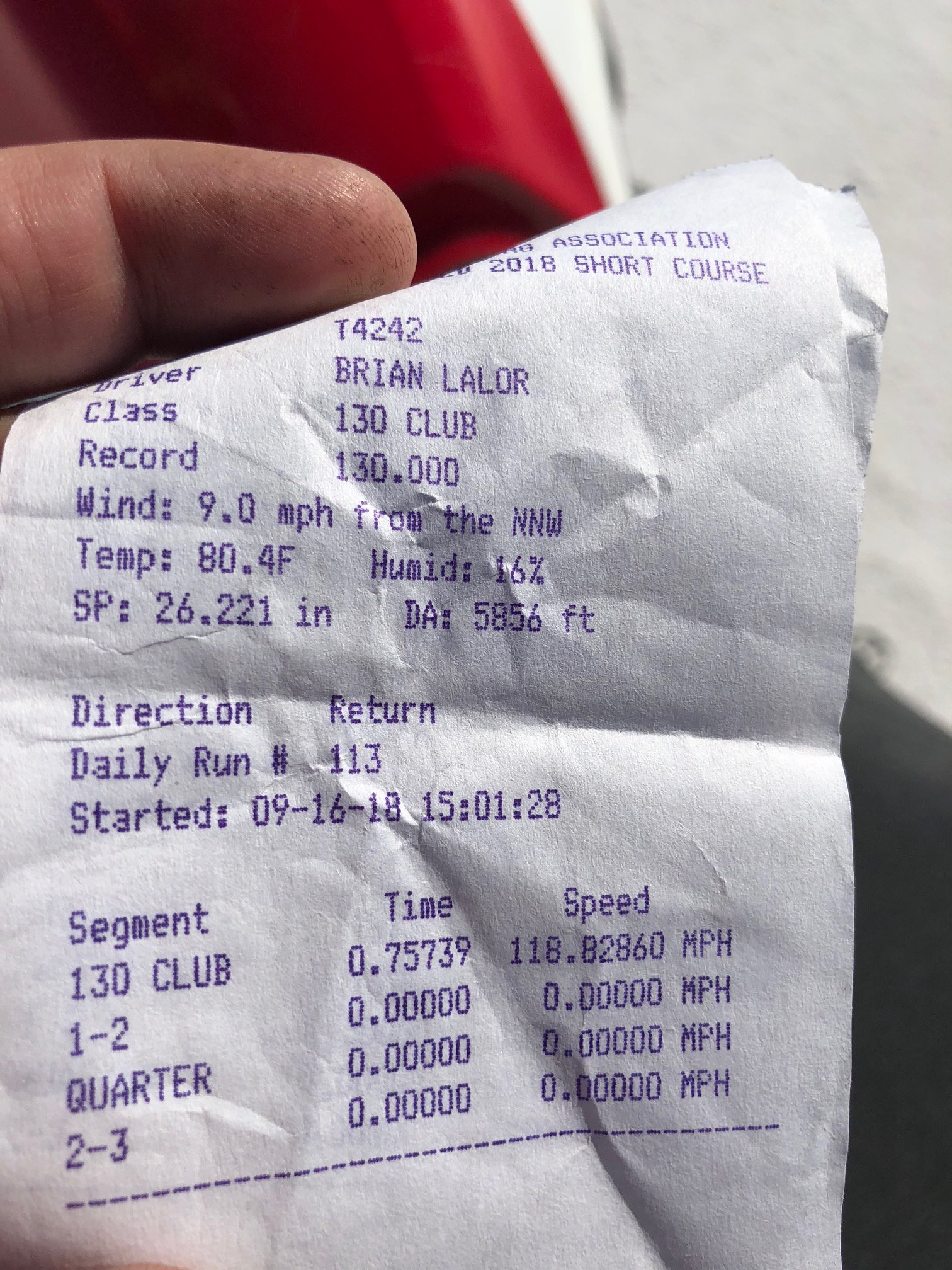
Today was the last full day of racing. The line for the 130 club was longer than any other: that’s great for the organization, and a little frustrating for those of us in it (it took 3+ hours to get in each of my two runs). But I spent the downtime chatting with my fellow racers, and they’re a fun bunch.
My first run today was 118.7mph with zero wind, a touch faster than yesterday. I removed the wind deflectors for the hand guards and the top box. With all the time I had before the next one I swapped to a -1 tooth sprocket and removed the windscreen. The result: 118.8. But there was a 9mph headwind. The bike definitely pulled harder all the way through 5th gear and into 6th.
I have two runs left tomorrow and my plan is to be on the salt at 7:30am to make them count. Racing is done at noon, however, and I need to start heading back East.
Thanks to Reia for the photo; to Jonathan, JJ, Augie, Jimmy, Carlos, Sam, Steph, and Dave for keeping me entertained; and to the folks from San Jose BMW for the tool loan.
As aerodynamic as a closet
I only got one run in today before racing was put on hold due to the wind (and I suspect it’s done for the day). My GPS and the timing slip agree, which is nice. I was at 117 in 5th gear but not accelerating much, and lost 1mph after shifting into 6th. I have a few bits to remove to try to make the closet — I mean bike — a little more sleek. And I have a -1 tooth front sprocket that I’ll put on to attempt to make 6th usable, but I really don’t think anything will make up that 13mph difference. That’s ok, though. It’s still something to have gotten it out there, and the reactions have been awesome.
double take “Wait, you’re racing that?”
Yeah, I rode it from Virginia.
double take “Virginia?!”
Let’s go racing! 🏍💨
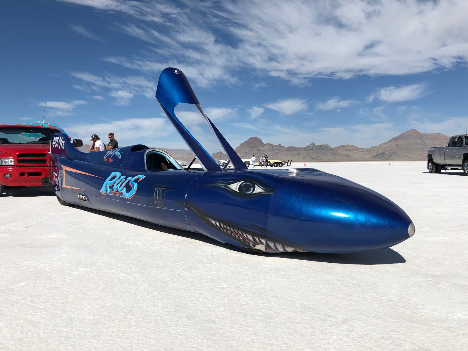
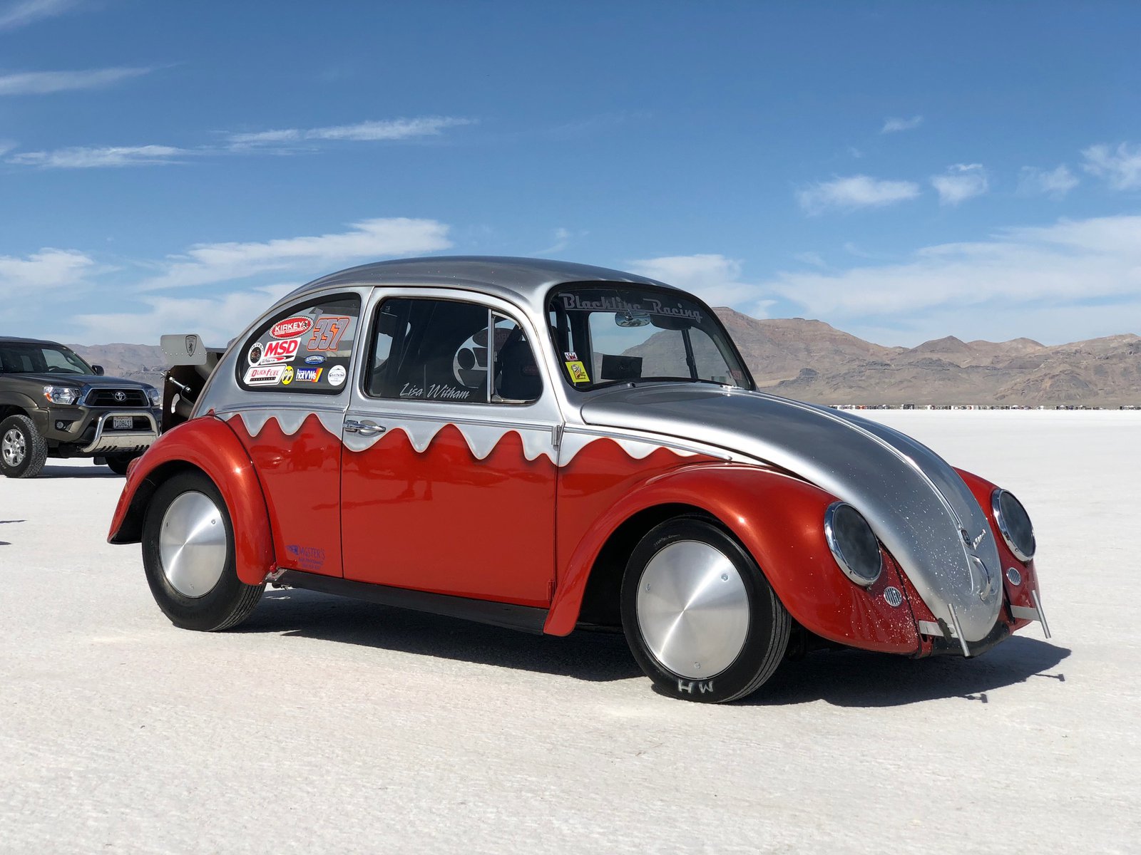
A few from the salt today
Great turnout today, but it was hot hot hot!
On the salt!
Pole Creek Fire
My route today took me up routes 191 and 6 through Price, Helper, and into Spanish Fork. The Pole Creek Fire started a week ago from a lightning strike and is only 2% contained and is about 20,000 acres. The theme for the day was 💨💨💨 and more 💨; the fire crews have their work cut out for them.
Desperado 🦕
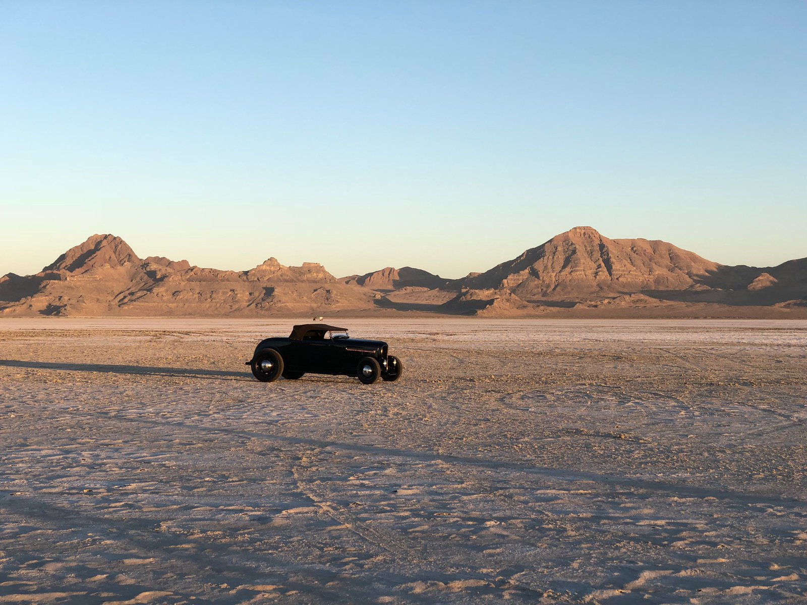
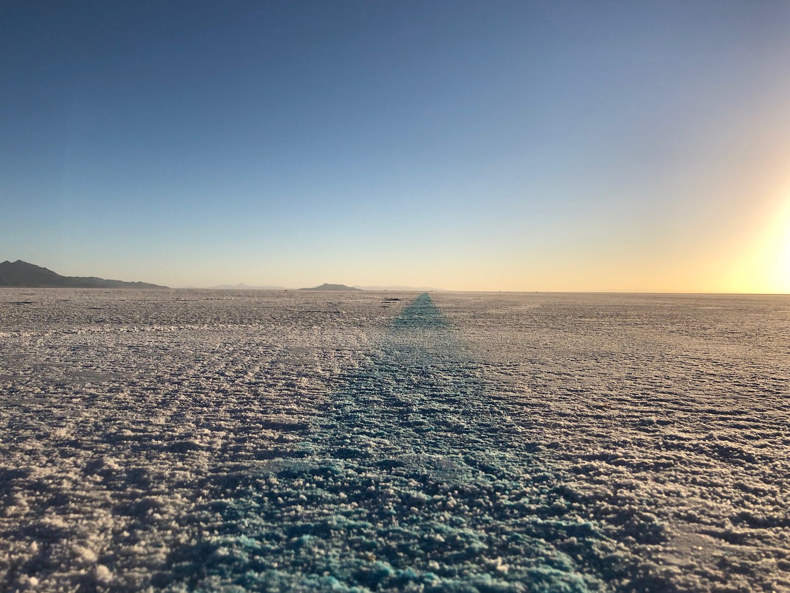
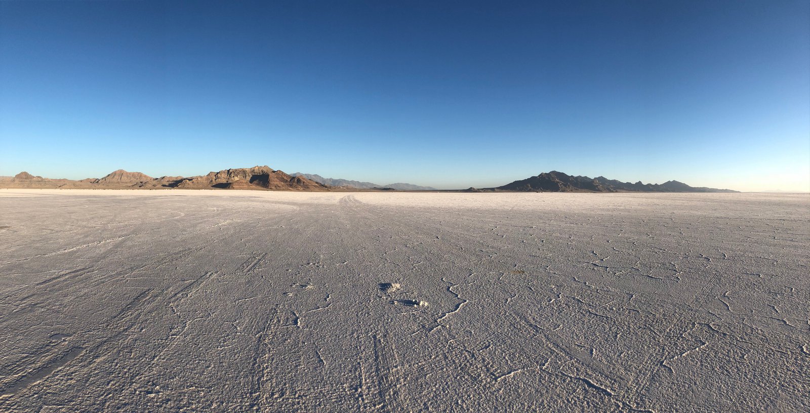
Big skies in Utah
I know it’s right in the name, but the Bonneville Salt Flats make Kansas feel hilly. This was the first time my throttle lock would actually hold a speed (no cruise control; this widget just clamps to the throttle tube and rests on the brake lever).
Anyway, not long after the sun finished blinding me it made for a very pretty sunset, and the pattern in the clouds stretched so far across the sky I really couldn’t see the whole thing at once. This part of Utah is just so wide open and vast.
Made it!
I almost skipped the speedway tonight. It’d been a long, hot day, and I have been looking forward to a bed, shower, and air conditioning for most of it. But I couldn’t resist.
Thanks to Lori working security for not just letting me get to the sign, but for taking this otherwise-woulda-been-a-selfie.
Still going!
Long day yesterday and no service in Black Canyon National Park where I camped last night. Today’s destination is Wendover, UT and the Bonneville salt flats (and a bed, and a shower). There is SO MUCH more to see in Colorado, another trip is warranted. But I’m afraid today will be mostly interstate. The altitude, dry air, and high temps (plus 5 straight days in the saddle) are taking their toll.
My ☕️ tastes like 🐔, and other joys of ⛺️
Bedding down in Gunnison
After all the rugged terrain from the last couple of days it was sort of a shock to pop out into a huge, flat valley south of Jefferson. There is all manner of geography here, and sometimes they run into each other. The flat land continued through Buena Vista (where I removed a layer) and gave way to another mountain pass on 50 west of Salida (where it was cold and wet and I wished for that layer again).
The lodging has been more expensive than I wanted, and I’ve been lugging my camping gear for 2,000 miles, so it was time to sleep under the stars. Freecampsites.net turned up Hartman Rocks recreation area, a BLM-managed area mostly for mountain bikers, but it seems pretty much anything goes. There are a few dozen primitive campsites here, and mine is on a ridge overlooking the valley to the east. I’m looking forward to the sunrise.
A few random shots
Coming out into the valley in Buena Vista; rain shrouding Guanella Pass; beautiful silvery water in a creek along Guanella Pass Road.
I’m trying to balance some technical limitations to how I’m posting these photos with making the trip at all interesting to anyone other than me. Not sure if it’s working. But hey! More photos!
Guanella Pass
After Mt Evans I headed back down into Idaho Springs and jumped over to Georgetown via I-70. I must have loaded the bike poorly today because the front end was really unsteady: it followed every rut, seam, and tar snake. I had a bit of that on the first 800mi day to St Louis, but it was better after moving a few heavy things lower from the seat bag to the saddle bags. Wind doesn’t help, either, and today was GUS-TY. It didn’t feel unsafe, but wasn’t comfortable, either.
Anyway, from Georgetown I took Guanella Pass Rd south to 285. I’d never heard of the pass or the road (great job I did with all that research, right?) but it went in the right direction and looked properly twisty and mountain-y. I’d waved to a couple on a Tiger and we passed each other when stopping to take photos. I pulled up next to them at the summit and we chatted bikes for quite a while. Then another couple guys - one on a Harley and the other on an F650 - joined us. The AT gets a lot of attention, which kind of surprises me, but I do like it. It probably helps that it’s obviously not been pampered. The pillion rider took the photo of me, after being coached on composition by Mr F650, who is “in media” per the Harley dude. It was a fun impromptu biker gathering, and not the first of the trip. It seems we like talking bikes as much as riding them.
I must have put on and taken off my down jacket 6 times today and each time I was at the perfect temperature until I wasn’t. I saw low 80s and upper 50s, bright sun and rain. Usually the rain accompanied the colder temps, of course.
Mt. Evans
A co-worker suggested I visit Evans, which I hadn’t even heard of before. It has North America’s highest auto road at 14,000’ and change. Unfortunately it closed for the season just a few days ago and you can now “only” get up to 12,800 at Summit Lake. It’s still a breathtaking view, and not a little windy and cold. There was a small herd of wild goats wandering around, completely unperturbed by the people. A ranger was walking around telling people to stay 30+’ back from them, but the goats made that hard. I wonder if they knew the power they possessed.
Roadside oddities
The adventure has begun
I got a bit of a wake-up call today. I heard about St. Mary’s Glacier from Joe at Woody’s, and I’d decided to stay in Idaho Springs already, so with an extra hour to kill it seemed natural to pay it a visit. I followed my GPS out of Denver, past Red Rocks, up Rt. 74 through Evergreen, and through the densest concentration of casinos I’ve seen this side of Vegas, in Central City (right near Nevadaville; how ironic). Once past the casinos you pass through what looks like the old town, and then suddenly the road turns to dirt, and shortly later it’s a rutted sandy ATV trail. But hey, I’m on an ADV bike with fresh ADV tires! Let’s adventure already! The trail got pretty rocky, and then abruptly turned into a mini hill-climb with some pretty big obstacles. I’m … not very good off-road, and the bike’s got the scars to prove it. I got almost to the top and faltered negotiating around a boulder and toppled over. The AT is probably 600lbs or more with all the bags and fuel: once it starts going, there’s not much I can do to stop it. This time it was leaning uphill and pretty easy to right; I got moving again and popped out into a clearing with some nicely maintained dirt roads. Easy. Let’s keep going.
From there the GPS suggested a closed trail, and the next alternative turned out to be a rough, rocky, sandy track with lots of exposed mountain poking out: Woodpecker Gulch, which becomes Hamlin Gulch. The skid plate earned its keep. About ¾ths of a mile later the trail forked and I went right, but found a gate a short while later, near a hunting cabin with a couple of early-90s cars abandoned in the yard. I was on private land. I turned around (awkwardly), hoped I hadn’t heard a shotgun being loaded, and went back the way I came. The turn to the other branch of the track was sharp, downhill, and very loose, so I retraced my path to where I could turn around (again). This time was more awkward and I dropped the bike on the left side, downhill. After a couple of attempts I got it back up after taking two of the bags off and swinging it around on the crash bars. (A Harley guy tried to tell me they were “engine bars” the other day, but I explained that my term was intentional and correct.) Now pointed in the right direction, I took the left track for maybe another half mile and found an old rock slide that looked waaay too sketchy to get over solo, even without the luggage. With a spotter or two, no problem. But not on my own. So another awkward (and somewhat precarious) turnaround commenced, this time without the luggage, and making sure I didn’t accidentally lose the bike down the hillside: the path wasn’t much wider than the bike is long. Once again pointed the other way and the bags reattached, I’m hot, sweaty, a little shaky from exertion at 10,000’, and just about out of water. And it’s about two hours from sunset. Shit.
I rode back up to my nemesis, the fork in the road, put the kickstand down and had a think. The route back the way I came is not fun: lots of exposed, rutted, broken rock without a good line through it. Go too slow and it’s easy to stop or stall, and the footing can be hard, tempting another 0mph topple. Take a bad line with some momentum and, well, that’s a steep downhill on the right. I’m tired. And there’s not a soul around. It’s beautiful, though! I decided to walk back to the cabin next to the gate, hoping I might be able to find (a) water and (b) someone to suggest a route, or provide an escort. I found neither. The gate, however, was not locked, and had a sign saying to close it after going through. The map showed the route past the gate joined up with the route with the rock slide, which didn’t feel super encouraging.
Walking back to the bike I realized that I was less than a mile from the easy road I’d seen before, so not that far. Just that technical rocky stuff to tackle. Another look at the map showed some houses not far from where I wanted to be. It wasn’t as remote as it felt. Time to channel my inner Lyndon Poskitt: pin it. 👊✊ The ascent wasn’t pretty to anybody with a touch more skill than I possess, but it worked, with only a couple pucker moments. Back at the top I still wasn’t sure where to go, but down seemed reasonable, and around the next bend the road became the most well-maintained dirt road I’d ever seen. Figures. Oh, and that “don’t trust your gps sign”? It was at the other end of Hamlin Gulch, about 1,000’ from my last turnaround (and 400’ down).
So, what’d I learn? Carry more water than I think I’ll need (which is usually far more than I actually drink); I’ll be keeping my extra camelbak filled for the rest of this trip. Situational awareness is important, too: the roads (and “roads”) change quickly around here, and things get remote pretty quick. It might not be easy to get back out the same route I took in, so be ready to abort sooner.
I’ll probably keep to the pavement a little more tomorrow, but I can’t wait to keep exploring this beautiful area.
New shoes, and an RVA sighting
Lyndon Poskitt, Eva Hakansson, and now me. But my sponsorship application must have gotten lost in the mail.
Woody’s is a cool place, known (in some circles) for their bomb-proof spoked wheels. But they also mount tires for us plebes. Nice folks, and I was out the door earlier than expected. I’ve now got a new set of V-rated Pirelli MT90s which have already proven themselves in sandy and rocky terrain. But more on that later…
Denver!
I honestly wasn’t sure I could do RVA → Denver in two days. 1600(ish) miles is no joke, especially when punching through a hurricane in the middle of Indiana. (How does that even happen?) Day 2 was a little harder: the wind protection on the AT is not great (it’s more dirt bike than continental tourer), and frankly I was kind of tired from yesterday. Plus all of Kansas was a crosswind. But 14 hours and 850mi after leaving an anonymous St Louis suburb/business park I’m drinking beer in an anonymous strip mall bar in a Denver ‘burb. This part of the trip wasn’t about getting to know the local flora and fauna, it was about getting through the middle of the country to the “good stuff”.
I’d intended to get a photo of every state line, but several of them are inconveniently located on bridges, and then I blew past the Colorado one (ostensibly the most important one). So you get windmills, a motorcycle in a field, and a Mountain Dew sign.
Tomorrow the AT gets some new (V-rated) boots and I’ll figure out my next stop, but bike service will eat up most of the day, so I’ll probably not get very far.
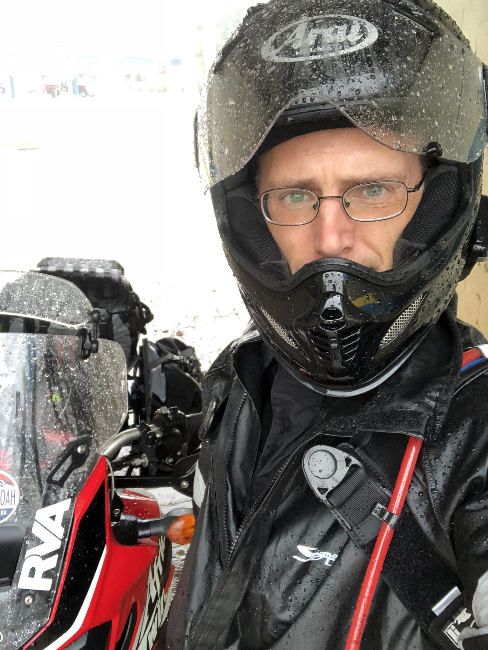
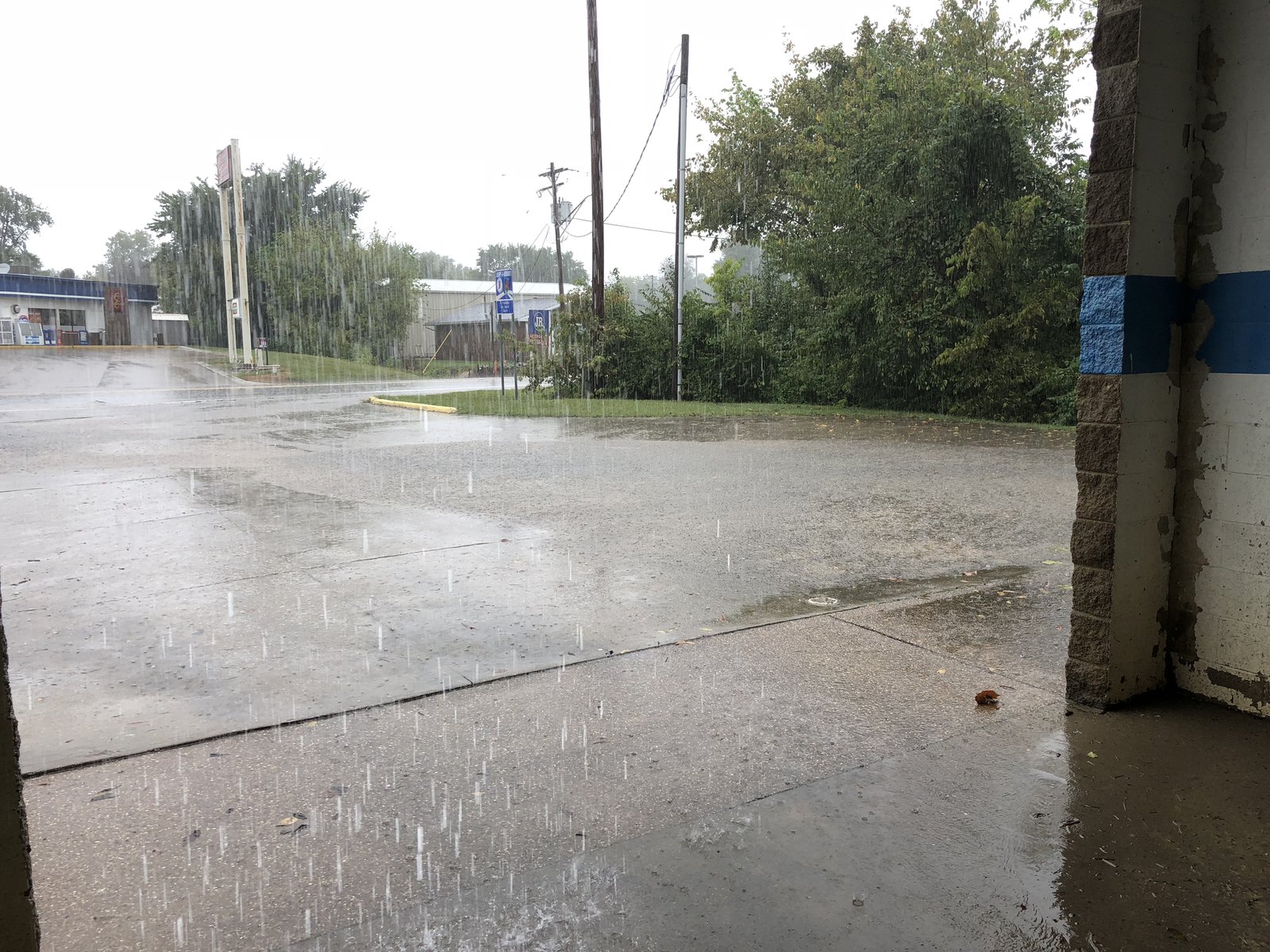
It was a wet one
“Ok, Thanks”. I mean, what else do you do with that? I was making great time until I hit whatever hurricane wandered into southern Indiana. I pulled off in Ferdinand for over an hour when I couldn’t see the highway anymore, and again in Lynnville - about 5 miles further on - when the cell I thought had gone past … hadn’t. At least the rain washed off the Salt-Away I meticulously applied a couple of days ago.
This is the way every great road trip starts
The rain and I are going to become good friends after tomorrow.

summer2019
DIY dinner
When the Red Shoe Pub is unexpectedly closed, you’ve just gotta make do. So far Nova Scotia has been colder, wetter, and windier than expected. Good thing I missed the hurricane!
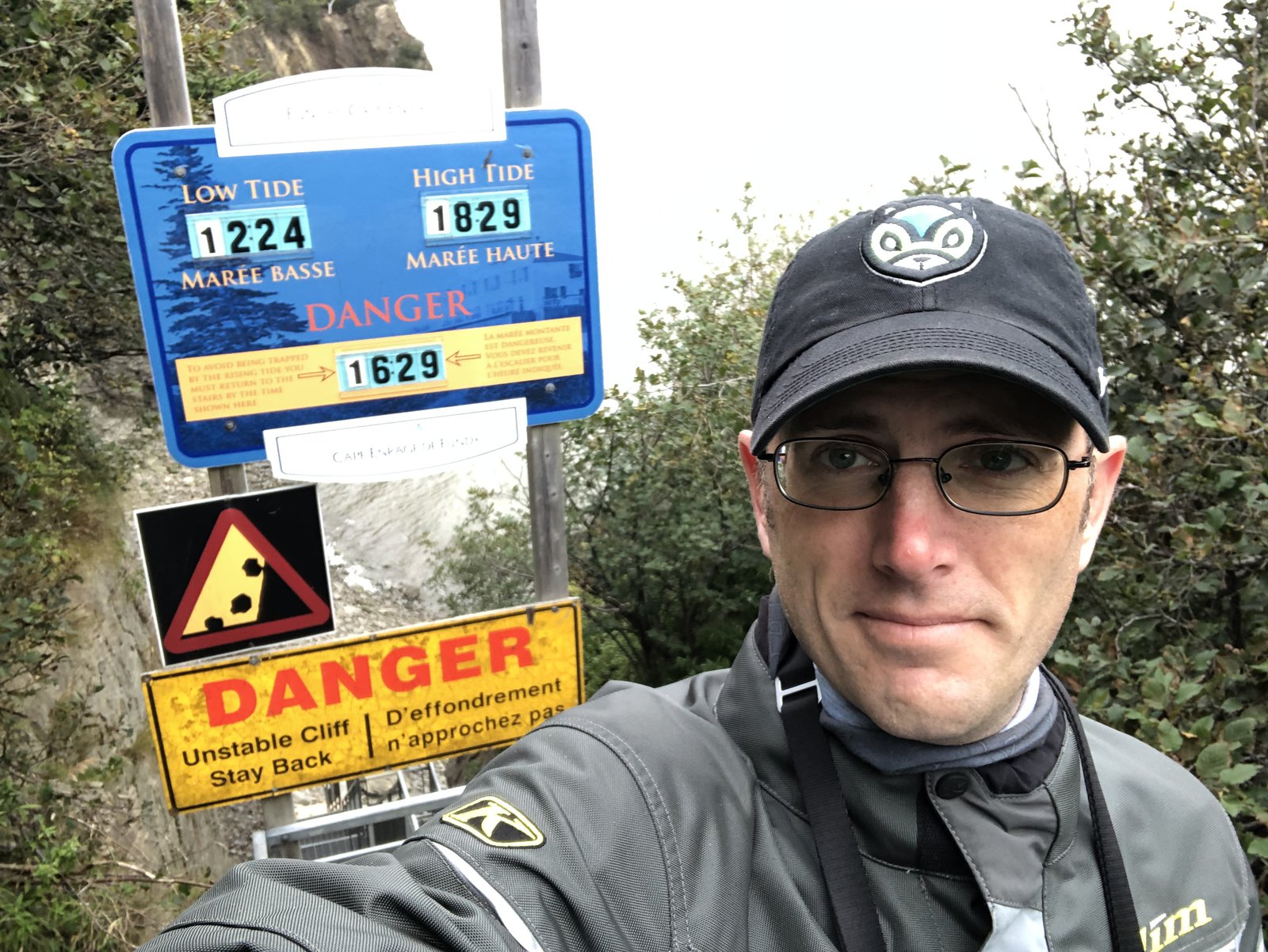
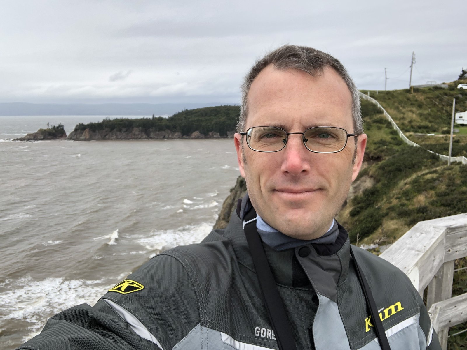
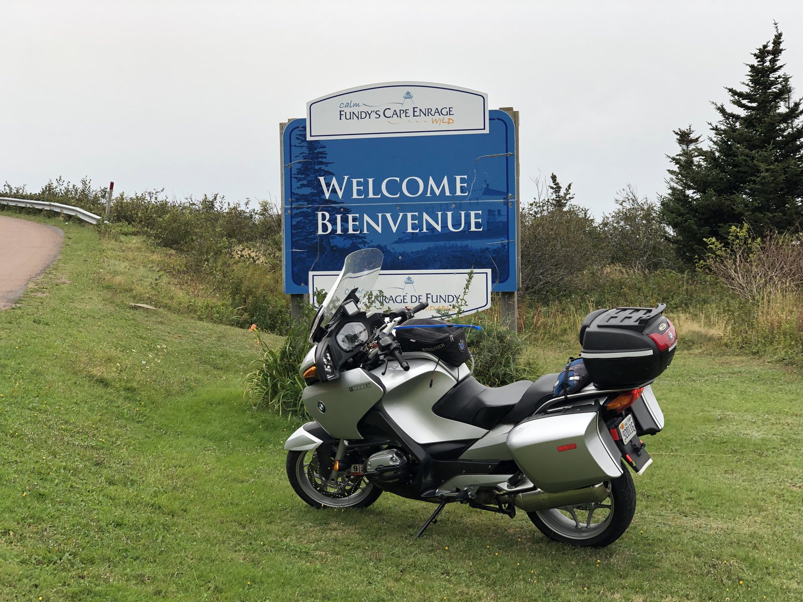
Cape Enrage
I failed at visiting Hopewell Rocks this morning. Arrived too early and then got distracted trying to find breakfast and a cup of coffee. My internal conversion from kilometers to miles seems faulty (maybe from the lack of coffee), or perhaps the signs are misleading, but the side trip got me back to Hopewell at high tide, and that didn’t seem special enough to warrant paying an entry fee. Cape Enrage, on the other hand, was worth the trip. It’s an old lighthouse on the edge of nowhere with strong winds and exposed rocks, and a foghorn that has hearing damage warning signs nearby (I put earplugs in just in case). The photos don’t capture the wind: it was strong and gusty and made sticking to a line on the bike impossible. They’d just opened today after being closed for 4 days due to the storm. I was told the wind was blowing extra strong to make up for lost time.
The Adirondacks to Maine
Up early this morning, made a cup of coffee, packed up camp, and had breakfast at the Tamarack Café in Inlet. More fun roads as I pushed East, but befouled by traffic and (SO MUCH) road construction. Really pretty riding around the lakes and streams of this part of NY. If they finish the construction the roads will be awesome next spring!
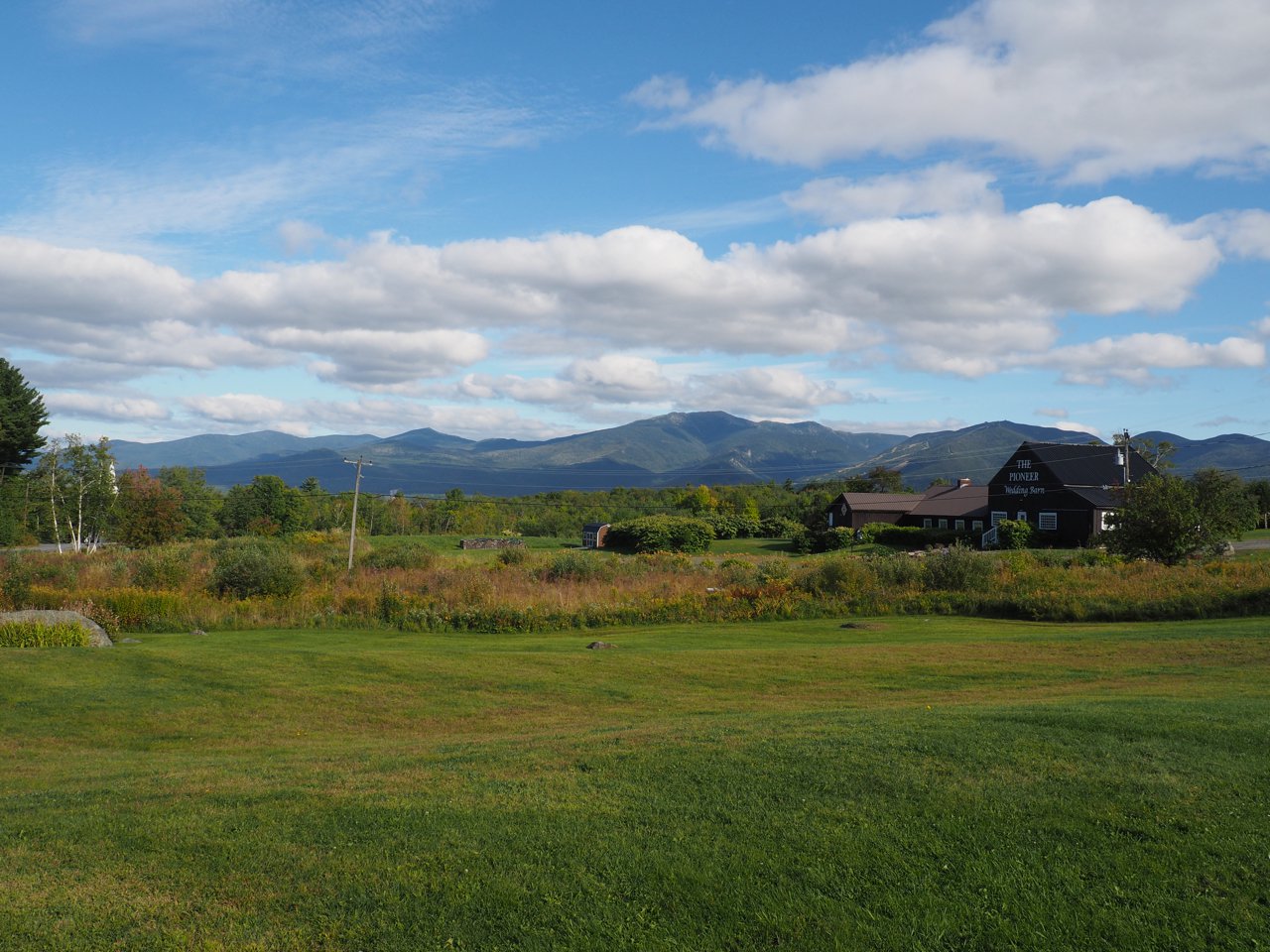
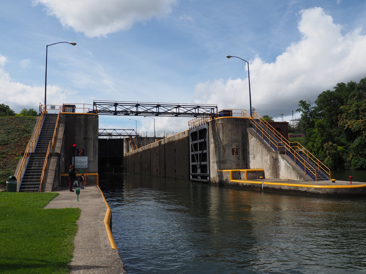
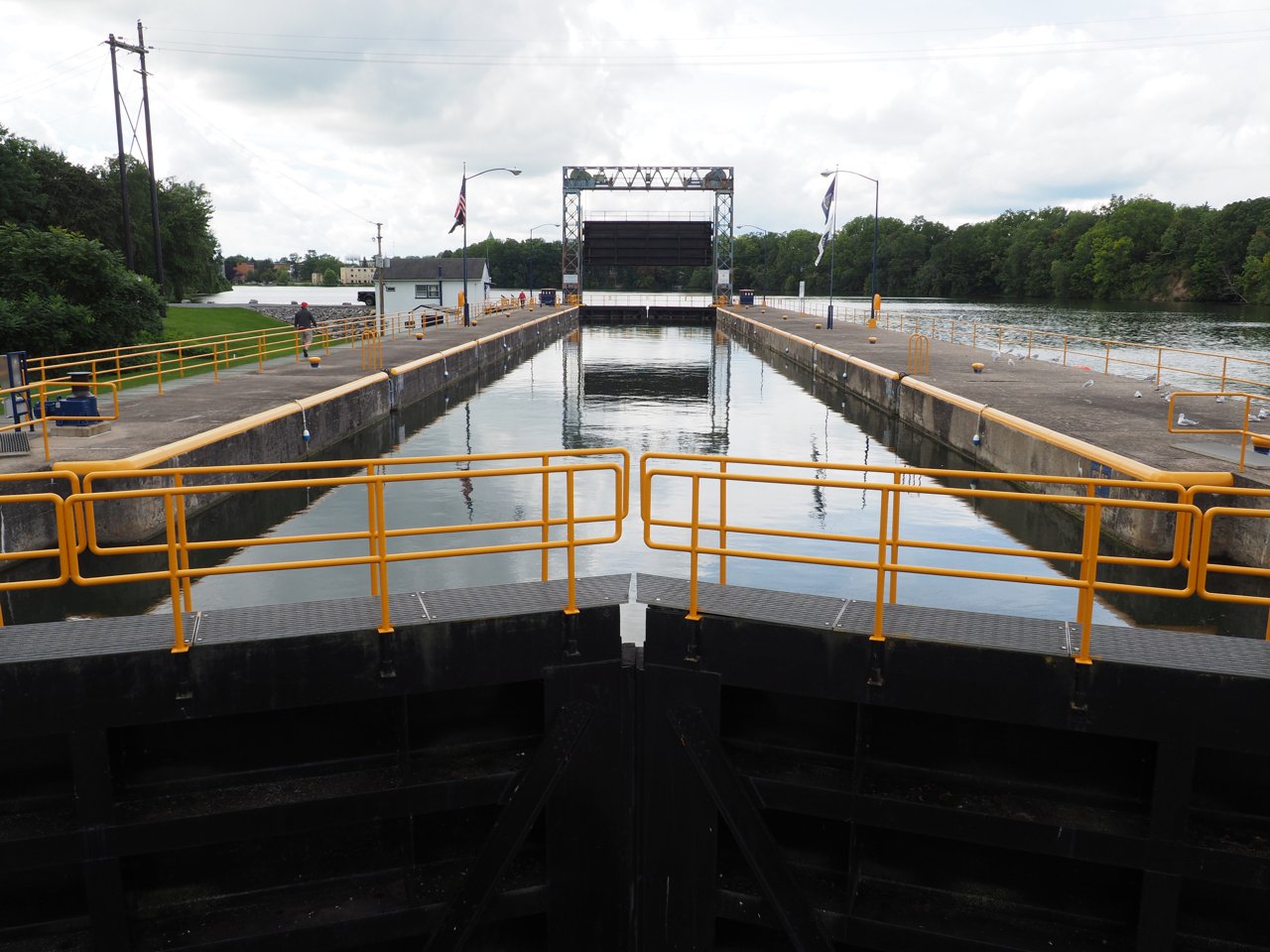
Around noon I got my first ferry of the trip, from Essex, NY to Charlotte, VT, crossing Lake Champlain. A bit cool, but otherwise perfect with blue skies and puffy clouds. Recognizing that I’d packed for far warmer weather I headed toward Burlington to try to get a more appropriate base layer; Dick’s failed me, REI is “coming soon” (Burlington doesn’t have an REI, yet‽), and I quickly tired of the traffic and malls, so I gave up and pointed myself toward Maine again. Typically for me, after taking my time in the morning and early afternoon, I started feeling some (entirely self-supplied) pressure to make more progress, so I hopped on the interstate for a bit toward Barre and then headed for the White Mountains of New Hampshire. I’m generally only vaguely aware of road names and route numbers; once I learn my way around an area I navigate by feel: I was delighted when I realized I was going past some of the old MINIsOnTop haunts, like the Town & Country motel.
I wound my way across NH and Maine, through Augusta, and to my final destination near Rockland to meet MINI friends Blaine and Monica at the amazing Café Miranda. They graciously offered to put me up for the night; it was a long day and this was a great end to it.
Tomorrow: 🇨🇦!
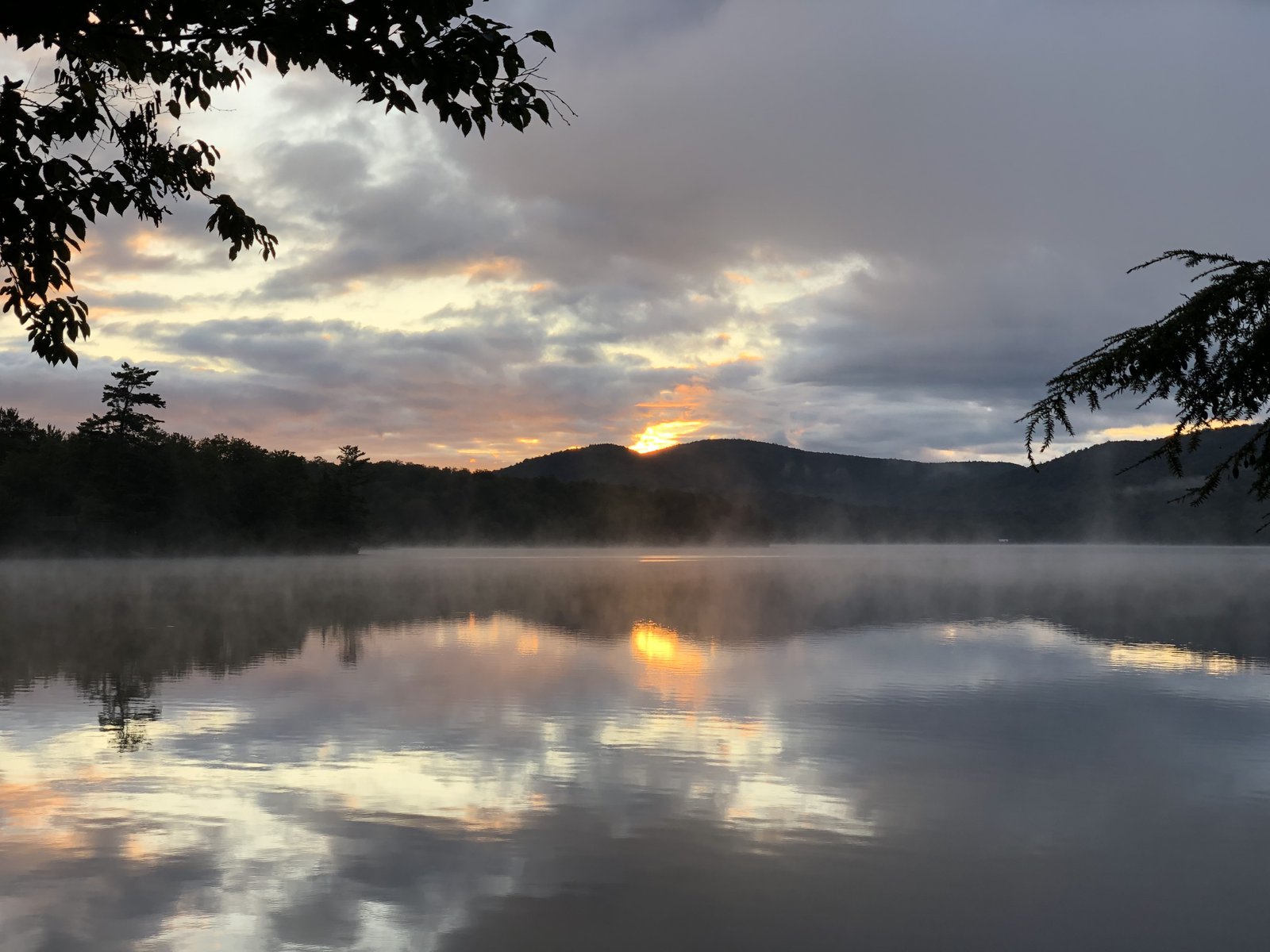
Sunrise on Limekiln Lake
Spencer to the Adirondacks
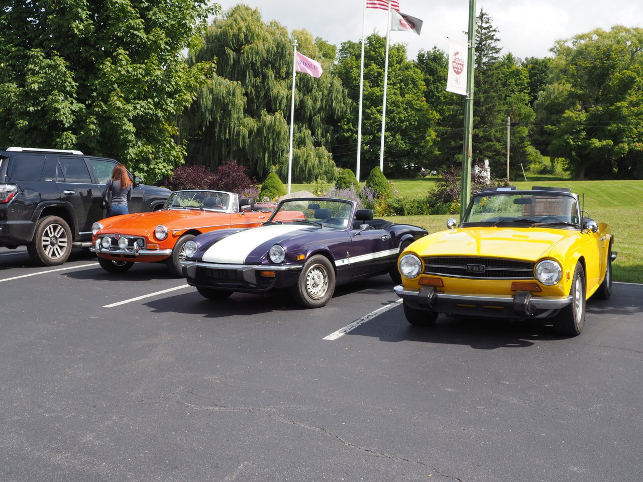
After messing with the drone we headed up through Watkins Glen to the Ginny Lee Café in Lodi, which has great views of Seneca Lake and the Wagner vineyard. There was some kind of vintage car festival going on at the Glen, so (a) there was a ton of traffic through Watkins, and (b) there were of cool cars old and new all over the region. It was a chilly morning and it made me happy to see so many roadsters out with their tops down.
After lunch I split off on my own again and headed for the Adirondacks. My initial plan had been to make a mad dash for Cape Breton in Nova Scotia from home, but Hurrican Dorian and I would have been arriving at the same time, which is right about now. So now I’m taking a far less direct but much more scenic route through NY, VT, NH, and ME, and will probably save the mad dash for getting back home. This part of NY, between the Finger Lakes and around Syracuse, is pretty flat. It’s scenic (as Scenic Highway 414 would imply), but not particularly interesting. 414, routes 5 and 20, and bunch of other pretty but straight roads took me Northeast around Syracuse, toward Rome, and generally in the direction of the Adirondacks, with no particular destination other than a pin on the map somewhere on Rt 28, which did look interesting. From Rome on to Inlet and Limekiln Lake Campground (my destination tonight) it was really a pretty ride through the woods and with some great twisty, flowing roads. I could spend a lot of time just exploring the area.
After getting settled into camp I headed back into Inlet for a glass of cider, boxed pizza, and some wifi at the Screamen Eagle (yes, it’s spelled like that). Tonight I’m camping, but it’s promising to be a chilly evening and so far I don’t think I’ve got enough warm clothes with me…
I’m loving the new bike, a 2007 BMW R1200RT. It looks one step removed from a Goldwing, but moves and handles well, and does a good job coping with the weight of all the crap I’m carrying.
Droning Over Spencer
I bring my drone with me on lots of motorcycle trips. If I’m lucky I’m able to get some neat shots that just aren’t possible from the ground. If I’m really lucky I can avoid crashing it. If I’m super lucky it doesn’t get broken in transit. So far so good. 🍀
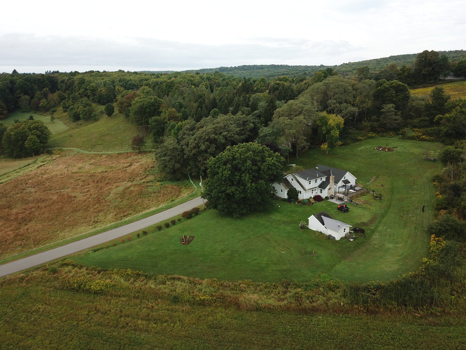
These were taken over the house I grew up in and that my mom still lives in. Not a lot’s changed: it’s still rural, still beautiful, still grey most of the dang year. Which makes the field of solar panels across from the high school all the more ironic. I’ve got a lot of memories from this place. I flew sailplanes for a lot of my teens and early 20s, but never managed to get over my own house, so I find these particularly neat.
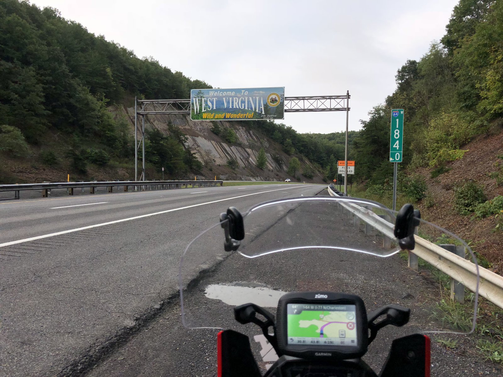
Richmond to Spencer
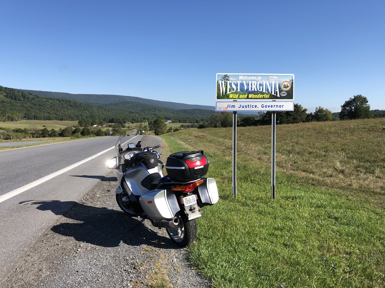
I got a late start this morning. I was on the road before dawn, which may seem early, but it was later than I’d hoped: my alarm went off at 4am but I fell back asleep until after 5. I only had a couple things left to stash away, which is good because there were only a few remaining unoccupied nooks and crannies on the bike. North on I-95 out of Richmond for about an hour, and then start avoiding the major roads as much as possible. It’s not exhilirating riding: the Piedmont is generally flat, but the occasional bit of farm land away from NoVA is pretty. I started off fighting the GPS (a Garmin zūmo 395) pretty much right away. I had a rough route laid in to take me Northwest on 17 from I-95, and as soon as I got to 17 it wanted to take me back onto 95 and into DC. Hell no. It’s a terrible device. I blindly continued NW in the general direction of Winchester, trying to balance the desire to keep off major roads with the need to get at least one state out of the way so I’d feel like I’m making some progress. 522 looked pretty good so I started following that from the pointy top of VA through WV, MD, and into PA. Now we’re getting somewhere. At some point around Needmore, PA the GPS decided there were better roads to be found and tried a Hail Mary pass at redemption. It worked (for a bit) and for a couple of hours there were some great back roads through the middle of Nowheresville, PA (nb. not a real place, but it’s not a stretch given other places like Intercourse, Bird-in-Hand, and Burnt Cabins).
Around Lewiston I checked in with my mom and realized my late start and an unexpected shuffling of plans on her end made it so I really didn’t have a lot of extra time to burn. Fastest route it is, then: State College; Williamsport; Mansfield; Corning, NY; and now I’m back in familiar territory, riding roads I grew up on, retracing routes I could do (and have done) in my sleep. I took this area for granted: it’s beautiful, although economically depressed and grey 10 months out of the year. But the roads and scenery are great.
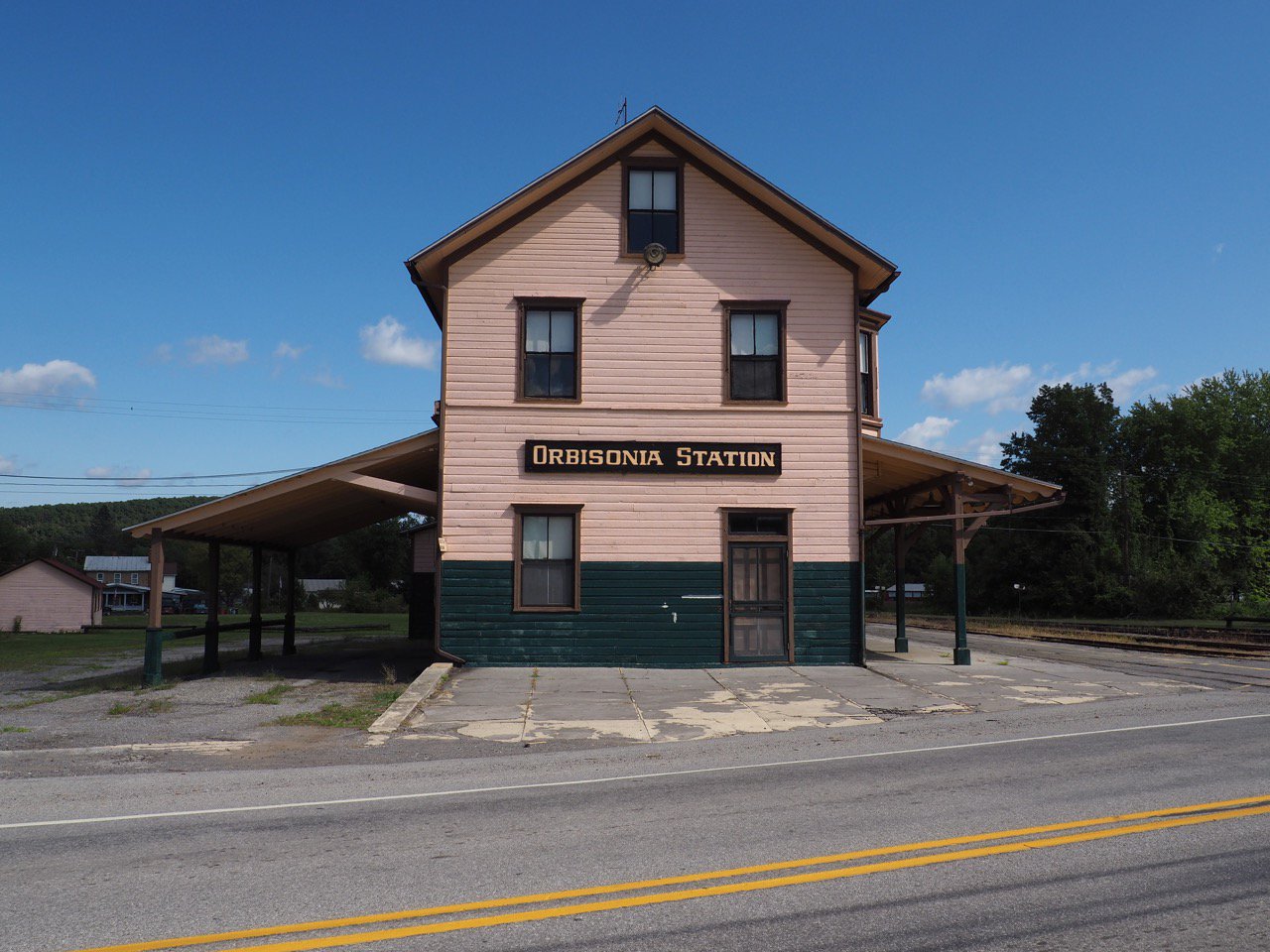
Not much in the way of photos today, just a neat little whistle-stop that loves its trolleys, and a rare blue sky over the old homestead.
Goodbye Virginia, see you in a week or so!
hex2019
Anniston and Selma, Alabama
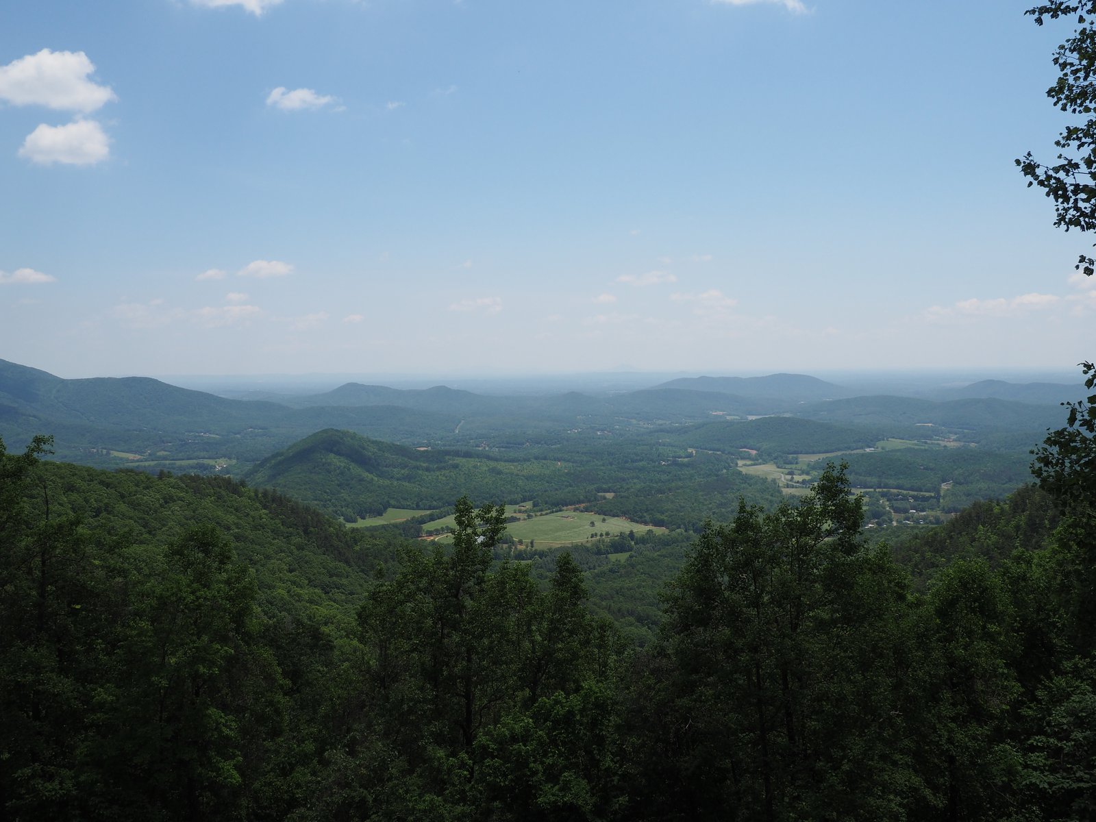
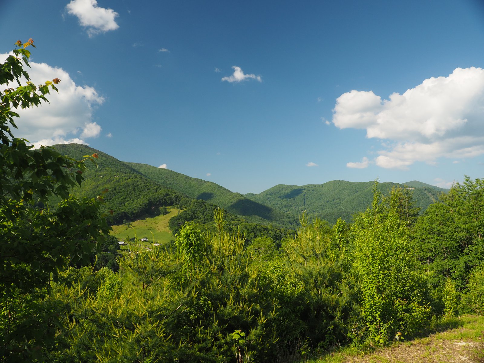
I started planning this trip back in January without anything more than a destination of Austin in mind. It was pretty easy to see that I’d spend some time in the Smokies revisiting a few places I’d enjoyed before, but after that I didn’t have much to build an agenda with. A friend (who has inspired me to write this blog and do more trips) did the Iron Butt National Park Tour Challenge last year and I realized looking for National Parks and Monuments to check out would be a good way to find some stuff to see in places I’d normally never go. In the end I only ended up with one National Monument stop, but it helped inform the rest of the trip and gave me a lot to think about.
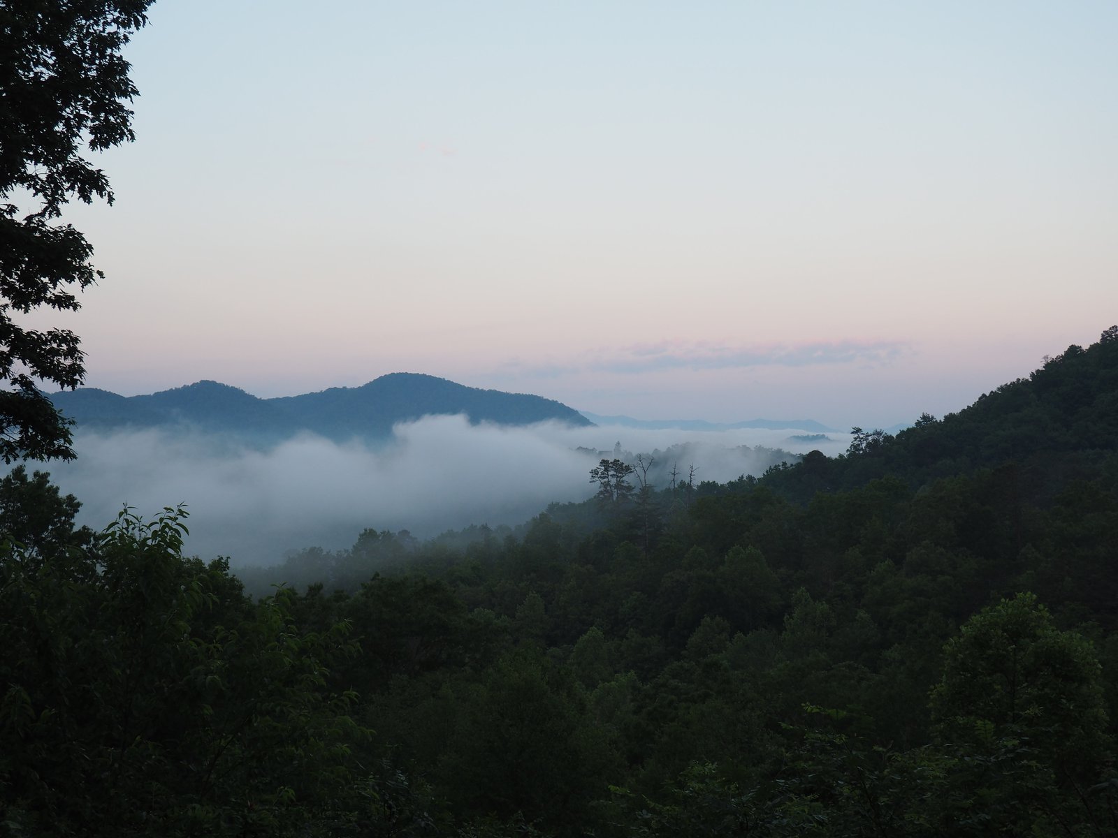
The Smokies from above
Confirming the adage that “stuff expands to fill available space” I grabbed my drone at the last minute because I had the room (sort of). I don’t use it much, and traveling with it on the bike is kind of a pain in the ass. But if I only use it on this trip to get these shots it’ll have been worth it.
The Smokies are amazing and photos from the ground never do the views justice. I think these do, however.
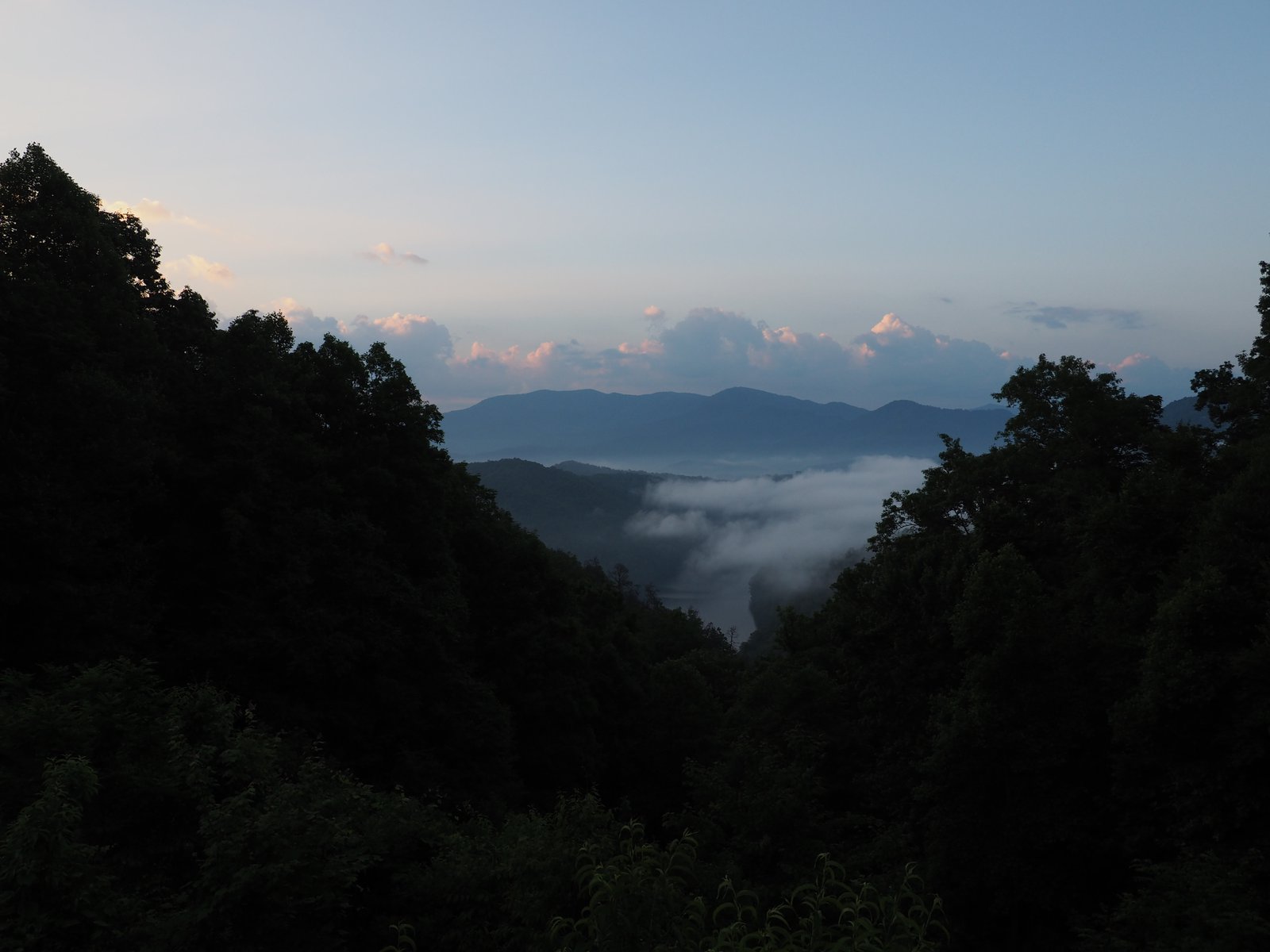
The Road to Nowhere
While I was exploring Bryson City last night I saw a sign for “Road to Nowhere”. When I asked the host of the hostel about it, she told me it was a twisty road up into the national park that dead ends at an abandoned tunnel, with lots of great hikes around it. Right up my alley. A little more digging turned up that it was supposed to be part of a road that provided the residents of the county access to their ancestors’ burial grounds after Fontana Dam was started in 1943. But there was an “environmental problem” that couldn’t be solved, so the road was never completed. (And the US Government didn’t hold up their end of the bargain to the residents, obviously).
As promised the ride up was fantastic (there’s not a bad road in the region) with some amazing views. At the end there’s a barrier just a few hundred feet from the tunnel. Hikers and horse riders use the tunnel to access trails, but it was dark af and I didn’t feel comfortable going in there without a flash light: I didn’t want to be eaten by a grue.
A hot and humid start
I hit the road this morning, almost on schedule, leaving just a little after 6am. Morning rides through the country are one of my favorite things. The smells are much more noticeable in the cool, damp air. And there’s (generally) less traffic. 221 from Lynchburg to Roanoke looked pretty good on the map, but it was really just divided highway; south of Roanoke, however, it got fun and interesting: no longer divided, some really twisty sections (like shockingly twisty), and nice views. I stayed with it until lunch beckoned and I ran south to Fancy Gap 🎩 where I had an excellent reuben at The Gap Deli. From there I took the Blue Ridge Parkway until I got bored with the traffic and the speed limit (which doesn’t take long on Memorial Day weekend…) and split off toward Glade Valley for gas. At that point I was starting to feel the heat (upper 80s) and I’d already been in the saddle for the better part of 7 hours, so I opted for interstates to get to Asheville. That only sort of worked: it took less time than back roads, but at the expense of frequent stop-n-go traffic and higher temperatures at the lower elevations. I saw 100° for a while, and it was above 90° for most of the afternoon.
I’m staying at the Smokey Mountains Hostel in Bryson City. Clean, friendly folks, and walking distance from a brewery with a taco truck and around the corner from an ice cream shoppe. Could be worse.
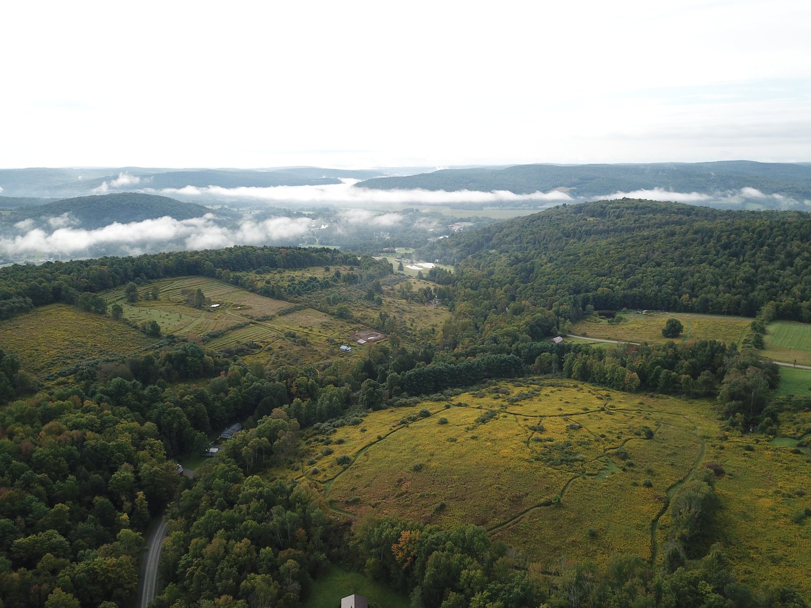
drone
Droning Over Spencer
I bring my drone with me on lots of motorcycle trips. If I’m lucky I’m able to get some neat shots that just aren’t possible from the ground. If I’m really lucky I can avoid crashing it. If I’m super lucky it doesn’t get broken in transit. So far so good. 🍀
These were taken over the house I grew up in and that my mom still lives in. Not a lot’s changed: it’s still rural, still beautiful, still grey most of the dang year. Which makes the field of solar panels across from the high school all the more ironic. I’ve got a lot of memories from this place. I flew sailplanes for a lot of my teens and early 20s, but never managed to get over my own house, so I find these particularly neat.
The Smokies from above
Confirming the adage that “stuff expands to fill available space” I grabbed my drone at the last minute because I had the room (sort of). I don’t use it much, and traveling with it on the bike is kind of a pain in the ass. But if I only use it on this trip to get these shots it’ll have been worth it.
The Smokies are amazing and photos from the ground never do the views justice. I think these do, however.
The seasons are running backwards
Less than a month ago — almost 2 weeks before the official start of winter — Richmond got a foot of snow. Today was the first 🏍 & ☕️ of 2019: it was nearly 60° and 50+ bikes showed up for coffee and waffles. It’s weird, but I’ll take it!
mbta
Back to Top ↑night
Back to Top ↑Boston
Back to Top ↑🚲
Back to Top ↑🌕
Back to Top ↑❤️
Back to Top ↑home improvement
Let there be light!
A year or so ago I saw an Instructable on installing LED lighting in a workshop using bulk LED reels. The idea resonated with me: I spend a lot of time in the garage and there is (well, was) never enough light.
diy
Let there be light!
A year or so ago I saw an Instructable on installing LED lighting in a workshop using bulk LED reels. The idea resonated with me: I spend a lot of time in the garage and there is (well, was) never enough light.